

Click for full-size.
Mapa De Los Ferro Carriles De La República Argentina Y De Los Paises Limítrofes.: Construido segun los datos é instrucciones suministrados por el Presidente de la Direccion Dor Don Luis Faraoz por el Ingeniero Geógrafo Don José Chavanne.
by Chavannes, José
- Used
- near fine
- Condition
- Near Fine/none
- Seller
-
Cranston, Rhode Island, United States
Payment Methods Accepted
About This Item
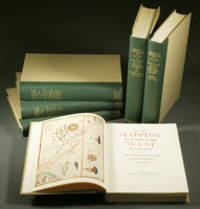
Buenos Aires, Dirección de Ferro Carriles Nacionales, 1892. Color topographical printed map in four parts of eighteen sections each, backed with linen. Scale: 1: 1,000,000. The map encompasses approximately 41° South latitude to approx. 20° S. latitude, and approx. 53° West longitude to a little beyond 73° W. latitude. This includes Chile along its entire western border, in some cases to the Pacific, and parts of Bolivia, Paraguay, and Uruguay. Railroad lines are shown as far south as Bahía Nueva in Chubut on the east coast and a bit inland from Valdivia (Chile) in the west; in the north Asunción is the farthest inland reach, and both completed and projected sections of the Transandine (Valparaiso to Buenos Aires) line are shown (the last tunnel was completed in 1909). Development of railways in the Argentine dates from 1857 and was mostly supported by private companies largely controlled in England, about 15% being owned and operated by the government. Produced following an investment crisis in 1890, this map may have been intended to encourage support of an already well-developed transportation system carrying the pastoral and agricultural products of Argentina's steadily developing export trade, which contributed greatly to maintaining the country's economic stability. Besides showing railways, the large scale on which this map was produced allows a comprehensive view of the country and its physical peculiarities. Dry rivers, mountain peaks, saline lakes, central plateaus, the Gran Chaco, countless rivers-- all are shown with the detail and elevations one expects from railroad survey expeditions. Each part consists of a single horizontal fold and nine vertical folds and attaches to its covers at the lower left section. Each section measures 8.25 x 12.25 inches. Each unfolded part of 18 sections measures 24.5 inches high by 74.5 inches wide; the entire map unfolds to eight feet two inches in height and six feet two inches wide. The four parts are bound in embossed green cloth covers printed in gold. Oval stamp of the DFCN near the cartouche. Despite a little old worming and a few minor stains, the map is handsome and brilliant. Stock#NS0156.
Reviews
(Log in or Create an Account first!)
Details
- Seller
- The Owl at the Bridge
 (US)
(US)
- Seller's Inventory #
- NS0156
- Title
- Mapa De Los Ferro Carriles De La República Argentina Y De Los Paises Limítrofes.
- Author
- Chavannes, José
- Book Condition
- Used - Near Fine
- Jacket Condition
- none
- Quantity Available
- 1
- Publisher
- Dirección de Ferro Carriles Nacionales
- Place of Publication
- Buenos Aires
- Date Published
- 1892
- Weight
- 0.00 lbs
- Keywords
- 19th century Argentine Republic transporttion history railway railroad map
- Bookseller catalogs
- History: South America and Carib; Atlases: historical;
Terms of Sale
The Owl at the Bridge
Full refund includes original shipping cost up to ten days after delivery if an item is misdescribed or damaged.
About the Seller
The Owl at the Bridge
Biblio member since 2013
Cranston, Rhode Island
About The Owl at the Bridge
We continue to list reference works, Machiavelli, art history, bibliographies, and Italian literature from our private collections. We are happy to discuss discounts for bulk purchases.
Glossary
Some terminology that may be used in this description includes:
- Cloth
- "Cloth-bound" generally refers to a hardcover book with cloth covering the outside of the book covers. The cloth is stretched...
This Book’s Categories

Signed Books
Why settle for an ordinary copy of your favorite book when you could have an autographed copy? Find signed books here.

Beat Poet Michael McClure
From the fateful reading at Six-Gallery in 1955 to his novels, poetry, and stage productions, Michael McClure was right in the thick of the Beat Generation as it was born. See his books and art and learn more about the works of Michael McClure.
Also Recommended
-

-

-
![Colton's New Topographical Map of the States of Virginia, Maryland and Delaware, showing also eastern Tennessee, and parts of other adjoining states; all the Fortifications, Military Stations, Rail Roads, Common Roads and other internal improvements.; [Cover reads: Colton's Map of the States of Virginia, Maryland and Delaware...]](https://d3525k1ryd2155.cloudfront.net/h/666/740/838740666.0.m.jpg)
-
-

Save 10% on every purchase!
Join the Bibliophiles’ Club and start saving 10% on every book.
$29.95 / Year