Rare and Antiquarian Books
Maps and Atlases
Biblio is proud to not just sell rare and antique books, but to also sell rare and antique maps and atlases. You can find a diverse selection of rare maps and atlases in the Biblio Rare Book Room, and many of them include astounding illustrations and detailed notes. Be sure to browse the rare maps and atlases section of the Biblio Rare Book Room to find a special book or map that just might add considerable value to your rare and antique book collection.
Results 1 - 15 of 325

More Photos
Carey's General Atlas
by CAREY, Mathew (1760-1839)
- Used
- Condition
- Used
- Seller
-
New York, New York
- Item Price
-
£26,124.80FREE shipping to USA
Show Details
Item Price
£26,124.80
FREE shipping to USA

More Photos
Map of Massachusetts proper compiled from Actual Surveys made by Order of the General Court, and under the inspection of agents of their appointment
by CARLETON, Osgood (fl.1792-1806)
- Used
- Condition
- Used
- Seller
-
New York, New York
- Item Price
-
£14,695.20FREE shipping to USA
Show Details
Item Price
£14,695.20
FREE shipping to USA
More Photos
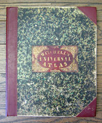
A New Universal Atlas Containing Maps of the various Empires, Kingdoms, State and Republics of the World. With a Special Map of each of the United States, Plans of Cities, &c.
by Mitchell, Samuel Augustus
- Used
- Hardcover
- first
- Condition
- Used
- Binding
- Hardcover
- Seller
-
San Francisco, California
- Item Price
-
£6,123.00£3.99 shipping to USA
Show Details
Item Price
£6,123.00
£3.99
shipping to USA
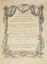
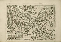
(History of Cartography, Geographic description of the Antilles): Description geographique des isles Antilles possédées par les Anglois
by Bellin, Jacques Nicolas
- Used
- very good
- Hardcover
- first
- Condition
- Used - Very Good
- Edition
- First Edition
- Binding
- Hardcover
- Seller
-
Crozet, Virginia
- Item Price
-
£6,184.23£8.50 shipping to USA
Show Details
Item Price
£6,184.23
£8.50
shipping to USA

More Photos
Map of Clear Creek County, Colorado. Drawn and compiled by Theo. H. Lowe and F.F. Bruné, C.E., Idaho, Colorado, Ter
by LOWE, Theodore H. and Francis F. BRUNÉ
- Used
- Condition
- Used
- Seller
-
New York, New York
- Item Price
-
£24,083.80FREE shipping to USA
Show Details
Item Price
£24,083.80
FREE shipping to USA
More Photos
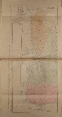
OTTOMAN ATLAS CONTAINS THIRTY NINE HAND COLORED MAPS PREPARED AND PRINTED IN THE MUHENDISHANE I BERRI HUMAYUN (THE ROYAL SCHOOL OF MILITARY ENGNEERING) IN ISTANBUL. POSSIBLY THE FIRST ADMINISTRATIVE ATLAS TO BE PRINTED IN USKUDAR AFTER THE ESTABLISHMENT OF THE TELEGRAPH LINES IN THE OTTOMAN WILAYAS (STATES)
by THE OTTOMAN AUTHORITY
- Used
- very good
- Hardcover
- Signed
- Condition
- Used - Very Good
- Binding
- Hardcover
- Seller
-
Riyadh, Saudi Arabia
- Item Price
-
£40,820.00£15.50 shipping to USA
Show Details
Item Price
£40,820.00
£15.50
shipping to USA
More Photos
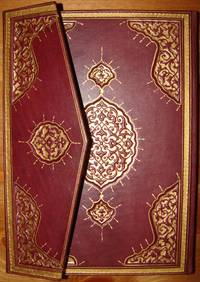
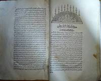
Tuhfet ul Kibar fi Esfar il Bihar, complete with the all maps contemporarly hand colored
by katib Celebi, Haci Halife
- Used
- Condition
- Used - Very Good+
- Seller
-
Riyadh, Saudi Arabia
- Item Price
-
£48,984.00£15.50 shipping to USA
Show Details
Item Price
£48,984.00
£15.50
shipping to USA

More Photos
Historia de Gentibus septentrionalibus, earumqve diversis statibus, conditionibus, moribus, ritibus, superstitionibus, disciplinis, excercitiis, regimine, victu, belleis, structuris, instrumentis, ac mineris metallicis, & rebus mirabilibus, necnon uni... - [THE LARGE COMMENTARY TO "CARTA MARINA"]
by MAGNUS, OLAUS.
- Used
- Hardcover
- first
- Condition
- Used
- Binding
- Hardcover
- Seller
-
Copenhagen, Denmark
- Item Price
-
£13,271.00£200.00 shipping to USA
Show Details
Item Price
£13,271.00
£200.00
shipping to USA

More Photos
The Edinburgh Geographical and Historical Atlas
by John Hamilton
- Used
- Hardcover
- Condition
- Used - Very good +
- Binding
- Hardcover
- Seller
-
London, Ontario
- Item Price
-
£6,123.00£8.25 shipping to USA
Show Details
Item Price
£6,123.00
£8.25
shipping to USA
More Photos
cihannuma or Jihannuma (Mirror of the world)
by KATIB CELEBI (Mustafa ibn Abd Allah, aka Haci Halife, 1609-1657)
- Used
- Fine
- Hardcover
- Condition
- Used - Fine
- Edition
- 1st Edition
- Binding
- Hardcover
- Seller
-
Riyadh, Saudi Arabia
- Item Price
-
£69,394.00£15.50 shipping to USA
Show Details
Item Price
£69,394.00
£15.50
shipping to USA

More Photos
NAVIGANTIUM ATQUE ITINERANTIUM BIBLIOTHECA; OR, A COMPLETE COLLECTION OF VOYAGES AND TRAVELS .... Now Carefully Revised, with Large Additions, and Continued down to the Present Time; Including Particular Accounts of the Manufactures and Commerce of Each Country. [Two volumes]
by Harris, John; Emanuel Bowen
- Used
- Condition
- Used
- Seller
-
Middletown, Maryland
- Item Price
-
£10,205.00£5.50 shipping to USA
Show Details
Item Price
£10,205.00
£5.50
shipping to USA

More Photos
A COMPLETE SYSTEM OF GEOGRAPHY: Being a description of all the ... known world
by Bowen, Emanuel
- Used
- first
- Condition
- Used
- Seller
-
Middletown, Maryland
- Item Price
-
£12,041.90£5.50 shipping to USA
Show Details
Item Price
£12,041.90
£5.50
shipping to USA

More Photos
Cosmographey oder beschreibung aller Länder herrschafften, fürnemsten Stetten, geschichten, gebreüche, hantierungen etc. Beschriben durch Sebastianum Munsterum, auch durch in selbst gebessert, an welt und natürliche historie, jetzunder aber bisz auff das 1569 jar….
by MUNSTER, Sebastian.
- Used
- Hardcover
- Condition
- Used
- Binding
- Hardcover
- Seller
-
Paris, France
- Item Price
-
£25,270.60£9.24 shipping to USA
Show Details
Item Price
£25,270.60
£9.24
shipping to USA
More Photos
Theatro del mondo.
by ORTELIUS, Abraham.
- Used
- Hardcover
- Condition
- Used
- Binding
- Hardcover
- Seller
-
Paris, France
- Item Price
-
£9,149.70£9.24 shipping to USA
Show Details
Item Price
£9,149.70
£9.24
shipping to USA
![[COOK] Newton’s new & improved terrestrial pocket globe 1817](https://d3525k1ryd2155.cloudfront.net/h/926/764/1547764926.0.m.jpg)
[COOK] Newton’s new & improved terrestrial pocket globe 1817
by NEWTON FAMILY
- Used
- Condition
- Used
- Seller
-
Armadale, Victoria
- Item Price
-
£9,222.50£50.00 shipping to USA
Show Details
Item Price
£9,222.50
£50.00
shipping to USA

