Description:
London: For the author & William Faden (replaced by R.Faulder in vol.2), 1792. Hardcover. Very Good-. Aquatint plates (65 as listed) + 11 folding Maps. . 2 VOLUMES IN ONE 223x141mm green calf gilt key pattern border & spine gilt, gilt dent. & rev. (tips & hinges rubbed/spine darkened) All Edges Gilt Dedication to Prince of Wales the future George IV. TP + xvi =Dedic.+Introduction + contents & plate list +154pp Titlepage to Part II +viii=Contents & Plate list + 190pp+errata + 11 folding Maps. Coat of Arms bookplate James Forbes esq. & F.Fisher written in. Short tears to gutter edge - no loss - to first 3 leaves else a clean copy. Slight offset from plates to facing text but no foxing and great views with horses, coaches, people, boats etc. The maps without and misfold or tears -they look unused. A clean copy of a lovely aquatint book.
Carte Generale du Monde, ou Description du Monde Terrestre & Aquatique by van Luchenburg, Jan - [1729]
by van Luchenburg, Jan
![Carte Generale du Monde, ou Description du Monde Terrestre & Aquatique by van Luchenburg, Jan - [1729]](https://d3525k1ryd2155.cloudfront.net/h/193/072/471072193.379.m.jpg)
Carte Generale du Monde, ou Description du Monde Terrestre & Aquatique
by van Luchenburg, Jan
- Used
- Fine
Amsterdam: Jean Covens et Corneille Mortier, [1729]. Loose leaf. Fine. Pierre Mortier, Jan van Luchenburg, Jean Covens, Corneille Mortier. Image size: 16 x 18 1/2 inches. Pierre Mortier's unique world map drawn on Mercator's projection with CALIFORNIA AS AN ISLAND and the "Detroit d'Anian" connected by dotted lines through the NORTHWEST PASSAGE to Buttons Bay located to the west of Hudson Bay. In the Pacific is a small coastline of New Zealand. The northeast coast of Asia is severely truncated. Australia's northern coast is shown connected to New Guinea, along with a part of Van Diemen's Land. Across the top of the map are five spheres depicting Day and Night, the Flood, the phases of the moon, and a double hemisphere of the globe depicting the Western and Eastern hemispheres. The map was precisely engraved by Jan van Luchenburg, with his name at the lower left and the Covens and Mortier imprint at the lower right. Text in French and Dutch. A clean and well struck copy in fine condition, professionally conserved matted (dark blue) and framed. See Shirley #427, #622. Frame size: 22 1/8 x 25 inches. A fine Covens & Mortier world map with depictions of the legendary Northwest Passage and California as an Island.
-
Bookseller
St. Wulfstans Books
 (US)
(US)
- Illustrator Pierre Mortier, Jan van Luchenburg, Jean Covens, Corneille Mortier
- Format/Binding Loose leaf
- Book Condition Used - Fine
- Quantity Available 1
- Publisher Jean Covens et Corneille Mortier
- Place of Publication Amsterdam
- Date Published [1729]
- Keywords world map framed mercator travel engraving illustrated 18th

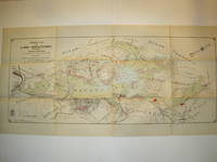
TOPOGRAPHICAL SURVEY OF THE GREAT ROAD FROM LONDON TO BATH AND BRISTOL. With historical and descriptive accounts of the country, towns, villages, and gentlemen's seats on and adjacent to it; illustrated by perspective views of the most select and picturesque scenery. To which is added a correct map of the country three miles on each side of the road, planned from a scale of one inch to a mile.
by Robertson,Archibald
- Used
- Hardcover
- Condition
- Used - Very Good-
- Binding
- Hardcover
- Quantity Available
- 1
- Seller
-
Blockley, Gloucestershire, United Kingdom
- Item Price
-
£1,064.00
Show Details
Item Price
£1,064.00

More Photos
A Large Draught of the North Part of China Shewing the Passages and the Chanells into the Harbour of Chusan
by THORNTON, John (1641-1708) & Samuel (fl.1703-39)
- Used
- Condition
- Used
- Binding
- Unknown
- Quantity Available
- 1
- Seller
-
New York, New York, United States
- Item Price
-
£971.40
Show Details
Description:
London: William Mount & Thomas Page, 1734. Copper-engraved sea chart, in excellent condition, apart from an expertly repaired centre fold, and mild creases where the map folded. A very fine sea chart of China's Zhejiang Province, from the celebrated Third Book of 'The English Pilot.' This elegant and large sea chart captures China's modern day Zhejiang province. Located on the East China sea, just below the Yangtze Delta, this region was of major interest to European traders during the eighteenth-century. It features the major port of Zhousan (Chusan), and was the location of the entrance of the Grand Canal of China. The canal, construction of which began in the 5th-century B.C., was then the oldest and longest man-made waterway in the world, which allowed barges to travel hundreds to Beijing. In 1671, the London cartographer John Seller (fl.1664-97) commenced work on The English Pilot, a work that intended to challenge Dutch hegemony in the sea atlas market. Intended to be published in four books…
Read More Item Price
£971.40

More Photos
Paralleles de Latitude, from Description de L'Univers
by [Mallet, Allain Mannesson]
- Used
- Fine
- Condition
- Used - Fine
- Binding
- Unknown
- Quantity Available
- 1
- Seller
-
Fayetteville, Arkansas, United States
- Item Price
-
£224.88
Show Details
Description:
n.p.: n.p., 1685. Loose leaf. Fine. Original hand colored copper engraving depicting the Equator and lines of latitude superimposed over Europe, Asia, Africa and Antarctica. Image size: 4 1/4 x 5 1/2 inches. Framed and conserved. Frame size: 11 7/8 x 13 3/4 inches. A fine hand colored 17th Century map of Europe, Asia, Africa and Antarctica.
Item Price
£224.88

More Photos
Cercles de Longitude, from Description de L'Univers
by [Mallet, Allain Mannesson]
- Used
- Fine
- Condition
- Used - Fine
- Binding
- Unknown
- Quantity Available
- 1
- Seller
-
Fayetteville, Arkansas, United States
- Item Price
-
£224.88
Show Details
Description:
n.p.: n.p., 1685. Loose leaf. Fine. Original hand colored copper engraving depicting the Equator and lines of longitude (including the Prime Meridian) superimposed over Europe, Asia, Africa and Antarctica. Image size: 4 1/4 x 5 1/2 inches. Professionally conserved, matted and framed. Frame size: 11 7/8 x 13 3/4 inches. A fine hand colored 17th Century map of Europe, Asia, Africa and Antarctica.
Item Price
£224.88

More Photos
Where Stucco Meets Chaparrel.
by [Pie in the Sky Press] Rebecca Chamlee.
- Used
- Hardcover
- Signed
- Condition
- Used
- Edition
- Edition of 60 + 26 lettered copies
- Binding
- Hardcover
- Quantity Available
- 1
- Seller
-
Hoover, Alabama, United States
- Item Price
-
£1,011.88
Show Details
Description:
[Simi Valley, California]:: Pie in the Sky Press,, 2014.. Edition of 60 + 26 lettered copies. Of the edition there are three states: Deluxe (Lettered copies); Standard (numbered 1-25); and Special (Numbered 26-60). Printed letterpress. Handset California Old Style cast by M & H Typefounders and Gothic XX Condensed wood type. Printed using photopolymer plates and hand-carved Gomuban relief plates. Signed by the artist on the colophon.
Standard: 6 x 9"; 108 pages. Printed on Somerset papers. Bound in simplified style with printed abaca wrapped boards and a cloth spine. Numbered. Rebecca Chamlee, prospectus: "Like the self-taught naturalists of the Victorian era, my recent work examines the intersection of my artistic and scientific interests by collecting and cataloging the natural world. I am inspired to record, interpret, and celebrate nature.
"In my new artist's book I observe the natural world around me. Where Stucco Meets Chaparral explores the trails through…
Read More Item Price
£1,011.88
More Photos
A Large Draught of the North Part of China Shewing the Passages and the Chanells into the Harbour of Chusan
by THORNTON, John (1641-1708) & Samuel (fl.1703-39)
- Used
- Condition
- Used
- Binding
- Unknown
- Quantity Available
- 1
- Seller
-
New York, New York, United States
- Item Price
-
£971.40
Show Details
Description:
London: William Mount & Thomas Page, 1734. Copper-engraved sea chart, in excellent condition, apart from an expertly repaired centre fold, and mild creases where the map folded. A very fine sea chart of China's Zhejiang Province, from the celebrated Third Book of 'The English Pilot.' This elegant and large sea chart captures China's modern day Zhejiang province. Located on the East China sea, just below the Yangtze Delta, this region was of major interest to European traders during the eighteenth-century. It features the major port of Zhousan (Chusan), and was the location of the entrance of the Grand Canal of China. The canal, construction of which began in the 5th-century B.C., was then the oldest and longest man-made waterway in the world, which allowed barges to travel hundreds to Beijing. In 1671, the London cartographer John Seller (fl.1664-97) commenced work on The English Pilot, a work that intended to challenge Dutch hegemony in the sea atlas market. Intended to be published in four books…
Read More Item Price
£971.40
Property Map of Lake Hopatcong, New Jersey, Prepared by Hudson Maxim for the Morris Canal Investigation Commission, November 16, 1912, Compiled from Various Maps and Actual Surveys by P. E. Boomer, C. E.
by Maxim, Hudson; & P. E. Boomer
- Used
- Paperback
- first
- Condition
- Used - Near Fine condition
- Edition
- First Edition
- Binding
- Paperback
- Quantity Available
- 1
- Seller
-
Henderson, Nevada, United States
- Item Price
-
£1,210.20
Show Details
Description:
Borough of Hopatcong, New Jersey?, 1912. Near Fine condition. SEE PHOTO. This is a beautiful and very scarce color map of Lake Hopatcong, New Jersey. When unfolded it measures 18" tall by 38" wide. Some folds have been neatly reinforced on the blank side with archival-quality document repair tape. Buildings are represented by red squares, water in green. Some of the properties and locations depicted are: Port Morris, Landing, Roxbury Township, Borough of Mount Arlington, Byram Township, Nolans Point, Atlas Powder Co., Brookland, Borough of Hopatcong, Byram Cove, Henderson Bay, Byram Bay, Maxim Park, Jefferson Township, Woodport, Hurdtown, Hurd Mining Co., W. M. Force Estate, John P. Lawless, Mary Ingram estate, Aaron Peck estate, Raccoon Island, Halsey Island, Bertrand Island, Theodore King, Gertrude Otten, Violet Littell, Robert Dunlap estate, etc. Full title: "Property Map of Lake Hopatcong, New Jersey, Prepared by Hudson Maxim for the Morris Canal Investigation Commission,…
Read More Item Price
£1,210.20
More Photos
Paralleles de Latitude, from Description de L'Univers
by [Mallet, Allain Mannesson]
- Used
- Fine
- Condition
- Used - Fine
- Binding
- Unknown
- Quantity Available
- 1
- Seller
-
Fayetteville, Arkansas, United States
- Item Price
-
£224.88
Show Details
Description:
n.p.: n.p., 1685. Loose leaf. Fine. Original hand colored copper engraving depicting the Equator and lines of latitude superimposed over Europe, Asia, Africa and Antarctica. Image size: 4 1/4 x 5 1/2 inches. Framed and conserved. Frame size: 11 7/8 x 13 3/4 inches. A fine hand colored 17th Century map of Europe, Asia, Africa and Antarctica.
Item Price
£224.88
More Photos
Cercles de Longitude, from Description de L'Univers
by [Mallet, Allain Mannesson]
- Used
- Fine
- Condition
- Used - Fine
- Binding
- Unknown
- Quantity Available
- 1
- Seller
-
Fayetteville, Arkansas, United States
- Item Price
-
£224.88
Show Details
Description:
n.p.: n.p., 1685. Loose leaf. Fine. Original hand colored copper engraving depicting the Equator and lines of longitude (including the Prime Meridian) superimposed over Europe, Asia, Africa and Antarctica. Image size: 4 1/4 x 5 1/2 inches. Professionally conserved, matted and framed. Frame size: 11 7/8 x 13 3/4 inches. A fine hand colored 17th Century map of Europe, Asia, Africa and Antarctica.
Item Price
£224.88
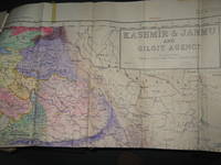
Survey of Pakistan Kashmir
- Used
- very good
- Paperback
- first
- Condition
- Used - Very Good
- Edition
- 1st Edition
- Binding
- Paperback
- Quantity Available
- 1
- Seller
-
Bath, Maine, United States
- Item Price
-
£793.31
Show Details
Description:
Jammer & Gilgit Agency, 1940 Government of Pakistan Full color Map 1 Inch = 16 miles. Extremely RARE OCLC locates 0 copies. 0 copies LOC. Oblong, no tears, or markings.. Oblong. 1st Edition. Soft cover. Very Good.
Item Price
£793.31

More Photos
The Sky and the Forest
by Forester, C.S
- Used
- very good
- Hardcover
- first
- Condition
- Used - Very Good
- Jacket Condition
- Very Good
- Edition
- First Edition
- Binding
- Hardcover
- Quantity Available
- 1
- Seller
-
Salem, Oregon, United States
- Item Price
-
£28.24£16.94Save £13.96!
Show Details
Description:
C.S. Forester: The Sky and the Forest. Little, Brown and Company, Boston. Stated First Edition First Printing Thus August, 1948. Cover price $2.75. Used. VG BOOK/VG UNCLIPPED DUST JACKET. A story of a central Africa. By C.S. Forester, author of the Admiral Hornblower series.
Item Price
£28.24£16.94
Save £13.96
!
![Alaska and Klondike Region; [With inset of Klondike Region on the Upper Yukon detail] [From an...](https://d3525k1ryd2155.cloudfront.net/h/062/537/1339537062.0.m.jpg)
Alaska and Klondike Region; [With inset of Klondike Region on the Upper Yukon detail] [From an atlas, "Gazetteer of Alaska and Yukon Region " pp. 105 and 106]
by Miller, J. Martin
- Used
- very good
- Condition
- Used - Very Good
- Edition
- Unknown
- Quantity Available
- 1
- Seller
-
Sebastopol, California, United States
- Item Price
-
£31.57
Show Details
Description:
Chicago: J. Martin Miller, 1899. Unknown. Map. Very Good. [Map copyright 1899, printing date of Atlas later] [19.875x15.125in]; Colored map of Alaska with steamer routes from Portland and Seattle, insets of the Klondike Region on the Upper Yukon and Western portion of Aleutian Islands; On verso index of places and names with two large black and white images; Age toning to all edges, water stain marks on bottom, slight printing offset of colors, small chips and closed tears to lower edge;.
Item Price
£31.57

Zemepis Sveta - Monsunova Asie
by De La Blache, P. Vidal; Gallois, L
- Used
- Hardcover
- Condition
- Used - Very Good Condition
- Jacket Condition
- No Dust Jacket
- Binding
- Hardcover
- Quantity Available
- 1
- Seller
-
Oak Point, Texas, United States
- Item Price
-
£48.57
Show Details
Description:
Aventinum, Prague, Czechoslovakia, 1930. Hardcover. Very Good Condition/No Dust Jacket. Text entirely in Czech. Geography book on Asia with numerous photographs and maps. 1931 edition also available. Size: 4mo - over 9 3/4" - 12" tall. 400 pp. Pages are yellowed, but are tight and clean. Moderate shelfwear along the spine. Corners are lightly bumped. Quantity Available: 1. Shipped Weight: 3-5 pounds. Category: Travel & Places; Non-English Language::Czech; Pictures of this item not already displayed here available upon request. Inventory No: 001227. . Additional shipping charges may apply.
Item Price
£48.57

Zemepis Sveta - Monsunova Asie
by De La Blache, P. Vidal; Gallois, L
- Used
- Hardcover
- Condition
- Used - Very Good Condition
- Jacket Condition
- No Dust Jacket
- Binding
- Hardcover
- Quantity Available
- 1
- Seller
-
Oak Point, Texas, United States
- Item Price
-
£48.57
Show Details
Description:
Aventinum, Prague, Czechoslovakia, 1931. Hardcover. Very Good Condition/No Dust Jacket. Text entirely in Czech. Geography book on Asia with numerous photographs and maps. 1930 edition also available. Size: 4mo - over 9 3/4" - 12" tall. 400 pp. Pages are yellowed, but are tight and clean. Moderate shelfwear along the spine. Corners are lightly bumped. Quantity Available: 1. Shipped Weight: 3-5 pounds. Category: Travel & Places; Non-English Language::Czech; Pictures of this item not already displayed here available upon request. Inventory No: 001228. . Additional shipping charges may apply.
Item Price
£48.57

Asia from the Best Authorities, Russell, ca.1800
by Russell
- Used
- Condition
- Used
- Quantity Available
- 1
- Seller
-
Plymouth, Devon, United Kingdom
- Item Price
-
£20.00
Show Details
Description:
Russell, J. : Asia from the Best Authorities. Nd but ca.1800. From "A New Geographical, Historical and Commercial Grammar and Present State of Several Kingdoms of the World". Copper engraving. Size approx 200 x 230mm. Two neat folds. Some age colouring to edges, otherwise clean and bright. Includes Arabia, India, Borneo, Japan, China and eastern Russia.
Item Price
£20.00

North America from the Best Authorities, Russell, ca.1800
by Russell
- Used
- Condition
- Used
- Quantity Available
- 1
- Seller
-
Plymouth, Devon, United Kingdom
- Item Price
-
£20.00
Show Details
Description:
Russell, J. : A General Map of North America from the Best Authorities. Nd but ca.1800. From "A New Geographical, Historical and Commercial Grammar and Present State of Several Kingdoms of the World." Copper engraving. Size approx 200 x 230mm. Two neat folds. Some age colouring to edges, otherwise very clean and bright.
Item Price
£20.00
![MAP OF UTAH [Territory]](https://d3525k1ryd2155.cloudfront.net/h/836/461/1485461836.0.m.jpg)
More Photos
MAP OF UTAH [Territory]
- Used
- Condition
- Used - Very Good-
- Edition
- Original
- Quantity Available
- 1
- Seller
-
Williamsburg, Virginia, United States
- Item Price
-
£52.62
Show Details
Description:
New York, Richmond, Chicago, & Toledo: H. H. Hardesty, 1885. Original color lithographed map printed by Rand, McNally & Company, Engravers and published in HARDESTY'S HISTORICAL AND GEOGRAPHICAL ENCYCLOPEDIA: SPECIAL VIRGINIA EDITION. 19 3/8 inches by 13 1/4 inches on a 21" X 14 1/2" sheet. The map depicts the Territory of Utah in its final form--large areas had been removed and ceded to Nevada, Colorado, Wyoming, and Nebraska since Utah became a U. S. Territory in 1850. The issue of polygamy prevented statehood until it was finally granted in 1896. This map features railroads and topography and uses color to set off counties from each other. Unlike most atlas maps of the period, this map identifies most small towns. The map is guaranteed to be moe than 135 years old. The map is in about very good condition: generally clean and bright, with slight toning of paper and one faint water stain near the center-left edge of the map.. Original. Single Sheet. Very Good-. Elephant…
Read More Item Price
£52.62

Philips Special Map of the Nile, The Advance on Khartum and the Environs of Omdurman. Cc1900
by George Philips and Son,
- Used
- Condition
- Used
- Quantity Available
- 1
- Seller
-
Plymouth, Devon, United Kingdom
- Item Price
-
£26.00
Show Details
Description:
Philips Special map of the Nile illustrating the Advance on Khartum [Khartoum] with an enlargement of the environs of Omdurman [Omdur]. George Philips and Son, London and Liverpool Ca 1900. 580mm x 900mm folded map. Front title wrapper has come loose, not affecting map area. Three maps are displayed within the sheet. Map1. Map of the Nile Valley 520mm x 300mm showing the approaches of Khartum. Scale 1inch to 100 Geographical miles. Coloured indicating Possessions and Protectorates of European Powers. Map 2. Special map of the Nile from Dongola to Khartum. Scale 16 miles to the inch. Coloured. In set in this map is Map3. Environs of Omdurman, Scale 5 statute miles to the inch. Some small breaks at some folds, not affecting imagery or use of map. Title label is damaged, the map is clean and bright, probably unused. A very interesting record.
Item Price
£26.00

Last Tales
by Dinesen, Isak
- Used
- very good
- Hardcover
- first
- Condition
- Used - Very Good
- Jacket Condition
- Good+
- Edition
- First Edition
- Binding
- Hardcover
- Quantity Available
- 1
- Seller
-
Salem, Oregon, United States
- Item Price
-
£97.14£58.28Save £48.00!
Show Details
Description:
Dinesen, Isak: Last Tales, A Collection of Twelve New Tales of Compelling Beauty 1957, Random House. First Edition. Stated First Printing Thus. Used. Very Good/Good+ original red dust jacket, price-clipped. Jacket states 11/57 on front flap. 5 3/4 X
Item Price
£97.14£58.28
Save £48.00
!

The Adventure of Wrangel Island
by Vilhjalmur Stefansson
- Used
- good
- Hardcover
- first
- Condition
- Used - Good
- Jacket Condition
- No DJ Included
- Edition
- First Edition
- Binding
- Hardcover
- Quantity Available
- 1
- Seller
-
Salem, Oregon, United States
- Item Price
-
£101.10£60.66Save £49.96!
Show Details
Description:
The Adventure of Wrangel Island, Alaska (1925 Macmillan 1st Edition) HISTORY OF ALASKA. EXLIB. Good Condition/ No DJ included. Fold-out map affixed to binding at the back of the book has never been opened. The story of the (unsuccessful) attempted colonization of Wrangel Island Alaska. 413 pages plus appendix, Index. Titling is still bright. A clean, solid copy. Scarce.
Item Price
£101.10£60.66
Save £49.96
!