Atlases
From The Mapmakers to The Reader's Digest Complete Atlas Of Australia Including Papua-New Guinea, from The Mapmakers to Atlas Of Columbus and The Great Discoveries, we can help you find the atlases books you are looking for. As the world's largest independent marketplace for new, used and rare books, you always get the best in service and value when you buy from Biblio.co.uk, and all of your purchases are backed by our return guarantee.
Top Sellers in Atlases

The Mapmakers
by John Noble Wilford
John Noble Wilford is a science correspondent for The New York Times. He lives in New York.


Atlases Books & Ephemera

The Mapmakers
by Wilford, John Noble
John Noble Wilford is a science correspondent for The New York Times. He lives in New York.


COLTON'S INDIANA
by Colton, J. H
New York: J. H. Colton, 1855. The image is 15 3/4 inches by 12 3/4 inches on a sheet measuring 17 1/2 inches by 14 3/8 inches. This map is from the 1855 first edition of Colton's Atlas of the World, Illustrating Physical and Political Geography. It was the first atlas published by the Colton family, who had been in the map business since the 1830s. The atlas is considered to be among the most accurate of the time, and it was so successful that new editions continued to be published well into the...
Read more about this item
Item Price
£121.42

EMPIRE d'ALLEMAGNE
by Vaugondy, Dirier Robert De
Paris: Vaugondy, 1778. The image is 9 3/8 inches by 11 inches on a folded sheet measuring 11 1/4 inches by 16 3/8 inches. Original hand-colored in outline map of the German Empire by Didier Robert de Vaugondy (circa 1723-1786). He and his father Gilles Robert de Vaugondy were the premier French cartographers of the 18th century. This map was published circa 1778 in Vaugondy's Atlas Portatif. The map is guaranteed to be more than 240 years old. It is in about very good condition: clean and bright,...
Read more about this item
Item Price
£80.95

Antique Map - Natal, Transvaal and Orange River Colony.
London: The Harmsworth Atlas and Gazetteer., 1900 Map measures 15.5 by 20 inches or 39 by 25 cm. Some age toning and light creasing. Vertical fold as issued. Very Good.
Item Price
£20.20

The Times Concise Atlas of The World
by Times Books Group
London: Times Books. 2009. Folio Size [37x27cm]. Fine copy in Near Fine slipcase. Colour maps. A like new copy. 438 pages. Robust, professional packaging and tracking provided for all parcels. . 11th Edition. Hardback.
Item Price
£26.46

Andrees allgemeiner Handatlas in 99 Haupt- und 82 Nebenkarten nebst vollständigem alphabetischem Namensverzeichnis.
by Geographische Anstalt von Velhagen & Klasing (Hrsg.):
1896.. Bielefeld und Leipzig, Verlag von Velhagen & Klasing, 140 farblithographierte Kartenseiten, 188 Seiten Text gebundene Ausgabe Dritte, völlig neubearbeitete und vermehrte Auflage. Revidierter und vermehrter Abdruck 1895. Großformat, abgegriffen, abgerieben, verschmutzt, fleckig, Goldprägung, hinterer Deckel des Einbandes lose, Lederbuchrücken mehrmals eingerissen, mit mehreren Fehlstellen, abgerieben, Kanten und Ecken bestossen, schiefgelesen, Seiten gebräunt, wellig,...
Read more about this item
Item Price
£130.10

Antique Map - South America General Map.
London: The Harmsworth Atlas and Gazetteer., 1900 Map measures 15.5 by 20 inches or 39 by 25 cm. Some age toning and light creasing. Vertical fold as issued. Very Good.
Item Price
£20.20

Fold-Out Topographical Survey Map in Co Lour. Sheet 83 N.W. Grande Prairie, Alberta
Ottawa: Geological Survey of Canada/Department of Mines., 1941 Map is scale 1 inch to 8 miles and measures 24" by 30" with border. Includes: Boundries, Railways, Abandoned Railway Grades, Main Highways, Secondary Roads, Towns, Villages, Telegraph or Telephone Lines, Ferries, Marsh or Swamp, Lookout Towers, and gives height in feet. One small tear, minor wear. Very Good.
Item Price
£20.20
![TURKEY IN EUROPE [Original Hand-colored Lithographed Map]](https://d3525k1ryd2155.cloudfront.net/h/839/461/1485461839.0.b.jpg)
TURKEY IN EUROPE [Original Hand-colored Lithographed Map]
by Mitchell, Samuel Augustus
Philadelphia: Thomas, Cowperthwaite & Co., 1848. This map is from the 1848 edition of A NEW UNIVERSAL ATLAS CONTAINING MAPS OF THE VARIOUS EMPIRES. The atlas was based primarily on the H. S. Tanner UNIVERSAL ATLAS, the rights to which were purchased by Mitchell from Carey & Hart. The early Mitchell maps are distinguished by their vivid hand-coloring and attractive decorated borders. They are among the most sought after ante-bellum maps published in the United States. This map is guaranteed...
Read more about this item
Item Price
£89.04

WHEELER
by Fraser, Esther
Banff, AB: Summerthought. Very Good in Very Good- dust jacket. 1978. First Canadian Edition. Hardcover. 0919934072 . Previous owner's name on FFEP, wear to top of DJ, small tears, back of DJ scuffed, 2 sticker pulls. ; DJ in Mylar, bright, solid book ; B&W Photographs; Large 8vo 9" - 10" tall; 164 pages; "Born in Ireland in 1860, Wheeler emigrated to Canada at an early age with his parents and brothers and sisters. He was the first surveyor to provide a complete map of the...
Read more about this item
Item Price
£14.17

Atlas Österreich
by Berndt, Freytag:
1999.. Freytag-Berndt u. Ataria Wien, 255 Seiten Softcover, Ecken und Kanten bestossen, Ganzkunstleder, Einband verknickt, Seiten verfärbt, ISBN 3850842002, mittlerer Zustand Bücher
Item Price
£13.01

Mercator : The Man Who Mapped The Planet
by Nicholas Crane
HardCover . 🔴 Condition - Good🔴Australian buyers can combine up to 5Kg of Books for the same postage charge.🟢 This Book weighs 750 Grams.🟢 ** INTERNATIONAL POSTAGE ON THIS ITEM WILL REQUIRE AN ADDITIONAL CHARGE(weight is over 500 grams) **
Item Price
£12.10

Atlas de Toutes les Parties Connues du Globe Terrestre
by BONNE, Rigobert; RAYNAL, Guillaume Thomas Francois
Geneva: J. L. Pellet, 1783. hardcover. Atlas. 4to (9 3/4 x 8 inches); 22pp, 50 double-page or folding engraved maps, by Rigobert Bonne, the index numbered to 49; 23 letter-press tables, giving economic data. All maps have centerfold, plate I ("L'Ancien Monde et le Nouveau en Deux Hemispheres") has two additional folds. Minor scuffing to original brown leather binding, gilt spine in 7 compartments. Original marble end pages. Green silk book mark present. Only very minor toning and light...
Read more about this item
Item Price
£3,885.60

The Mapmakers
by WILFORD, John Noble
New York: Vintage Books, 1982. Softcover. Near Fine. Reprint, first Vintage Books edition. 414pp. Trade paperback. Black and white illustrations, maps. Near fine with minimal edge wear. The story of the great pioneers in cartography from antiquity to the space age.
Item Price
£16.19

SOIL SURVEY OF CRAIG COUNTY, OKLAHOMA (Series 1931, Number 24))
by Anderson, A. C., A. W. Goke, O. H. Brensing, R. E. Penn, and C. B. Boatright
Washington, D. C.: USDA Bureau of Chemistry and Soils, 1936. 35 pages + one huge color folding map of the county. Internally the book is clean and tight, with light soiling of the covers.. Early Printing. Paperback. Very Good. 8vo - over 7¾" - 9¾" tall. Book.
Item Price
£19.83

Maps Of Missions Of The American Board Of Commissioners For Foreign Missions.
by American Board Of Commissioners For Foreign Missions
Boston: Published By the Board. Good. 1876. Wraps. Front wrap and first map are detached. ; 8vo; Printed gray wraps, seven maps on seven leaves. **OCLC #822979826: locating on the copy at Wisconsin Historical Society. **Folding map of Turkey, full page maps: Natal Colony, Southern & Western India, Eastern China, Southern Japan, Micronesia, and Dacota. .
Item Price
£60.71

SOIL SURVEY OF ANNE ARUNDEL COUNTY, MARYLAND (Series 1928, Number 18)
by Phillips, S. W., S. O. Perkins, and H. B. Winant
Washington, D. C.: USDA Bureau of Chemistry and Soils, 1928. 29 pages + one huge color folding map of the county. Internally the book is clean and tight, with light soiling of the covers; some splitting of the covers along the spine fold.. First Printing. Paperback. Good-. 8vo - over 7¾" - 9¾" tall. Book.
Item Price
£19.83

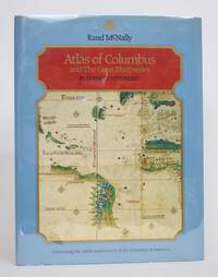
Atlas of Columbus and the Great Discoveries
by Kenneth Nebenzahl
Rand McNally, 1990. Hardcover. Very Good. May have limited writing in cover pages. Pages are unmarked. ~ ThriftBooks: Read More, Spend Less.Dust jacket quality is not guaranteed.
Item Price
£6.27

Antique Map - Asiatic Russia and the Siberian Railway.
London: The Harmsworth Atlas and Gazetteer., 1900 Map measures 15.5 by 20 inches or 39 by 25 cm. Some age toning and light creasing. Vertical fold as issued. Very Good.
Item Price
£20.20

Britannia. Volume the first : or an illustration of the kingdom of England and dominion of Wales by a geographical and historical description of the principal roads thereof / by John Ogilby
by Ogilby, John (1600-1676) [cartographer]. Ogilby, John (1600-1676)
London : Alexander Duckham & Co. Ltd , 1939. Facsimile Edition. Hardcover. Near fine copy in title-blocked pictorial cloth. Slightest suggestion only of dust-dulling to the spine bands and panel edges. Remains particularly well-preserved overall; tight, bright, clean and strong. Physical description; atlas (8 unnumbered pages, 100 pages of plates) : colour maps ; 25 cm x 32 cm. Notes; A reproduction of the original (London, Printed by the author, 1675) of which vol. 1 was the only volume pulished....
Read more about this item
Item Price
£58.28

Red River Corridor. Draft Management Plan
by Hilderman, Feir, Witty And Associates, Et Al
Winnipeg, Manitoba: Canada-Manitoba Agreement for Recreation and Conservation Board., 1980 First printing in large oblong paper covers with plastic spiral binding. 361 pp. Maps, photographs, bibliography. Some light soiling and creasing to covers and some pages in text. Good.
Item Price
£40.43

Antique Map. Central States - Eastern Section.
by Jacques W. Redway
Philadelphia: E.H. Butler and Company, 1888 Original color map from "Geography of Pennsylvania." Measures 12 by 10 inches. Printed on back. Staple holes in right margin, some small edgetears, minor age toning. Good.
Item Price
£7.25

Large Wall Map of Indonesia. Pembagian Adminstrasi Permintahan Negara
P.T. Starnico Measures 50 by 34 inches or 127 by 86 cm. Full colour. Minor creasing, one small edgetear. Very Good.
Item Price
£24.24

Antique Map. South Atlantic and Gulf States - Eastern States.
by Jacques W. Redway
Philadelphia: E.H. Butler and Company, 1888 Original color map from "Geography of Pennsylvania." Measures 12 by 10 inches. Printed on back. Staple holes in bottom margin, some small edgetears, minor age toning. Good.
Item Price
£7.25

Mapping Time and Space. How Medieval Mapmakers Viewed Their World
by Edson, Evelyn
London: The British Library., 1997 First edition hardcover in dust jacket. 210 pp. Illustrations, notes, bibliography, index. Minor wrinkle to jacket otherwise Fine/Fine.
Item Price
£121.38

Mapping the Second World War The History of the War through Maps from 1939 to 1945
by Chasseaud, Peter
New York: Chartwell Books. Very Good+ in Very Good dust jacket. 2016. Reprint. Hardcover. 0785834354 . DJ shows light shelf wear, 1" tear top fore edge.; A bright, solid book, dustjacket in Mylar, unclipped. Map endpapers, color and B&W maps throughout ; 11.0 X 9.0 X 1.1 inches; 304 pages; "From the earliest onslaught of troops in the Invasion of Poland to the D-Day and the Liberation of France. Features historical maps and photographs from their archives, and fascinating commentary...
Read more about this item
Item Price
£28.33

