Maps And Atlases from Foster Books - Stephen Foster, ABA, ILAB, PBFA
New Arrivals

More Photos
Neues Panorama des Rheins von Mainz bis Coln / Nouveau Panorama du Rhin depuis Mayence jusqu'a Cologne
by Delkeskamp, Frederick Wilhelm
- Condition
- Used - Very Good
- Published
- 1837
- Binding
- Publisher's Morocco
- Quantity Available
- 1
- Seller
-
London, Greater London, GBR
- Item Price
-
£250.00
Show Details
Description:
Frankfurt: Frederick Wilhelm Delkeskamp 1837. Small Oblong 4to.Map. 28, [4], fold-out panorama [17] pp. 32-page 'Notes to the new Panorama of the Rhine from Mentz to Cologne by Frederick William Delkeskamp' - 'Original edition entirely revised and augmented with 60 marginal views' 1838 bound to front pastedown, beneath which is the crest bookplate of Ivor A. B. Ferguson. Fold-out engraved… Read more about this item Item Price
£250.00

More Photos
The Geographical Journal: Asia, 1924-1934. 2 volumes.
by [The Royal Geographical Society]
- Condition
- Used - Very Good
- Published
- 1921
- Binding
- Cloth
- Quantity Available
- 1
- Seller
-
London, Greater London, GBR
- Item Price
-
£250.00
Show Details
Description:
London: [The Royal Geographical Society] ca. 1934. 8vo. 2 volumes. Blue buckram with dark blue morocco labels. A collection of articles (44 in total) from the Geographical Journal relating to Asia, dated between 1924-1934. With maps, fold-out maps and photographs throughout both volumes. Spines faded and some occasional markings to leaves internally. One loose map enclosed in volume 1. Bindings… Read more about this item Item Price
£250.00

More Photos
Philips' International Atlas: A Series of 160 Pages of Coloured Maps and Plans Forming a Complete Geographical Survey of the International Relationships of the New Era, its Territorial Changes and Commercial Communications with an Index of over 65,000 Names.
by Philip, George (ed.)
- Condition
- Used - Very Good
- Published
- 1936
- Binding
- Hardcover
- Quantity Available
- 1
- Seller
-
London, Greater London, GBR
- Item Price
-
£125.00
Show Details
Description:
London: George Philip & Son, Ltd. 1936. Atlas Folio. iv, [158 plates], 4, 94 pp. Cloth with gilt lettering to board and repaired with a new cloth spine. 158 colour plate maps. Some sections a little loose. Bumping and wear to corners of boards. Internally clean. This is a heavy item and may require additional postage if being shipped outside… Read more about this item Item Price
£125.00

More Photos
12 Original Lithographic Prints Comprising the First Twelve - up to October 1947 - of the Series of Picture Maps of London
by Sayer, J. P.
- Condition
- Used - Very Good
- Published
- 1947
- Binding
- Cloth
- Quantity Available
- 1
- Seller
-
London, Greater London, GBR
- Item Price
-
£125.00
Show Details
Description:
London: George Newnes Ltd. 1947. Oblong 8vo. Unpaginated. Green cloth. Oblong 8vo (21 x 28.5 cm). Spotting to boards. Minor yellowing to pages, otherwise internally clean. Twelve highly detailed colour lithographic maps of areas of central London - including Piccadilly, Mayfair, Fleet Street, Blackfriars, the Tower of London, and many more - with an almost overwhelming number of annotations and… Read more about this item Item Price
£125.00

More Photos
The Gough Map: The earliest road map of Great Britain?
by Millea, Nick
- Condition
- Used - Near Fine
- Jacket Condition
- Near Fine
- Published
- 2008
- Binding
- Hardcover
- ISBN
- 9781851240227
- Quantity Available
- 1
- Seller
-
London, Greater London, GBR
- Item Price
-
£125.00
Show Details
Description:
Oxford: Bodleian Library, University of Oxford 2008. 4to. Scarce. 95 pp. Black hardback in a colour illustrated jacket. Minimal rubbing to jacket extremities. Board clean, internally clean. A study - with many colour illustrations - of early maps of Britain, particularly the Gough Map, a 650 year old medieval map that was arguably the first to depict a recognisable British… Read more about this item Item Price
£125.00
More Photos
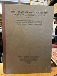
Four Maps of Great Britian Designed by Matthew Paris About A. D. 1250
by Paris, Matthew; Gilson, J. P (editor)
- Condition
- Used - Very Good
- Published
- 1928
- Binding
- Cloth Spine Card Boards
- Quantity Available
- 1
- Seller
-
London, Greater London, GBR
- Item Price
-
£95.00
Show Details
Description:
London: Printed by Order of the Trustees 1928. Atlas FolioIllustrated. 11 pp., 4 prints. Brown cloth spine with paper boards. Some marks to the boards and wear to the corners, with slight fraying to the spine ends. Internally clean with book plate excised from the top corner of the front endpaper. Four beautiful reproductions of maps from three manuscripts in… Read more about this item Item Price
£95.00

More Photos
Courtiers and Cannibals, Angels and Amazons: The Art of the Decorative Cartographic Titlepage
by Shirley, Rodney W
- Condition
- Used - Very Good
- Jacket Condition
- Very Good
- Published
- 2009
- Binding
- Hardcover
- ISBN
- 9789061940609
- Quantity Available
- 1
- Seller
-
London, Greater London, GBR
- Item Price
-
£30.00
Show Details
Description:
Houten: Hes & De Graaf Publishers BV 2009. Square 4to. 272 pp. Hardback in colour illustrated jacket with some creasing to edges otherwise very clean and bright. Illustrated in colour throughout. From the blurb... 'This book aims to preserve and bring forward for wider appreciation the outstanding works of art that many engraved title pages and frontispieces represent. Over the… Read more about this item Item Price
£30.00

More Photos
Japan: A Cartographic Vision. European Printed Maps from the Early 16th to the 19th Century
by Walter, Lutz [ed.]
- Condition
- Used - Near Fine
- Jacket Condition
- Very Good
- Edition
- First Edition in English
- Published
- 1994
- Binding
- Hardcover
- ISBN
- 9783791313214
- Quantity Available
- 1
- Seller
-
London, Greater London, GBR
- Item Price
-
£35.00
Show Details
Description:
New York: Prestel 1994. 4to. 232 pp. Hardcover with illustrated jacket. Slight curled top edge of jacket. Clean and bright internally - near fine. With 265 illustrations, of which 182 are in colour, these mainly being early maps of Japan. Includes the 'List of Printed Maps of Japan before 1900', useful for a collector and map historian. 3791313215 . Near… Read more about this item Item Price
£35.00

More Photos
The Wardington Library : Important Atlases & Geographies (in Two Volumes)
by Sotheby's
- Condition
- Used - Near Fine
- Edition
- First Edition
- Published
- 2005
- Binding
- Gilt-decorated Cloth
- Quantity Available
- 1
- Seller
-
London, Greater London, GBR
- Item Price
-
£68.00
Show Details
Description:
London: Sotheby's 2005-6. 4to. In two volumes. 347 pp.; 369 pp. Bright red cloth covers with gilt text to front and spine, with illustrated plates set into front. Very small section of wear to top corner of spine in volume 1, otherwise clean and fresh. Internally clean and bright. The two-volume auction catalogue for the sale of the 650 maps… Read more about this item Item Price
£68.00

More Photos
Collectors' Guide to Maps of the African Continent and Southern Africa
by Tooley, R. V.
- Condition
- Used - Very Good
- Jacket Condition
- Very Good
- Published
- 1969
- Binding
- Cloth
- ISBN
- 9780904041125
- Quantity Available
- 1
- Seller
-
London, Greater London, GBR
- Item Price
-
£25.00
Show Details
Description:
London: Carta Press 1969. Small 4to.Illustrated. xvi, 132 pp., with over 100 plates. Hardcover with jacket. Slight wear to the edges of the jacket. Boards clean with some bumping to the extremities. Binding firm and internally clean. Nearly 500 maps are listed and described. Illustrated with more than 100 full-page reproductions of maps, six in full colour. 0904041123 . Very… Read more about this item Item Price
£25.00

More Photos
Novus Atlas Sinensis 1655 : Faksimiles nach der Prachtausgabe der Herzog August Bibliothek Wolfenbuttel
by Blaeu, Joan and Hans Kauffmann & York Alexander Haase
- Condition
- Used - Near Fine
- Jacket Condition
- Slipcase
- Published
- 1973
- Binding
- Parchment Paper Covered Boards
- Quantity Available
- 1
- Seller
-
London, Greater London, GBR
- Item Price
-
£68.00
Show Details
Description:
Stuttgart: Muller und Schindler 1973. Facsimile. Facsimile. Large folio measuring 50cm x 35cm. Quarter red cloth over parchment-paper covered boards. In slipcase. Paperback text volume in German language. Double-page colour folding sheets, loose, as issued. A few marks to slipcase. Internally in Fine unused condition. . Near Fine. Parchment Paper Covered Boards. 1973. Item Price
£68.00

More Photos
The Oarsman's and Angler's Map of the River Thames. From Its Source to London Bridge. One Inch to a Mile
by Stanford's
- Condition
- Used - Very Good
- Published
- 1901
- Binding
- Cloth
- Quantity Available
- 1
- Seller
-
London, Greater London, GBR
- Item Price
-
£110.00
Show Details
Description:
London: Edward Stanford ca. 1927. 12mo.Map. 22, plus map, pp. Original green cloth boards with yellow title label to front board. Rubbing to extremities, marks to title label. Map clean. 22 pages of text followed by linen-backed concertina style folding map. Coloured map extends to 267cm. Accompanying text highlights hotels, inns, boatyards, etc. In6 Very Good condition. . Very Good.… Read more about this item Item Price
£110.00

More Photos
A New Map of the River Thames from Oxford to London, from entirely new surveys, taken during the Summer of 1871: with a Guide, giving every information required by the Tourist, the Oarsman, and the Angler
by Taunt, Henry W.
- Condition
- Used - Very Good
- Edition
- Second Edition
- Published
- 1873
- Binding
- Cloth
- Quantity Available
- 1
- Seller
-
London, Greater London, GBR
- Item Price
-
£250.00
Show Details
Description:
Oxford: Henry W. Taunt 1873. Oblong 12mo.Map. Second Edition. 79 pp. Green cloth with blind-stamped decorations and gilt lettering to boards; 25 x 16cm. Worn at edges and marked boards; internally yellowed and occasional smudges not affecting text. A detailed map of the Thames, along with relevant information for the river-goer, including fishing spots, shops and inns to stay at;… Read more about this item Item Price
£250.00

More Photos
A New Map of the River Thames from Oxford to London, from entirely new surveys, taken during the Summer of 1871: with a Guide, giving every information required by the Tourist, the Oarsman, and the Angler
by Taunt, Henry W.
- Condition
- Used - Very Good
- Edition
- First Edition
- Published
- 1873
- Binding
- Cloth
- Quantity Available
- 1
- Seller
-
London, Greater London, GBR
- Item Price
-
£450.00
Show Details
Description:
Oxford: Henry W. Taunt 1872. Oblong 8vo.Map. First Edition. 79 pp. Green cloth with blind-stamped decorations and gilt lettering to boards; 25 x 16 cm. Worn at corners, spine ends and a few marks to boards; internal scattered spotting and slight water-crinkling, but no ownership names. A detailed map of the Thames, along with relevant information for the river-goer, including… Read more about this item Item Price
£450.00

More Photos
Comparative Urban Design: Rare Engravings, 1830-1843
by Branch, Melville Campbell
- Condition
- Used - Near Fine
- Edition
- First Edition
- Published
- 1978
- Binding
- Decorative Cloth
- Quantity Available
- 1
- Seller
-
London, Greater London, GBR
- Item Price
-
£60.00
Show Details
Description:
New York: Arno Press Inc. 1978. Oblong 4to. First Edition. iv, 104 pp. Decorative boards. Minor rubbing to spine ends, otherwise near fine condition. Collection of city map engravings in colour, and illustrated elsewhere throughout. Including New York, London, Paris, Calcutta, Vienna etc. . Near Fine. Decorative Cloth. First Edition. 1978. Item Price
£60.00
![Civitates Orbis Terrarum [6 Parts in 3 Volumes]](https://d3525k1ryd2155.cloudfront.net/h/070/417/1531417070.0.m.jpg)
More Photos
Civitates Orbis Terrarum [6 Parts in 3 Volumes]
by Braun, Georg ; Hogenberg, Franz
- Condition
- Used - Near Fine
- Jacket Condition
- Good
- Edition
- First Edition
- Published
- 1965
- Binding
- Card Covers
- Quantity Available
- 1
- Seller
-
London, Greater London, GBR
- Item Price
-
£375.00
Show Details
Description:
Cleveland: The World Publishing Company 1965. Folio. 6 parts in 3 volumes. Card covers over loose leaves within large publisher's boxes - 2 parts in each box. The boxes have some damages to corners and illustrated covers, but pages within are completely unaffected, clean and in near fine condition. Facsimiles of all 6 volumes of Civitates Orbis Terrarum (1572-1618), descriptions… Read more about this item Item Price
£375.00

More Photos
Speculum Orbis Terrarum
by de Jode, Gerard
- Condition
- Used - Near Fine
- Jacket Condition
- Good
- Edition
- Facsimile
- Published
- 1965
- Binding
- Hardcover
- Quantity Available
- 1
- Seller
-
London, Greater London, GBR
- Item Price
-
£90.00
Show Details
Description:
Amsterdam: Theatrum Orbis Terrarum Ltd. 1965. Atlas FolioMap. 292 pp. Hardback folio in jacket. Facsimile of atlas originally published in Antwerp, 1578. Jacket torn in places, with spots of loss and scratches; otherwise all in near fine condition. With 64 double page maps and descriptions of geography in Latin. This is a heavy item and may require additional postage if… Read more about this item Item Price
£90.00

More Photos
Cosmographei
by Munster, Sebastian
- Condition
- Used - Very Good
- Edition
- Facsimile
- Published
- 1968
- Binding
- Hardcover
- Quantity Available
- 1
- Seller
-
London, Greater London, GBR
- Item Price
-
£95.00
Show Details
Description:
Amsterdam: Theatrum Orbis Terrarum Ltd. 1968. Atlas FolioMap. xxviii, mccxxxiv (1234) pp. Hardcover with green title label, gilt lettering and borders to spine. Facsimile of scarce early German book, the 1544 Cosmographia - description of the world. A few scratches to boards, with wear to front and rear joint. Clean and bright within. Facsimile in German language. This is a… Read more about this item Item Price
£95.00

More Photos
Miniature Antique Maps: an illustrated guide for the collector
by King, Geoffrey L.
- Condition
- Used - Near Fine
- Jacket Condition
- Near Fine
- Edition
- Second Edition, Revised
- Published
- 2003
- Binding
- Hardcover
- Quantity Available
- 1
- Seller
-
London, Greater London, GBR
- Item Price
-
£125.00
Show Details
Description:
Oxford: Tooley Adams & Co. 2003. 8vo. Scarce. 223 pp. Purple hardcover with gilt lettering to spine inside illustrated jacket. In near fine condition. Illustrated throughout in black & white. A highly detailed complete chronology, bibliography and printing history of miniature maps, from in 1472 to 1900. A scarce book. . Near Fine. Hardcover. Second Edition, Revised. 2003. Item Price
£125.00

More Photos
Richardson's New Chart of the British Isles : showing Railways, Steamship Routes (with distances), Ports, Rivers, Canals, Main Roads, Distances between Towns, and Rainfall. With Additional Inset Maps, Diagrams, and Tabulated Motor and Other Information.
by Richardson
- Condition
- Used - Very Good
- Published
- 1912
- Binding
- Cloth
- Quantity Available
- 1
- Seller
-
London, Greater London, GBR
- Item Price
-
£50.00
Show Details
Description:
Manchester: Frank S. Richardson ca. 1912. Narrow 4toFolding Map. Brown cloth binding with black lettering. 2 folding maps charting the British Isles in two halves, with a massive amount of demographic information - occupations, population density etc. Spine ends and corners worn, boards slightly scratched. Maps within are very clean. An interesting, attractive map. . Very Good. Cloth. 1912. Item Price
£50.00
