Description:
Speed, John : Cheshire. The Countye Palatine of Chester with that most Ancient Citie described. Basset & Chiswell, [London, 1610-1676]. Size approx 510mm x 380mm ( 20 x 15 inches). Early hand coloured double page copper engraved map. From Speed's "The Theatre of the Empire of Great Britain" with English text on verso and a description of the county and a gazetteer. Inset town plan of Chester. Seven coast of arms of "The Armes of the Earles of Chester since the Norman Conquest". Four decorative cartouches. Speed has used William Smith's revisions of Saxton and the Braun & Hogenberg plan of Chester. Good margins. Very small hole (approx 2mm or 1/10in) in the decorative border, otherwise fine condition. A strong dark impression of this famous decorative county map of Cheshire.
Totius Americae Septentrionalis et Meridionalis Novissima Repraesentatio quam ex singulus recentium Geographorum Tabulis collecta luci publicae accomodavit by HOMAN Johannes Baptista - [c. 1740]
by HOMAN Johannes Baptista
![Totius Americae Septentrionalis et Meridionalis Novissima Repraesentatio quam ex singulus recentium Geographorum Tabulis collecta luci publicae accomodavit by HOMAN Johannes Baptista - [c. 1740]](https://d3525k1ryd2155.cloudfront.net/h/327/187/246187327.0.m.jpg)
Totius Americae Septentrionalis et Meridionalis Novissima Repraesentatio quam ex singulus recentium Geographorum Tabulis collecta luci publicae accomodavit
by HOMAN Johannes Baptista
- Used
Norimberg, [c. 1740]. 20 1/8” x 23 1/2”. Faint vertical crease in the center from previous folding, otherwise in fine condition. Approximately. Single sheet laid on stiff board and wrapped in clear plastic. Colored map of the western hemisphere c. 1740 showing California as a peninsula rather than an island and with several place names in Baja California but no details or place names in Alta California [despite the published explorations of Cabrillo and Vizcaino, illustrating the slow diffusion of knowledge in the days before rapid transportation and electronic transmission]. In fact the map shows the northwest coast of America extending far to the north and west with no cartographic details and the latin term “Terra Esonis Incognita” printed therein800.
-
Bookseller
Randall House Rare Books
 (US)
(US)
- Format/Binding 20 1/8” x 23 1/2”
- Book Condition Used - Faint vertical crease in the center from previous folding, otherwise in fine condition
- Publisher Norimberg
- Date Published [c. 1740]
- Keywords Maps, cartography, Homan, North and South Americas, Geography
- Size Approximately
![The Countye Palatine of Chester with that most Ancient Citie described. [Cheshire], John Speed,...](https://d3525k1ryd2155.cloudfront.net/h/266/067/50067266.0.m.jpg)
More Photos
The Countye Palatine of Chester with that most Ancient Citie described. [Cheshire], John Speed, [1676]
by John Speed
- Used
- very good
- Condition
- Used - Very Good
- Edition
- Basset & Chiswell, [London, 1610-1676].
- Quantity Available
- 1
- Seller
-
Plymouth, Devon, United Kingdom
- Item Price
-
£750.00
Show Details
Item Price
£750.00

More Photos
Chios. "Chios Maris Aegæ ieiusdem nominis Insulae Civitas
by Braun & Hogenberg
- Used
- Condition
- Used
- Binding
- Unknown
- Quantity Available
- 1
- Seller
-
Nafplion, Greece
- Item Price
-
£1,046.04
Show Details
Description:
Greece: Cologne G von Kempen 1588. Copper engraved view of Chios from the fourth volume of Braun & Hogenberg's "Civitas Orbis Terrarum. " Latin text to verso; black & white as issued. The engraving shows the port and capital of Chios, seen from the east in a bird's-eye view. The town is represented as divided into the strongly fortified Byzantine Kastro and the town itself, which is defended on the landward side by massive watchtowers with a moat and a drawbridge. Windmills line the coast; A canon fire s out to sea from a tower on the sea wall; numerous ships and galleys. Decorative title cartouche The city is often locally referred to as "Chora" (Χώρα; literally meaning "town") or "Kastro" (Κάστρο) to distinguish it from the entirety of the island with which it shares the name. Originally the site of an ancient settlement, the town was first built at the north side of a natural harbour. By the 16th century, the walled town had been further fortified by successive rulers into a massive…
Read More Item Price
£1,046.04

More Photos
Hudson River and the Hudson River Railroad: with a complete map and wood cut views of the principal objects of interest upon the line
by HUDSON RIVER RAILROAD
- Used
- Condition
- Used - Wrappers chipped at edges, professionally rebacked, some unobtrusive offsetting on map
- Binding
- Unknown
- Quantity Available
- 1
- Seller
-
Ardsley, New York, United States
- Item Price
-
£811.40
Show Details
Description:
New York: Wm. C. Locke & Co, 1851. Wrappers chipped at edges, professionally rebacked, some unobtrusive offsetting on map. 8vo. 50 pages. Large folding map on three joined sheets (21 x 1788 cm; 8.25 x 61.75 inches). 11 woodblock illustrations in text (and with 2 more not recorded in the index but always present). Original printed wrappers with woodblock vignette. SCARCE Hudson River Railroad travel guide published the first year in which the full line was completed. It covers points of interest along the route, with woodblocks illustrating the text. Topics include: the history of the Hudson River, the history of the construction of the Hudson River Railroad, and the cities, towns and villages along the Hudson, from New York City all the way to Troy. Concerning the West Point Foundry at Cold Spring, the guide states: "the iron foundry [was] established here by Gouverneur Kemble. The works are situated about a mile west of the village, upon a small stream which tumbles rapidly down the mountains,…
Read More Item Price
£811.40
More Photos
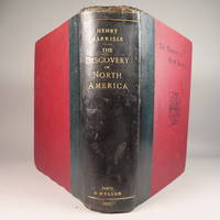
The Discovery of North America, A Critical, Documentary, and Historic Investigation,: with an essay on the early cartography of the New World, including descriptions of two hundred and fifty maps or globes existing or lost, constructed before the year 1536...
by Henry Harrisse
- Used
- very good
- Hardcover
- first
- Condition
- Used - Very Good
- Edition
- First Edition
- Binding
- Hardcover
- Quantity Available
- 1
- Seller
-
Fort Lauderdale, Florida, United States
- Item Price
-
£1,176.53
Show Details
Description:
Quarter morocco over pictorial maroon cloth board with gilt particulars to spine. Top edge gilt. Limited edition copy No. 91 of 380 issued, this being the English Toned Paper edition. Hors textes plates with tissue guards throughout. Black and white illustrations throughout text as well. Title continued: "to which are added a chronology of one hundred voyages westward, projected, attempted, or accomplished between 1431 and 1504; biographical accounts of the three hundred pilots who first crossed the Atlantic; and a copious list of the original names of American regions, caciqueships, mountains, islands, capes, gulfs, rivers, towns, and harbours." Topics include: John Cabot, Gaspar Corte-Real, Christopher Columbus, Ancient Maps, First Knowledge of Florida, Colonisation [colonization] of Nova Scotia, Aliminos, Pardon Real, Lusitano-Germanic Cartography, and much more. Wear to head of spine and hinges, but still intact and sturdy. 802 pp. 9 3/4 x 11 3/4. A clean, bright volume without previous owners'…
Read More Item Price
£1,176.53

More Photos
1753 George Anson World Voyage 3 HUGE MAPS Spain South America Sea Navigation
by ANSON, George
- Used
- near fine
- Hardcover
- Condition
- Used - Near Fine
- Binding
- Hardcover
- Quantity Available
- 1
- Seller
-
COLUMBIA, Missouri, United States
- Item Price
-
£770.83
Show Details
Description:
1753 George Anson World Voyage 3 HUGE MAPS Spain South America Sea Navigation George Anson was an 18th-century British Navy admiral who is noted for his important world voyage in which he circumnavigated the globe. This voyage, beginning in 1740, was initiated in order to disrupt Spain and their acquisitions from the Pacific – even though the squadron saw certain danger.
"Anson's voyage is remembered as a classic tale of endurance and leadership in the face of fearful disasters" (Rodger, 239)
He saw substantial victory by capturing Spanish ships carrying pieces of eight, silver, and other treasure; thus, allowing Anson to return home a very rich sailor. This voyage took Anson and company into South America and home by way of China – a true world voyage!
This 1753 edition contains the expected three folding maps – a truly rare and desirable printing!
Item number: #18211
Price: $950
ANSON, George
A voyage round the world: in the years MDCCXL, I, II, III, IV. by George Anson, Esq; commander in… Read More
Item Price
£770.83

TOPOGRAPHICAL SURVEY OF THE GREAT ROAD FROM LONDON TO BATH AND BRISTOL. With historical and descriptive accounts of the country, towns, villages, and gentlemen's seats on and adjacent to it; illustrated by perspective views of the most select and picturesque scenery. To which is added a correct map of the country three miles on each side of the road, planned from a scale of one inch to a mile.
by Robertson,Archibald
- Used
- Hardcover
- Condition
- Used - Very Good-
- Binding
- Hardcover
- Quantity Available
- 1
- Seller
-
Blockley, Gloucestershire, United Kingdom
- Item Price
-
£1,064.00
Show Details
Description:
London: For the author & William Faden (replaced by R.Faulder in vol.2), 1792. Hardcover. Very Good-. Aquatint plates (65 as listed) + 11 folding Maps. . 2 VOLUMES IN ONE 223x141mm green calf gilt key pattern border & spine gilt, gilt dent. & rev. (tips & hinges rubbed/spine darkened) All Edges Gilt Dedication to Prince of Wales the future George IV. TP + xvi =Dedic.+Introduction + contents & plate list +154pp Titlepage to Part II +viii=Contents & Plate list + 190pp+errata + 11 folding Maps. Coat of Arms bookplate James Forbes esq. & F.Fisher written in. Short tears to gutter edge - no loss - to first 3 leaves else a clean copy. Slight offset from plates to facing text but no foxing and great views with horses, coaches, people, boats etc. The maps without and misfold or tears -they look unused. A clean copy of a lovely aquatint book.
Item Price
£1,064.00

More Photos
A Large Draught of the North Part of China Shewing the Passages and the Chanells into the Harbour of Chusan
by THORNTON, John (1641-1708) & Samuel (fl.1703-39)
- Used
- Condition
- Used
- Binding
- Unknown
- Quantity Available
- 1
- Seller
-
New York, New York, United States
- Item Price
-
£973.68
Show Details
Description:
London: William Mount & Thomas Page, 1734. Copper-engraved sea chart, in excellent condition, apart from an expertly repaired centre fold, and mild creases where the map folded. A very fine sea chart of China's Zhejiang Province, from the celebrated Third Book of 'The English Pilot.' This elegant and large sea chart captures China's modern day Zhejiang province. Located on the East China sea, just below the Yangtze Delta, this region was of major interest to European traders during the eighteenth-century. It features the major port of Zhousan (Chusan), and was the location of the entrance of the Grand Canal of China. The canal, construction of which began in the 5th-century B.C., was then the oldest and longest man-made waterway in the world, which allowed barges to travel hundreds to Beijing. In 1671, the London cartographer John Seller (fl.1664-97) commenced work on The English Pilot, a work that intended to challenge Dutch hegemony in the sea atlas market. Intended to be published in four books…
Read More Item Price
£973.68

CENT VUES SUISSES remarquables par leur Situation, ou par des Faits Historiques. Dessinn�es et grav�es par Hess, Hegui [sic], K�nig, Lory, Meyer, Wetzel etc.
by Orell, F�ssli (Publishers)
- Used
- very good
- Hardcover
- Condition
- Used - Very Good
- Binding
- Hardcover
- Quantity Available
- 1
- Seller
-
Blockley, Gloucestershire, United Kingdom
- Item Price
-
£762.00
Show Details
Description:
Zurich: Orell, F�ssli et Comp., 1825 approx). Hardcover. Very Good. Copperplate engravings (100) of Swiss views and domestic scenes by Hess, Hegui, K�nig, Lory, Meyer, Wetzel and others.. Oblong octavo green morocco elaborately gilt on 4 raised bands (lacks lowest spine compartment, tips & hinges worn but sound) All Edges Gilt. Titlepage +[3]pp publisher's list +[4]pp contents + 100 plate leaves printed one side only. Clean and crisp - lovely views with a few genre scenes - wedding, peasants defending land against invaders in 1798, making cheese etc. Minor foxing almost entirely to the margins or blank back of plates, small wormhole at foot of 3 leaves. *A charming work containing views by various artists here collected together for the first time (Lonchamp 3199).
Item Price
£762.00
Property Map of Lake Hopatcong, New Jersey, Prepared by Hudson Maxim for the Morris Canal Investigation Commission, November 16, 1912, Compiled from Various Maps and Actual Surveys by P. E. Boomer, C. E.
by Maxim, Hudson; & P. E. Boomer
- Used
- Paperback
- first
- Condition
- Used - Near Fine condition
- Edition
- First Edition
- Binding
- Paperback
- Quantity Available
- 1
- Seller
-
Henderson, Nevada, United States
- Item Price
-
£1,213.04
Show Details
Description:
Borough of Hopatcong, New Jersey?, 1912. Near Fine condition. SEE PHOTO. This is a beautiful and very scarce color map of Lake Hopatcong, New Jersey. When unfolded it measures 18" tall by 38" wide. Some folds have been neatly reinforced on the blank side with archival-quality document repair tape. Buildings are represented by red squares, water in green. Some of the properties and locations depicted are: Port Morris, Landing, Roxbury Township, Borough of Mount Arlington, Byram Township, Nolans Point, Atlas Powder Co., Brookland, Borough of Hopatcong, Byram Cove, Henderson Bay, Byram Bay, Maxim Park, Jefferson Township, Woodport, Hurdtown, Hurd Mining Co., W. M. Force Estate, John P. Lawless, Mary Ingram estate, Aaron Peck estate, Raccoon Island, Halsey Island, Bertrand Island, Theodore King, Gertrude Otten, Violet Littell, Robert Dunlap estate, etc. Full title: "Property Map of Lake Hopatcong, New Jersey, Prepared by Hudson Maxim for the Morris Canal Investigation Commission,…
Read More Item Price
£1,213.04
Survey of Pakistan Kashmir
- Used
- very good
- Paperback
- first
- Condition
- Used - Very Good
- Edition
- 1st Edition
- Binding
- Paperback
- Quantity Available
- 1
- Seller
-
Bath, Maine, United States
- Item Price
-
£795.17
Show Details
Description:
Jammer & Gilgit Agency, 1940 Government of Pakistan Full color Map 1 Inch = 16 miles. Extremely RARE OCLC locates 0 copies. 0 copies LOC. Oblong, no tears, or markings.. Oblong. 1st Edition. Soft cover. Very Good.
Item Price
£795.17

More Photos
The Sky and the Forest
by Forester, C.S
- Used
- very good
- Hardcover
- first
- Condition
- Used - Very Good
- Jacket Condition
- Very Good
- Edition
- First Edition
- Binding
- Hardcover
- Quantity Available
- 1
- Seller
-
Salem, Oregon, United States
- Item Price
-
£28.31£14.16Save £17.44!
Show Details
Description:
C.S. Forester: The Sky and the Forest. Little, Brown and Company, Boston. Stated First Edition First Printing Thus August, 1948. Cover price $2.75. Used. VG BOOK/VG UNCLIPPED DUST JACKET. A story of a central Africa. By C.S. Forester, author of the Admiral Hornblower series.
Item Price
£28.31£14.16
Save £17.44
!
![Alaska and Klondike Region; [With inset of Klondike Region on the Upper Yukon detail] [From an...](https://d3525k1ryd2155.cloudfront.net/h/062/537/1339537062.0.m.jpg)
Alaska and Klondike Region; [With inset of Klondike Region on the Upper Yukon detail] [From an atlas, "Gazetteer of Alaska and Yukon Region " pp. 105 and 106]
by Miller, J. Martin
- Used
- very good
- Condition
- Used - Very Good
- Edition
- Unknown
- Quantity Available
- 1
- Seller
-
Sebastopol, California, United States
- Item Price
-
£31.64
Show Details
Description:
Chicago: J. Martin Miller, 1899. Unknown. Map. Very Good. [Map copyright 1899, printing date of Atlas later] [19.875x15.125in]; Colored map of Alaska with steamer routes from Portland and Seattle, insets of the Klondike Region on the Upper Yukon and Western portion of Aleutian Islands; On verso index of places and names with two large black and white images; Age toning to all edges, water stain marks on bottom, slight printing offset of colors, small chips and closed tears to lower edge;.
Item Price
£31.64

Last Tales
by Dinesen, Isak
- Used
- very good
- Hardcover
- first
- Condition
- Used - Very Good
- Jacket Condition
- Good+
- Edition
- First Edition
- Binding
- Hardcover
- Quantity Available
- 1
- Seller
-
Salem, Oregon, United States
- Item Price
-
£97.37£48.68Save £60.00!
Show Details
Description:
Dinesen, Isak: Last Tales, A Collection of Twelve New Tales of Compelling Beauty 1957, Random House. First Edition. Stated First Printing Thus. Used. Very Good/Good+ original red dust jacket, price-clipped. Jacket states 11/57 on front flap. 5 3/4 X
Item Price
£97.37£48.68
Save £60.00
!

Zemepis Sveta - Monsunova Asie
by De La Blache, P. Vidal; Gallois, L
- Used
- Hardcover
- Condition
- Used - Very Good Condition
- Jacket Condition
- No Dust Jacket
- Binding
- Hardcover
- Quantity Available
- 1
- Seller
-
Oak Point, Texas, United States
- Item Price
-
£48.68
Show Details
Description:
Aventinum, Prague, Czechoslovakia, 1931. Hardcover. Very Good Condition/No Dust Jacket. Text entirely in Czech. Geography book on Asia with numerous photographs and maps. 1930 edition also available. Size: 4mo - over 9 3/4" - 12" tall. 400 pp. Pages are yellowed, but are tight and clean. Moderate shelfwear along the spine. Corners are lightly bumped. Quantity Available: 1. Shipped Weight: 3-5 pounds. Category: Travel & Places; Non-English Language::Czech; Pictures of this item not already displayed here available upon request. Inventory No: 001228. . Additional shipping charges may apply.
Item Price
£48.68

Zemepis Sveta - Monsunova Asie
by De La Blache, P. Vidal; Gallois, L
- Used
- Hardcover
- Condition
- Used - Very Good Condition
- Jacket Condition
- No Dust Jacket
- Binding
- Hardcover
- Quantity Available
- 1
- Seller
-
Oak Point, Texas, United States
- Item Price
-
£48.68
Show Details
Description:
Aventinum, Prague, Czechoslovakia, 1930. Hardcover. Very Good Condition/No Dust Jacket. Text entirely in Czech. Geography book on Asia with numerous photographs and maps. 1931 edition also available. Size: 4mo - over 9 3/4" - 12" tall. 400 pp. Pages are yellowed, but are tight and clean. Moderate shelfwear along the spine. Corners are lightly bumped. Quantity Available: 1. Shipped Weight: 3-5 pounds. Category: Travel & Places; Non-English Language::Czech; Pictures of this item not already displayed here available upon request. Inventory No: 001227. . Additional shipping charges may apply.
Item Price
£48.68

The Adventure of Wrangel Island
by Vilhjalmur Stefansson
- Used
- good
- Hardcover
- first
- Condition
- Used - Good
- Jacket Condition
- No DJ Included
- Edition
- First Edition
- Binding
- Hardcover
- Quantity Available
- 1
- Seller
-
Salem, Oregon, United States
- Item Price
-
£101.34£50.67Save £62.44!
Show Details
Description:
The Adventure of Wrangel Island, Alaska (1925 Macmillan 1st Edition) HISTORY OF ALASKA. EXLIB. Good Condition/ No DJ included. Fold-out map affixed to binding at the back of the book has never been opened. The story of the (unsuccessful) attempted colonization of Wrangel Island Alaska. 413 pages plus appendix, Index. Titling is still bright. A clean, solid copy. Scarce.
Item Price
£101.34£50.67
Save £62.44
!

Seven Pillars Of Wisdom, A Triumph
by Lawrence, T.E
- Used
- good
- Hardcover
- first
- Condition
- Used - Good
- Jacket Condition
- No DJ Included
- Edition
- First American Edition
- Binding
- Hardcover
- Quantity Available
- 1
- Seller
-
Salem, Oregon, United States
- Item Price
-
£101.38£50.70Save £62.47!
Show Details
Description:
T.E. Lawrence. SEVEN PILLARS OF WISDOM, A TRIUMPH. AUTOBIOGRAPHY. Privately Printed, 1926. First Published for general circulation 1935. First American Edition. States MCMXXXVI on the title page. Doubleday, Doran & Company, Inc. Garden City, NY. GOOD CONDITION/ NO DUST JACKET IS INCLUDED. 672 pages, indexed. Beige buckram boards. Spine has darkened a bit. 6 7/8 X 9 ½.
Item Price
£101.38£50.70
Save £62.47
!

North America from the Best Authorities, Russell, ca.1800
by Russell
- Used
- Condition
- Used
- Quantity Available
- 1
- Seller
-
Plymouth, Devon, United Kingdom
- Item Price
-
£20.00
Show Details
Description:
Russell, J. : A General Map of North America from the Best Authorities. Nd but ca.1800. From "A New Geographical, Historical and Commercial Grammar and Present State of Several Kingdoms of the World." Copper engraving. Size approx 200 x 230mm. Two neat folds. Some age colouring to edges, otherwise very clean and bright.
Item Price
£20.00

Asia from the Best Authorities, Russell, ca.1800
by Russell
- Used
- Condition
- Used
- Quantity Available
- 1
- Seller
-
Plymouth, Devon, United Kingdom
- Item Price
-
£20.00
Show Details
Description:
Russell, J. : Asia from the Best Authorities. Nd but ca.1800. From "A New Geographical, Historical and Commercial Grammar and Present State of Several Kingdoms of the World". Copper engraving. Size approx 200 x 230mm. Two neat folds. Some age colouring to edges, otherwise clean and bright. Includes Arabia, India, Borneo, Japan, China and eastern Russia.
Item Price
£20.00
![MAP OF UTAH [Territory]](https://d3525k1ryd2155.cloudfront.net/h/836/461/1485461836.0.m.jpg)
More Photos
MAP OF UTAH [Territory]
- Used
- Condition
- Used - Very Good-
- Edition
- Original
- Quantity Available
- 1
- Seller
-
Williamsburg, Virginia, United States
- Item Price
-
£52.74
Show Details
Description:
New York, Richmond, Chicago, & Toledo: H. H. Hardesty, 1885. Original color lithographed map printed by Rand, McNally & Company, Engravers and published in HARDESTY'S HISTORICAL AND GEOGRAPHICAL ENCYCLOPEDIA: SPECIAL VIRGINIA EDITION. 19 3/8 inches by 13 1/4 inches on a 21" X 14 1/2" sheet. The map depicts the Territory of Utah in its final form--large areas had been removed and ceded to Nevada, Colorado, Wyoming, and Nebraska since Utah became a U. S. Territory in 1850. The issue of polygamy prevented statehood until it was finally granted in 1896. This map features railroads and topography and uses color to set off counties from each other. Unlike most atlas maps of the period, this map identifies most small towns. The map is guaranteed to be moe than 135 years old. The map is in about very good condition: generally clean and bright, with slight toning of paper and one faint water stain near the center-left edge of the map.. Original. Single Sheet. Very Good-. Elephant…
Read More Item Price
£52.74