
Click for full-size.
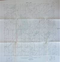
Fold-Out Topographical Survey Map. Trout Lake, Northwest Territories
- Used
- very good
- Paperback
- Condition
- Very Good
- Seller
-
Calgary, Alberta, Canada
Payment Methods Accepted
About This Item
(Ottawa): The Army Survey Establishment/Department of National Defence., 1956 Map is scale 1: 250, 000 with lakes shaded in blue. Measures 30" by 22" with border. Shows: houses, buildings, church, cemetery, quarry, sand or gravel pit, lighthouse, irrigation canals, etc. One small tear at one fold, small chip and some creasing at top edge, minor age toning to exposed areas when folded. Very Good.
Reviews
(Log in or Create an Account first!)
Details
- Bookseller
- Ken Jackson
 (CA)
(CA)
- Bookseller's Inventory #
- 256106
- Title
- Fold-Out Topographical Survey Map. Trout Lake, Northwest Territories
- Format/Binding
- Soft cover
- Book Condition
- Used - Very Good
- Quantity Available
- 1
- Binding
- Paperback
- Publisher
- The Army Survey Establishment/Department of National Defence.
- Place of Publication
- (Ottawa)
- Date Published
- 1956
- Weight
- 0.00 lbs
- Keywords
- CARTOGRAPHY AND MAPS FOLD-OUT TOPOGRAPHICAL SURVEY MAP. TROUT LAKE, NORTHWEST TERRITORIES MAP LAKE CANADA
- Bookseller catalogs
- Cartography and Maps;
Terms of Sale
Ken Jackson
Any book may be returned for any reason. If not as described we will pay shipping both ways.
About the Seller
Ken Jackson
Biblio member since 2005
Calgary, Alberta
About Ken Jackson
We are a family business and have been involved in books since 1971.
This Book’s Categories

Collecting the 1939 New York World’s Fair
Born in the midst of the Great Depression, the theme of the 1939 World’s Fair was “The World of Tomorrow” - a theme that captured the hearts of a generation. Check out the maps, souvenirs, and other ephemera on Biblio!

What did people buy in 2020?
Plague journals, escapist literature, political history: explore our year in review, where we share rare book trends and a gallery of some of the most beautiful and interesting books sold in 2020.
