Description:
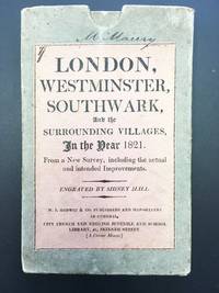
London: M.J. Godwin & Co, 1821. Some pale offsetting. Hand-colored engraved map by Sidney Hall, dissected into 21 sections and mounted on linen, overall 30 5/8 x 20 7/8 inches, folding to 7 x 4 3/8 inches. In original publisher's board slipcase, pink printed title label on front. This large and handsome map spans the entire city of London and its environs, drawn, as its cover label reports, from a new survey, "including the actual and intended Improvements." At furthest left are Hyde and Regents Parks, and at furthest left is Greenwich Park. The map shows as far north as Islington and Hackney and as far south as Deptford and Greenwich. The Thames is depicted horizontally across the map, and the hand-coloring demarcates various areas and features, such as central London defined by a red border, the major streets done in pink, the parks and water in green. Yellow is reserved only for Regent Street. Five bridges are shown, from west to east: Vauxhall, Westminster, Waterloo, Blackfriars, and London.…
Read More Search Results: England from Riverrun Books & Manuscripts
You searched for:
- Subject: England from Riverrun Books & Manuscripts
Results 1 - 1 of 1
More Photos
A Guide through London and the surrounding Villages
by [LONDON] Sidney HALL (engraver)
- Used
- Condition
- Used - Some pale offsetting
- Quantity Available
- 1
- Seller
-
Ardsley, New York, United States
- Item Price
-
£647.44£4.05 shipping to USA
Show Details
Item Price
£647.44
£4.05
shipping to USA

Didn’t find what you’re looking for?
Try adding this search to your want list. Millions of books are added to our site everyday and when we find one that matches your search, we’ll send you an email. Best of all, it’s free.
Add to Want List

Are you a frequent reader or book collector?
Join the Bibliophile's Club and save 10% on every purchase, every day — up to $20 savings per order!

Social Responsibility
Did you know that since 2004, Biblio has used its profits to build 16 public libraries in rural villages of South America?
