Description:
Bilthoven, Netherlands: Cartographica Neerlandia, 2015. Hardcover. 379p., plates, plats, maps and tables as called for, b&w only, no color reproductions but the b&w work is quite clear. Presswork is on gorgeous alkaline paperstock throughout, hardbound in 12x9.5 inch openweave green cloth boards gilt and enclosed in the glossy dust jacket. Slight crimping to cloth and dj at head- and tail-rims, small tape repair to head of dj, a near-fine copy: sound, clean, unmarked. From p.253: "The idea of producing maps on paper of a uniform sheet size and binding them together to make a book encompassing the whole world was a novelty invented by Ortelius
Search Results: Cartography from Bolerium Books Inc., ABAA/ILAB
You searched for:
- Subject: Cartography from Bolerium Books Inc., ABAA/ILAB
Results 1 - 20 of 104

Abraham Ortelius 1527-1598 Life . Works . Sources and friends
by van den Broecke
- Used
- Hardcover
- first
- Condition
- Used
- Binding
- Hardcover
- ISBN 10 / ISBN 13
- 9789090294865 / 9090294864
- Quantity Available
- 1
- Seller
-
San Francisco, California, United States
- Item Price
-
£109.28£5.67 shipping to USA
Show Details
Item Price
£109.28
£5.67
shipping to USA

Africa and Africans in the Making of the Atlantic World, 1400-1680
by Thornton, John
- Used
- Paperback
- Condition
- Used
- Binding
- Paperback
- ISBN 10 / ISBN 13
- 9780521398640 / 0521398649
- Quantity Available
- 1
- Seller
-
San Francisco, California, United States
- Item Price
-
£9.71£5.67 shipping to USA
Show Details
Description:
Cambridge: Cambridge University Press, 1992. Paperback. xxxviii, 309p., softbound illustrated solely with five skimpy line maps (a 1998 reprint may be better-furnished), anyway, theoretical cartography by a scholar of African history who had taught in Zambia, later doing research made possible by a Carter G. Woodson Institute fellowship. Thornton builds on Fernand Braudel's Mediterranean studies (who he says insufficiently valued Africa's role).
Item Price
£9.71
£5.67
shipping to USA
More Photos
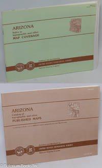
Arizona. Catalog of topographic and other Published Maps. Companion volume to the "Arizona Index to topographic and other Map Coverage" August 1987. [we offer the pair, AZ Catalog & AZ Index, together]
- Used
- Condition
- Used
- Quantity Available
- 1
- Seller
-
San Francisco, California, United States
- Item Price
-
£13.76£5.67 shipping to USA
Show Details
Description:
Reston VA: Published and distributed by United States Geological Survey, National Mapping Programj. Department of the Interior, 1987. Pamphlet. Index: 37p., softbound, an oblong pamphlet measuring 8.5x11 inches, fine condition. Catalog: 56p., all available maps shown here vignette-size in green & blue monochromes, fine condition. The two paired items together, complete.
Item Price
£13.76
£5.67
shipping to USA
More Photos
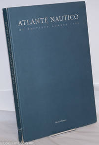
Atlante Nautico di Battista Agnese 1553. Presentazioni di Giandomenico Romanelli - Introduzioni e Commento di Marica Milanesi. Riproduzione in facsimili dell'esemplare Conservato nel Museo Correr di Venizia
by Agnese, Battista, map-maker; Giandomenico Romanelli, Marica Milanesi, critical apparatus
- Used
- Hardcover
- Condition
- Used
- Binding
- Hardcover
- ISBN 10 / ISBN 13
- 9788831753920 / 8831753924
- Quantity Available
- 1
- Seller
-
San Francisco, California, United States
- Item Price
-
£48.57£5.67 shipping to USA
Show Details
Description:
Venice: Marsilio Editori, 1990. Hardcover. 24p., followed by XXXIII fullpage doublespread facsimiles in full color, a large atlas (plates 16.5x11.5 inches), the doublespreads separated by blanks. The handsome text-block is in fine shape, from the preliminary blanks through terminal plate and abbreviated colophon. The hard binding (blue-grey papered boards lettered white) has a badly split tail (one-inch gaps both sides) and a much less severely split top rim, plus continuous light abrasion to all extremities and corner-tips - damage perhaps owing to poor packing of this gigantic tome. A good --good only-- copy, much better than "reference" copy. Laid in is a large high-gloss brochure advertising the next available facsimile in this series.
Item Price
£48.57
£5.67
shipping to USA

More Photos
Atlas Mexicano de la Conquista. Historia Geografica en 40 Cartas por Jesus Amaya Topete
by Amaya Topete, Jesus, compiler; dibujos de Francisco J. Amaya
- Used
- Hardcover
- first
- Condition
- Used
- Binding
- Hardcover
- Quantity Available
- 1
- Seller
-
San Francisco, California, United States
- Item Price
-
£40.48£5.67 shipping to USA
Show Details
Description:
Mexico D.F.: Fondo de Cultura Economica, 1958. Hardcover. vii, 32p., plus 40 full-page modern line maps in colors printed rectos only, hardbound in oblong boards, 9.5x13.5 inch wraparound pictorials overprinted with titling, under cloth backstrip gilt-titled. A banged-up copy, quite edgeworn with a severe bump to upper left corner that affects covers and text-leaves with an annoying crimp, then lesser bumps to both outer corner-tips. First edition, limited to 5,000 copies, we see no reprints. Not a great copy but entirely handleable, useful, and the diagrammatic maps seem very clear.
Item Price
£40.48
£5.67
shipping to USA
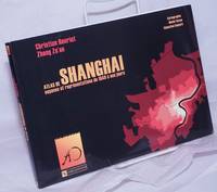
Atlas de Shanghai: Espaces et représentations de 1849 à nos jours (Collection Asie orientale) (French Language Edition)
by Henriot, christian, Zhen Zu'an
- Used
- Paperback
- Condition
- Used
- Binding
- Paperback
- ISBN 10 / ISBN 13
- 9782271057259 / 2271057256
- Quantity Available
- 1
- Seller
-
San Francisco, California, United States
- Item Price
-
£12.14£5.67 shipping to USA
Show Details
Description:
Paris: CNRS Editions, 1999. Paperback. 183 pages, 10.5x7.5 inches, illustrated wraps, illustrated with maps and drawings of Shanghai, very good condition.
Item Price
£12.14
£5.67
shipping to USA

More Photos
Atlas histórico de Chile
by Cunill Grau, Pedro
- Used
- Condition
- Used
- Quantity Available
- 1
- Seller
-
San Francisco, California, United States
- Item Price
-
£12.14£5.67 shipping to USA
Show Details
Description:
Santiago: Instituto Geográfico Militar, 1961. [55p.], color maps, original wraps bound in plain library boards with ex-library markings, cup ring on front board else good condition. Second edition. Text in Spanish.
Item Price
£12.14
£5.67
shipping to USA
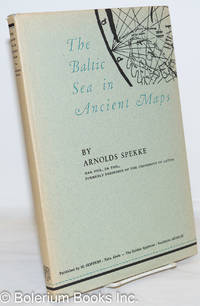
The Baltic Sea in Ancient Maps
by Spekke, Arnolds
- Used
- Hardcover
- Condition
- Used
- Binding
- Hardcover
- Quantity Available
- 1
- Seller
-
San Francisco, California, United States
- Item Price
-
£40.48£5.67 shipping to USA
Show Details
Description:
Stockholm: M. Goppers, 1961. Hardcover. ix, 75p., cloth-covered boards, 8x12 inches, illus., maps, including 10 fold-out maps, very good condition in a lightly edgeworn, unclipped dj with a sunned spine panel; one of an edition of 1,000 copies.
Item Price
£40.48
£5.67
shipping to USA
Bibliografia General de la Carta de Colon
by Columbus, Christopher, mapmaker; Carlos Sanz, historian
- Used
- Paperback
- Condition
- Used
- Binding
- Paperback
- Quantity Available
- 1
- Seller
-
San Francisco, California, United States
- Item Price
-
£28.33£5.67 shipping to USA
Show Details
Description:
Madrid: Libreria General Victoriano Suarez, 1958. Paperback. 305p., softbound in 11x8 inch rubricated buff wraps with "clerical" edges to cover, these overlapping margins are crimped all around from careless packing, with a half-dozen short tears and losses to top and tail of spine panel. Spine mildly sunned and dim. Publisher's original sash-wrap (obi) is present, an intact one laid in flat. Textblock itself is is very good shape, opened throughout a little inexpertly, but no disasters, cleanly and unmarked. In sum, a good (good-only) copy.
Item Price
£28.33
£5.67
shipping to USA

More Photos
Bunkyu kaisei shinsen kyo ezu 文久改正新選京繪圖
- Used
- Condition
- Used
- Quantity Available
- 1
- Seller
-
San Francisco, California, United States
- Item Price
-
£485.70£5.67 shipping to USA
Show Details
Description:
Kyoto: Takehara Yoshibē, 1863. Folded map with external boards, 27x19.5 inches when unfolded, minor wear at the creases, very good. A woodblock-printed depiction of Kyoto at the end of the Tokugawa shogunate.
Item Price
£485.70
£5.67
shipping to USA
A Call of Contemporary Society for Research in Asia Minor and Syria made through J.R. Sitlington Sterrett [cover title] // A Plea for Research in Asia Minor and Syria Authorized By Men Whose High Achievements And Representative Character Make The Project A Call of Humanity at Large for Light in regard to The Life of Man In The Cradle of Western Civilization by J.R. Sitlington Sterrett [title page version]
by Sterrett, J.R. Sitlington, spokesman
- Used
- first
- Condition
- Used
- Quantity Available
- 1
- Seller
-
San Francisco, California, United States
- Item Price
-
£17.81£5.67 shipping to USA
Show Details
Description:
Ithaca NY: Cornell University, 1911. 205p., softbound in 9x6 inch plain printed grey wraps paste-fastened over a tightly stapled textblock, a utilitarian job not meant to last. No illustrations or imagery. Front cover has torn away from the titlepage (there are no blanks, no halftitle, no frontispiece, no preliminaries of any kind. Damage attendant includes a huge chip from the spine panel, a ragged lefthand edge to cover-leaf and ugly rips to lefthand of titlepage. The remainder of the item is in good order: clean, unmarked, and else sound. This is a reading copy with nothing lacking.
Item Price
£17.81
£5.67
shipping to USA
The Canadian West Discovered: an exhibition of printed maps from the 16th to early 20th centuries
by Javorski, Mary
- Used
- Paperback
- Condition
- Used
- Binding
- Paperback
- ISBN 10 / ISBN 13
- 9780919224339 / 0919224334
- Quantity Available
- 1
- Seller
-
San Francisco, California, United States
- Item Price
-
£9.71£5.67 shipping to USA
Show Details
Description:
Calgary: Glenbow Museum, 1983. Paperback. 75p., wraps, 12x9 inches, maps, a few small stains on front wrap and front blank, foreedge lightly foxed else good condition.
Item Price
£9.71
£5.67
shipping to USA
Capitalism and Cartography in the Dutch Golden Age
by Sutton, Elizabeth A.
- Used
- Hardcover
- Condition
- Used
- Binding
- Hardcover
- ISBN 10 / ISBN 13
- 9780226254784 / 022625478x
- Quantity Available
- 1
- Seller
-
San Francisco, California, United States
- Item Price
-
£32.38£5.67 shipping to USA
Show Details
Description:
Chicago: University of Chicago Press, 2015. Hardcover. 184p., cloth-covered boards, 6.25x9.5 inches, illus., maps, corners bumped else very good condition in like dj.
Item Price
£32.38
£5.67
shipping to USA
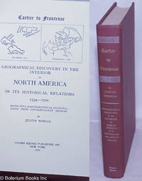
Cartier to Frontenac: Geographical Discovery in the Interior of North America in Its Historical Relations, 1534-1700
by Winsor, Justin
- Used
- Hardcover
- Condition
- Used
- Binding
- Hardcover
- Quantity Available
- 1
- Seller
-
San Francisco, California, United States
- Item Price
-
£9.71£5.67 shipping to USA
Show Details
Description:
New York: Cooper Square Publishers, 1970. Hardcover. viii, 379, illustrated. brown boards, pages 174 and 175 had some sort of sticker glued to both pages at gutter at one time, leading to smudging/obscuring ot text. A reader has reconstitued some of the words with pen. Overall, about good condition. Originally published in 1894.
Item Price
£9.71
£5.67
shipping to USA
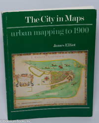
The City in Maps: urban mapping to 1900
by Elliot, James
- Used
- Paperback
- first
- Condition
- Used
- Binding
- Paperback
- Quantity Available
- 1
- Seller
-
San Francisco, California, United States
- Item Price
-
£17.81£5.67 shipping to USA
Show Details
Description:
London: The British Library, 1987. Paperback. 88p., profuse b&w reproductions facing the running text or incorporating detailed captions, with eight (8) fullpage color facsimiles, semi-glazed alkaline paperstock softbound in 9.5x7.5 inch color wraps. Covers mildly edgeworn, clean within and unmarked except for a dealer's price in pencil to half-title, a very good copy of a handsome book. Commences with a fragmentary stunning cuneiform 4th century BC plat of a city on the Euphrates, segues to an oddly similar map in stone of Rome, centuries later.
Item Price
£17.81
£5.67
shipping to USA
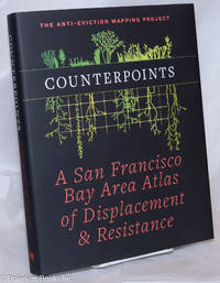
Counterpoints: A San Francisco Bay Area Atlas of Displacement & Resistance
by Roy, Ananya & Chris Carlsson
- Used
- Hardcover
- Condition
- Used
- Binding
- Hardcover
- ISBN 10 / ISBN 13
- 9781629638638 / 1629638633
- Quantity Available
- 2
- Seller
-
San Francisco, California, United States
- Item Price
-
£56.66£5.67 shipping to USA
Show Details
Description:
Oakland: PM Press, 2021. Hardcover. 403p, color illustrated dj over black boards, 8x10 inches, like new, photographs and drawings throughout including many in color. "Counterpoints: A San Francisco Bay Area Atlas of Displacement and Resistance brings together cartography, essays, illustrations, poetry, and more in order to depict gentrification and resistance struggles from across the San Francisco Bay Area and act as a roadmap to counter-hegemonic knowledge making and activism. Compiled by the Anti-Eviction Mapping Project, each chapter reflects different frameworks for understanding the Bay Area's ongoing urban upheaval, including evictions, indigenous geographies, health and environmental racism, state violence, transportation and infrastructure, migration and relocation, and speculative futures. By weaving these themes together, Counterpoints expands normative urban-studies framings of gentrification to consider more complex, regional, historically grounded, and entangled horizons for…
Read More Item Price
£56.66
£5.67
shipping to USA
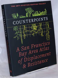
Counterpoints: A San Francisco Bay Area Atlas of Displacement & Resistance
by Roy, Ananya & Chris Carlsson
- Used
- Paperback
- Condition
- Used
- Binding
- Paperback
- ISBN 10 / ISBN 13
- 9781629638287 / 1629638285
- Quantity Available
- 3
- Seller
-
San Francisco, California, United States
- Item Price
-
£27.52£5.67 shipping to USA
Show Details
Description:
Oakland: PM Press, 2021. Paperback. xxvi, 403p, color illustrated cover wraps, 8x10 inches, like new, photographs and drawings throughout including many in color. "Counterpoints: A San Francisco Bay Area Atlas of Displacement and Resistance brings together cartography, essays, illustrations, poetry, and more in order to depict gentrification and resistance struggles from across the San Francisco Bay Area and act as a roadmap to counter-hegemonic knowledge making and activism. Compiled by the Anti-Eviction Mapping Project, each chapter reflects different frameworks for understanding the Bay Area's ongoing urban upheaval, including evictions, indigenous geographies, health and environmental racism, state violence, transportation and infrastructure, migration and relocation, and speculative futures. By weaving these themes together, Counterpoints expands normative urban-studies framings of gentrification to consider more complex, regional, historically grounded, and entangled horizons for understanding…
Read More Item Price
£27.52
£5.67
shipping to USA

More Photos
Dai Nihon meisho ichiran 大日本名所一覧
by Kisai Risshō 喜斎立祥 (Hiroshige II)
- Used
- Condition
- Used
- Quantity Available
- 1
- Seller
-
San Francisco, California, United States
- Item Price
-
£485.70£5.67 shipping to USA
Show Details
Description:
Edo: Kinrindo Seishichi. 金鱗堂清七, 1866. Five prints joined together, mounted on a later scroll, total 48x14 inches. Numerous ownership seals, moderate spotting throughout, penultimate print has a rectangular stain at the center. A map-scroll depicting famous sites across the breadth of Japan.
Item Price
£485.70
£5.67
shipping to USA

More Photos
Dai Nihon kokugun yochi zenzu 大日本國郡輿地全図
by Takashiba, Sanʼyu 高柴三雄
- Used
- Paperback
- Condition
- Used
- Binding
- Paperback
- Quantity Available
- 1
- Seller
-
San Francisco, California, United States
- Item Price
-
£607.12£5.67 shipping to USA
Show Details
Description:
Edo: Tsutaya Kichizo, 1849. Paperback. Approximately 57x29 inch map of Japan's prefectural divisions, folded in dark paper cover with title label, notes written with brush on rear cover. Some splits along the folds have old repairs to the rear, while other splits remain unbacked. A good candidate for professional rebacking. Small label of the bookseller J. Stanoff, a specialist in East Asian materials.
Item Price
£607.12
£5.67
shipping to USA

Decouverte fortuite de l'Australie et de la Nouvelle-Zelande par des navigateurs Portugais et Espagnols entre 1521 et 1528. Resultat de la critique des cartes dieppoises et documents apparentes
by Herve', Roger
- Used
- Paperback
- first
- Condition
- Used
- Binding
- Paperback
- ISBN 10 / ISBN 13
- 9782717716467 / 2717716467
- Quantity Available
- 1
- Seller
-
San Francisco, California, United States
- Item Price
-
£24.28£5.67 shipping to USA
Show Details
Description:
Paris: Bibliotheque Nationale, 1982. Paperback. 133p., b&w facsimiles appended (as called for), presswork on coated alkaline paperstock throughout and softbound in 9.5x6 inch printed green wraps. Except for some crimping to cover and text-block, a too-tight fault created at the printer/binders, item is in as-new condition: sound, clean and unmarked. Ministere de l'education nationale, comite des travaux historiques et scientifiques - Memoires de la section de geographie no.12.
Item Price
£24.28
£5.67
shipping to USA

Didn’t find what you’re looking for?
Try adding this search to your want list. Millions of books are added to our site everyday and when we find one that matches your search, we’ll send you an email. Best of all, it’s free.
Add to Want List

Are you a frequent reader or book collector?
Join the Bibliophile's Club and save 10% on every purchase, every day — up to $20 savings per order!

Social Responsibility
Did you know that since 2004, Biblio has used its profits to build 16 public libraries in rural villages of South America?
