Description:
Alan Godfrey Maps. Facsimilie. The Godfrey Edition.. Very Good.
Sutherland. Sheet 59. by Folding Map
by Folding Map
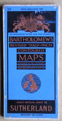
Sutherland. Sheet 59.
by Folding Map
- Used
- very good
- Hardcover
John Bartholomew & Son Ltd. Undated, circa 1930/40s. Bartholomew's Revised Half-Inch Contoured Map. Mounted on cloth. Slight wear.. Very Good.
-
Bookseller
N. G. Lawrie Books.
 (GB)
(GB)
- Book Condition Used - Very Good
- Binding Hardcover
- Publisher John Bartholomew & Son Ltd.
- Keywords Sutherland Scotland Map.

Sheffield (West) 1903. Old Ordnance Survey Maps. Yorkshire Sheet 294.07.
by Folding Map
- Used
- Very Good
- Condition
- Used - Very Good
- ISBN 10 / ISBN 13
- 9780850540482 / 0850540488
- Quantity Available
- 1
- Seller
-
Sheffield, United Kingdom
- Item Price
-
£1.00
Show Details
Item Price
£1.00

Old Ordnance Survey Maps of Durham: Sheriff Hill & High Fell 1895
by Folding Map
- Used
- Very Good
- Condition
- Used - Very Good
- ISBN 10 / ISBN 13
- 9780907554240 / 0907554245
- Quantity Available
- 1
- Seller
-
Sheffield, United Kingdom
- Item Price
-
£1.00
Show Details
Description:
Alan Godfrey Maps. Facsimilie. The Godfrey Edition.. Very Good.
Item Price
£1.00

Sheffield Park 1903. Old Ordnance Survey Maps. Yorkshire Sheet 294.12.
by Folding Map
- Used
- Very Good
- Condition
- Used - Very Good
- ISBN 10 / ISBN 13
- 9780850541205 / 0850541204
- Quantity Available
- 1
- Seller
-
Sheffield, United Kingdom
- Item Price
-
£1.00
Show Details
Description:
Alan Godfrey Maps. Facsimilie. The Godfrey Edition.. Very Good.
Item Price
£1.00

Mexborough 1901. Old Ordnance Survey Maps. Yorkshire Sheet 284.09.
by Folding Map
- Used
- Fine
- Condition
- Used - Fine
- ISBN 10 / ISBN 13
- 9780850540499 / 0850540496
- Quantity Available
- 1
- Seller
-
Sheffield, United Kingdom
- Item Price
-
£1.00
Show Details
Description:
Alan Godfrey Maps. Fine.
Item Price
£1.00
Greasbrough 1901. Old Ordnance Survey Maps. Yorkshire Sheet 289.02.
by Folding Map
- Used
- Fine
- Condition
- Used - Fine
- ISBN 10 / ISBN 13
- 9781841511115 / 1841511110
- Quantity Available
- 1
- Seller
-
Sheffield, United Kingdom
- Item Price
-
£1.00
Show Details
Description:
Alan Godfrey Maps. Fine.
Item Price
£1.00
Ordnance Survey Map. Epping and Chipping Ongar. Sheet TL 40/50.
by Folding Map
- Used
- Good
- Condition
- Used - Good
- Quantity Available
- 1
- Seller
-
Sheffield, United Kingdom
- Item Price
-
£2.00
Show Details
Description:
Ordnance Survey., 1982. Pathfinder Series of Great Britain. Sacle 1:25000. Some edge damp staining, some wear on the folds.. Good.
Item Price
£2.00

Liverpool. Landranger Sheet 108.
by Folding Map
- Used
- Very Good
- Condition
- Used - Very Good
- Quantity Available
- 1
- Seller
-
Sheffield, United Kingdom
- Item Price
-
£2.00
Show Details
Description:
Ordnance Survey., 1978. Scale 1:50000. 1 1/4 inches to 1 Mile.. Very Good.
Item Price
£2.00

West Cork. Sheet 24.
by Folding Map
- Used
- Condition
- Used - Very Good+
- Quantity Available
- 1
- Seller
-
Sheffield, United Kingdom
- Item Price
-
£2.00
Show Details
Description:
Ordnance Survey of Ireland., 1978. Scale: 1:126,720. Half Inch to One Mile.. Very Good+.
Item Price
£2.00

Ordnance Survey Map. The Dark Peak. Kinder Scout, Bleaklow and Black Hill.
by Folding Map
- Used
- Very Good
- Condition
- Used - Very Good
- Quantity Available
- 1
- Seller
-
Sheffield, United Kingdom
- Item Price
-
£2.00
Show Details
Description:
Southampton.: Ordnance Survey Office., 1980. 1:25000 Outdoor Leisure Map. Slight wear to the covers.. Very Good.
Item Price
£2.00

West Cumbria. Landranger Sheet 89.
by Folding Map
- Used
- Very Good
- Condition
- Used - Very Good
- Quantity Available
- 1
- Seller
-
Sheffield, United Kingdom
- Item Price
-
£2.00
Show Details
Description:
Ordnance Survey., 1980. Scale 1:50000. 1 1/4 inches to 1 Mile.. Very Good.
Item Price
£2.00
