Click for full-size.


Report of an Expedition Down the Zuni and Colorado Rivers
by Sitgreaves, Lerenzo (1811-1888)
- Used
- Hardcover
- first
- Condition
- About very good
- Seller
-
Fort Worth, Texas, United States
Payment Methods Accepted
About This Item
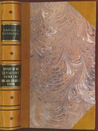
198 pages with 23 plates. Royal octavo (9 1/2" x 6") rebound in 3/4 leather with marbled boards and black label with gilt lettering to spine. 79 plates with one (Buffalo Dance) folding and some with a single tint, in this first issue there are errors in the list of illustrations corrected in later issues viz. Landscapes, etc., 23 plates, numbered as 1-13, 15-23 plus one unnumbered at end; Mammals, 6 plates; Birds, 5 plates, numbered 1, 3-6 (plate 2, Struthus Canicops, Woodhouse, male is called for but not present and most likely not to be found in this issue); Reptiles 21 plates, with 10a miss-numbered as 10, 12 as 13, and 13 as 16; Fishes, 3 plates; Plants, 21 plates, plate 21 Aploppus Nuttalii present but not called for. Includes Reconnaissance of the Zuni, Little Colorado, and Colorado Rivers Made in 1851 map as called for, but includes Lithographed map Boundary of the Creek Country (24" x 36") laid in not called for. (Senate Executive Document 59) (Howes: 528) First edition.
Survey of the watershed of the Canadian River and Red Fork of the Arkansas River in Indian Territory, extending from Fort Smith to the border with Texas. The lands of the Cherokee, Creek, Seminole and Choctaw Indians are located. The map locates numerous forts, including Smith, Coffee, Gibson and Old Fort Holmes, and their connecting wagon roads. Talasee is shown at the site of Tulsa. This map was issued with the "Northern and Western Boundary Line of the Creek Country" report by Sitgreaves and Lt. J.C. Woodruff. The surveys were made in 1848 and 1850, but the report in which the map was issued wasn't published until 1858.
After the conquest of New Mexico and California it was apparent that transportation and communications needed to be improved between these new territories and the rest of the United States east of the Mississippi. Geographical knowledge of most of this area, particularly northwestern New Mexico (now northern Arizona), was very limited and inaccurate. Some maps of the day showed a river system that might provide a possible navigable water corridor between New Mexico and the Gulf of California via the Zuni, Little Colorado, and Colorado Rivers. In September of 1851 Captain Lorenzo Sitgreaves, along with a small crew of topographers, naturalists, artists, and support personnel, and an escort of 30 infantrymen left the Zuni Pueblo in western New Mexico by pack train with instructions to explore and map the Zuni and Colorado Rivers and evaluate their navigability in light of a possible impending war with the Mormons in Utah. They traveled southwest along the Zuni River to its mouth and then headed northwest along the Little Colorado, intending to follow it to the Colorado. When they reached Grand Falls (northwest of present-day Winslow, Arizona) their guide, Antoine Leroux, advised them that it was unwise to follow the river any further because it flowed in a deep canyon for the rest of its course and emptied into the great canyon of the Colorado River. They left the river and struck off due west around the north side of the San Francisco Mountains, discovering the Wupatki Indian Ruins along the way, and looped southwestward around the south side of Bill Williams Mountain. The rest of their westward march followed near the future alignment of Route 66 to the Colorado River near the modern town of Bullhead City, Arizona. After a difficult march south along the Colorado River they reached Camp Yuma on November 30. Of course, Sitgreaves discovered that the Zuni and Little Colorado Rivers were not at all navigable and would be useless to transport troops and supplies. The Colorado River, however, was found to be navigable along the entire distance that he explored. Sitgreaves' official report, "Report of an Expedition Down the Zuni and Colorado Rivers in 1851," was published in 1853.
Condition:
Foxing, left margin trimmed as issued for folding, all other plates present as called for in Howes as well as Lithographed map Boundary of the Creek Country laid in and not called for, some folding. Rebound in attractive three quarter leather else a about very good.
Reviews
(Log in or Create an Account first!)
Details
- Bookseller
- The Book Collector ABAA, ILAB, TBA
 (US)
(US)
- Bookseller's Inventory #
- E0014
- Title
- Report of an Expedition Down the Zuni and Colorado Rivers
- Author
- Sitgreaves, Lerenzo (1811-1888)
- Book Condition
- Used - About very good
- Quantity Available
- 1
- Edition
- First
- Binding
- Hardcover
- Publisher
- Robert Armstrong
- Place of Publication
- Washington
- Date Published
- 1853
- Pages
- 198 pages with 23 plates.
- Size
- Royal octavo
- Weight
- 0.00 lbs
- Keywords
- Americana
- Bookseller catalogs
- Exploration;
Terms of Sale
The Book Collector ABAA, ILAB, TBA
All items are guaranteed as described. If an item is
not as described, it is returnable within seven days
of receipt, unless other arrangements are made.
Full refunds given only when items are received in
the same condition in which they were sent.
We require new customers to send payment with
their order. Customers known to us will be invoiced
with payment due in thirty days, unless prior
arrangements are made. Institutions will be billed
to meet their requirements. All items subject to prior
sale.
We accept Visa, Mastercard, and American Express
Please be advised that we can only ship to your billing address.
We accept checks, but may require that the check clears before we ship an order.
Prices of books do not include shipping.
We use UPS domestically and internationally. Other shipping arrangements can be made. Shipping is always charged at cost.
Texas residents must add 8.25% sales tax.
About the Seller
The Book Collector ABAA, ILAB, TBA
Biblio member since 2005
Fort Worth, Texas
About The Book Collector ABAA, ILAB, TBA
The Book Collector specializes in the finest collections of Chess, Anthropology, Americana and American Literature. Visit our website at www.bookcollectorshop.com
Glossary
Some terminology that may be used in this description includes:
- First Edition
- In book collecting, the first edition is the earliest published form of a book. A book may have more than one first edition in...
- Plate
- Full page illustration or photograph. Plates are printed separately from the text of the book, and bound in at production. I.e.,...
- Marbled boards
- ...
- Octavo
- Another of the terms referring to page or book size, octavo refers to a standard printer's sheet folded four times, producing...
- Spine
- The outer portion of a book which covers the actual binding. The spine usually faces outward when a book is placed on a shelf....
- New
- A new book is a book previously not circulated to a buyer. Although a new book is typically free of any faults or defects, "new"...
- Gilt
- The decorative application of gold or gold coloring to a portion of a book on the spine, edges of the text block, or an inlay in...
- Rebound
- A book in which the pages have been bound into a covering replacing the original covering issued by the publisher.
Frequently asked questions
This Book’s Categories

Collecting the 1939 New York World’s Fair
Born in the midst of the Great Depression, the theme of the 1939 World’s Fair was “The World of Tomorrow” - a theme that captured the hearts of a generation. Check out the maps, souvenirs, and other ephemera on Biblio!

Vertigo Comics
Vertigo Comics, an imprint of DC Comics, is being retired in 2020 after a 27 year run of groundbreaking comics. The imprint was DC’s home for mature tales that were often horror-themed or otherwise dark in nature. Learn more about Vertigo, home of V for Vendetta, Sandman, and Fables.
Also Recommended
-

-

-

-
-

Save 10% on every purchase!
Join the Bibliophiles’ Club and start saving 10% on every book.
$29.95 / Year