Click for full-size.

Ordnance Survey Map 1837/74: Dolgelley & Barmouth
by Ordnance Map Office (Col. Colby) and Edward Stanford, London:
- Used
- Hardcover
- Condition
- Very Good Condition/No Dust Jacket
- Seller
-
Llandudno, Conwy, United Kingdom
Payment Methods Accepted
About This Item
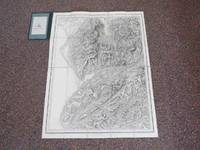
Ordnance survey, London, 1874. Early Edition. Hardcover (Original Cloth). Very Good Condition/No Dust Jacket. Scale is 1 inch to 1 statute mile. Linen mounted monochrome map, 26x20 inches, folds to form a hardcover cased booklet approximately 7x4 and a half inches. Engraved at the Ordnance Map Office and published by Col. Colby on Ist Jan 1837 (stated on right lower margin). On the left hand lower margin Electrotyped in 1874.The map is engraved in monochrome on paper backed with linen and folds out into 20 sections, Overall in very good condition, previous owners name to label and owners bookplate (Henry Gilbert Wintle). Quantity Available: 1. Shipped Weight: Under 1 kilogram. Category: Geography & Maps; Pictures of this item not already displayed here available upon request. Inventory No: 3675. .
Reviews
(Log in or Create an Account first!)
Details
- Seller
- Polar Books
 (GB)
(GB)
- Seller's Inventory #
- 3675
- Title
- Ordnance Survey Map 1837/74: Dolgelley & Barmouth
- Author
- Ordnance Map Office (Col. Colby) and Edward Stanford, London:
- Format/Binding
- Hardcover (Original Cloth)
- Book Condition
- Used - Very Good Condition
- Jacket Condition
- No Dust Jacket
- Quantity Available
- 1
- Edition
- Early Edition
- Binding
- Hardcover
- Publisher
- Ordnance survey
- Place of Publication
- London
- Date Published
- 1874
- Keywords
- BZDB349 Geography & Maps; Unbranded Ordnance Map Office (Col. Colby) and Edward Stanford, London: Ordnance Survey Map 1837/74: Dolgelley & Barmouth
Terms of Sale
Polar Books
POSTAGE: We will endeavour to charge post and packing at cost. This varies depending on the weight and value of the book and also if you, the customer, wish it to be tracked or not. Once an order has been received we will check the postage costs and either refund or request an extra amount to cover additional P&P/insurance. The Biblio Postage Matrix is not versatile enough and as such postage costs are estimates ONLY.
15 day return guarantee, with full refund including original shipping costs for up to 15 days after delivery if an item arrives misdescribed. We are happy to accept returns if not as described. Please contact us by email first.The books to be returned must be packed carefully, and securely, as we cannot accept back, or be held responsible for any damages incurred during the return postage.
About the Seller
Polar Books
Biblio member since 2014
Llandudno, Conwy
About Polar Books
We have secondhand and rare antiquarian books, scientific papers, reports, maps, photographs and other ephemera on Antarctica, the Arctic, polar travel, history, mountaineering and exploration and whaling for sale through this web site. If you are looking for scarce book you could find it here. Our books can also be viewed at www.polarbooks.net
Glossary
Some terminology that may be used in this description includes:
This Book’s Categories

A Brief History of the Dust Jacket
When did dust jackets first appear, and what exactly are they for? Learn about this often-important detail as it applies to book collecting. More...

Collecting Signed Books
Read through our tips, hints, and information on collecting books signed or inscribed by the author or illustrator.
