Description:
Storrs-Mansfield.: Maurizio Martino Publisher., No date. Limited edition, 350 copies. Reprint of the 1958 edition.. Green cloth, gilt spine title.. Very good, no dust jacket.. 31x23 cm.. Volume 2 only (of 6). Heavy book, will require extra shipping. weight: 3.7 lb. Illustrated with maps, some folding.
Mapping The Transmississippi West, 1540-1861. Volume One, The Spanish Entrada to the Louisiana Purchase, 1540-1804 by Wheat, Carl I - 1957
by Wheat, Carl I
Similar copies are shown below.
Similar copies are shown to the right.
Mapping The Transmississippi West, 1540-1861. Volume One, The Spanish Entrada to the Louisiana Purchase, 1540-1804
by Wheat, Carl I
- Used
- Hardcover
- first
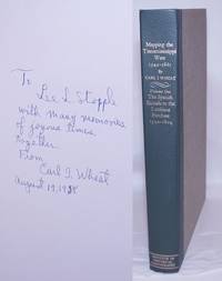
San Francisco: Grabhorn Press for the Institute of Historical Cartography, 1957. Hardcover. 263p., 10x14 inches, Volume 1 of 4, includes many full color maps and illustrations, rubricated full title page, Lee Lawrence Stopple bookplate to front pastedown endpaper. inscribed by author "To Lee L. Stopple with many memories of the joyous times together, from Carl I. Wheat, August 19, 1958." Also included is a separate hand written letter, dated Sept. 26, 1955, "Dear Lee..." Offset browning to front free endpaper where letter was laid in (now in mylar). Minor shelfwear, top edge has some foxing, pages a bit age toned.
-
Bookseller
Bolerium Books Inc., ABAA/ILAB
 (US)
(US)
- Format/Binding Hardcover
- Book Condition Used
- Binding Hardcover
- Publisher Grabhorn Press for the Institute of Historical Cartography
- Place of Publication San Francisco
- Date Published 1957
We have 3 copies available starting at £101.16.

More Photos
Mapping the Transmississippi West, 1540-1861; Volume 2 - From Lewis and Clark to Fremont,1804-1845.
by Wheat, Carl I
- Used
- Hardcover
- Condition
- Used - Very good, no dust jacket.
- Edition
- Limited edition, 350 copies. Reprint of the 1958 edition.
- Binding
- Hardcover
- Quantity Available
- 1
- Seller
-
Reno, Nevada, United States
- Item Price
-
£101.16
Show Details
Item Price
£101.16
![Mapping the Transmississippi West 1540-1861. [5 Volumes in 6, Complete, Plus Prospectus Volume]](https://d3525k1ryd2155.cloudfront.net/h/642/473/1462473642.0.m.jpg)
Mapping the Transmississippi West 1540-1861. [5 Volumes in 6, Complete, Plus Prospectus Volume]
by Wheat, Carl I
- Used
- near fine
- Hardcover
- first
- Condition
- Used - Near Fine
- Edition
- First Edition
- Binding
- Hardcover
- Quantity Available
- 1
- Seller
-
GRASS VALLEY, California, United States
- Item Price
-
£1,618.60
Show Details
Description:
San Francisco: The Institute of Historical Cartography. Near Fine. 1957-1963. First Edition. Hardcover. Volumes 1-4 with light offset tanning from plain brown paper jackets that the volumes were originally issued with. ; In an addition of 1000 copies, designed by the Grabhorn Press. Green cloth backs, lettered in gilt and linen over boards; over 300 reproductions of historical maps, many folding. Without the plain paper jackets. The Prospectus Volume bound the same , contains 8 printed leaves, reproducing title pages for volumes 2 through 5, along with descriptions of the project, and reviews. This followed by 7 blank leaves. There are two 8 page printed announcements, one inserted at first title page, the other laid in ; Folio 13" - 23" tall; Volume One, The Spanish Entrada to the Louisiana Purchase, 1540-1804; Volume Two, From Lewis and Clark to Fremont, 1804-1845; Volume Three, From the Mexican War to the Boundary Surveys 1846-1854; Volume Four, From the Pacific Railroad…
Read More Item Price
£1,618.60

Mapping the Transmississippi West 1540-1861 Five Volume Set (Volume Five in Two Parts)
by Wheat, Carl I
- Used
- very good
- Hardcover
- Condition
- Used - Very Good
- Jacket Condition
- Missing
- Binding
- Hardcover
- Quantity Available
- 1
- Seller
-
Portland, Oregon, United States
- Item Price
-
£1,942.32
Show Details
Description:
Institute of Historical Cartography , 1957-1963. Hardcover. Very Good/Missing. Folio. Map reproductions by Charles R. Wood & Associates of San Francisco. The bindings are tight and show very light rubbing to extremities. Corners are sharp. Some minor, isolated wear to text block edges. Text and images unmarked, foldout maps intact. Volume One has a thin strip of paper affixed to the front pastedown (possibly from an old bookplate). Volume Four shows very light toning to free front endpapers. Overall a very handsome set in VG+ condition. Volume One: published 1957; 364pp. Volume Two: published 1958; 281pp. Volume Three: published 1959; 349pp. Volume Four: published 1960; 260pp. Volume Five (in two parts): published 1963; 487pp. PLEASE NOTE: THIS SET IS NOT ELIGIBLE FOR INTERNATIONAL SHIPPING AND WILL REQUIRE A SUBSTANTIAL ADDITIONAL SHIPPING FEE TO DOMESTIC ADDRESSES.
Item Price
£1,942.32