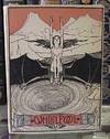
![A Map of the White Mountains of New Hampshire 1853. [with] Mt. Washington from North Conway [and four other views].](https://d3525k1ryd2155.cloudfront.net/h/679/919/1437919679.0.m.jpg)
A Map of the White Mountains of New Hampshire 1853. [with] Mt. Washington from North Conway [and four other views].
by [New Hampshire.] [White Mountains.] Bond, George and B[enjamin]. Champney
- Used
- Hardcover
- Condition
- See description
- Seller
-
Scarborough, Maine, United States
Payment Methods Accepted
About This Item
White Mountains Classic
The Bond map with the Champney views is without doubt one of the White Mountains classics. On the Bond map, "[t]he names of the individual peaks of the Presidential Range appear for the first time on any map, as well as the names Cannon Mt., Twin Mts., Carrigain, Tremont, and Giant's Stairs." ( Bent, p.84). Hachure marks are employed to suggest elevation, and Apt notes that this is the first topographic map of the region.
The five lithographed views after Champney are printed on the reverse of the map as called for by Bent. Apt notes that map and views appear on separate sheets in some cases. We do not know the precedence or relative rarity of the two formats. The front paste-down provides a "Table of Distances" while the rear has a "Table of Heights, Bearings and Distances" of 30 peaks.
References: Apt, Maps of the White Mountains of New Hampshire (Exhibition Catalogue): Map 14, pp. 9-10. Hanrahan [ed.], Bent's Bibliography of the White Mountains: p. 84. Cobb, Maps of New Hampshire to 1900: 206.
Condition: Dark green cloth-covered folder with gilt title on front board; some scuffing at top 2" of rear board. Foxing or glue staining to tables pasted down on inside of both boards. Map and scenes are bright and quite clean with an occasional spot; folds reinforced.
[ICN 3467.]
Reviews
(Log in or Create an Account first!)
Details
- Seller
- BICKERSTAFF'S BOOKS, MAPS &C.
(US)
- Seller's Inventory #
- 3764
- Title
- A Map of the White Mountains of New Hampshire 1853. [with] Mt. Washington from North Conway [and four other views].
- Author
- [New Hampshire.] [White Mountains.] Bond, George and B[enjamin]. Champney
- Book Condition
- Used
- Quantity Available
- 1
- Binding
- Hardcover
- Publisher
- [John Bartlett.]
- Place of Publication
- [Cambridge, MA.]
- Date Published
- 1853
- Size
- Map: 15 1/4 x 16 3/4."
- Weight
- 0.00 lbs
Terms of Sale
BICKERSTAFF'S BOOKS, MAPS &C.
30 day return guarantee, with full refund including original shipping costs for up to 30 days after delivery if an item arrives misdescribed or damaged.
About the Seller
BICKERSTAFF'S BOOKS, MAPS &C.
Biblio member since 2020
Scarborough, Maine
About BICKERSTAFF'S BOOKS, MAPS &C.
Since 1980 we have had the pleasure of offering interesting American books, maps and ephemera to discerning collectors and institutional clients. We would be happy to assist in fulfilling your collecting or acquisition needs. Please let us know how we can help.
Glossary
Some terminology that may be used in this description includes:
- Gilt
- The decorative application of gold or gold coloring to a portion of a book on the spine, edges of the text block, or an inlay in...
- New
- A new book is a book previously not circulated to a buyer. Although a new book is typically free of any faults or defects, "new"...
- Paste-down
- The paste-down is the portion of the endpaper that is glued to the inner boards of a hardback book. The paste-down forms an...
![A Map of the White Mountains of New Hampshire 1853. [with] Mt. Washington from](https://d3525k1ryd2155.cloudfront.net/h/679/919/1437919679.2.s.jpg)
![A Map of the White Mountains of New Hampshire 1853. [with] Mt. Washington from](https://d3525k1ryd2155.cloudfront.net/h/679/919/1437919679.5.s.jpg)

