Click for full-size.
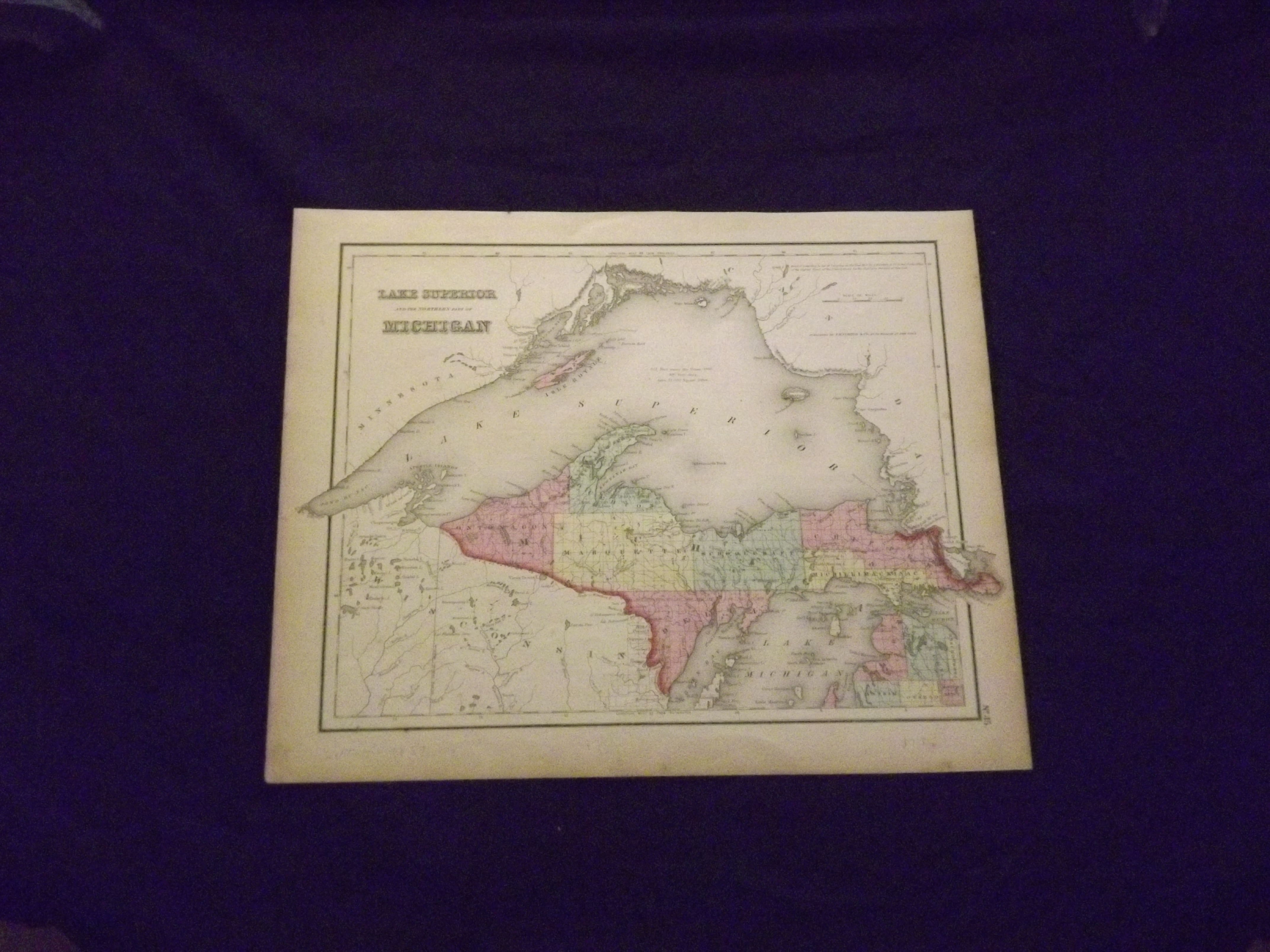
Colton's Map of Lake Superior and the Northern Part of Michigan.
by Colton, J.H
- Used
- Condition
- See description
- Seller
-
Florham Park, New Jersey, United States
Payment Methods Accepted
About This Item
Unbound, colored engraved map, 16 " x 13". Slight toning, darkening and aging; overall bright and clean and in very good condition. Maps are wrapped with acid free board, or in rigid sleeves. Beginning with J. H. Colton (1800-1893), the Colton family published atlases for over 30 years. Colton's Atlas of the World was first published in 1855 in a large two volume set. In 1857 it became Colton's General Atlas, and Colton's sons, George Woolworth and Charles B. would take over the business. This map of Northern Michigan is from the 1857 edition of Colton's General Atlas, even though the copyright date on the map indicates 1855. The mapis unusual in that Lake Superior is emphasized, and only the northern portion of the state is shown. Extra postage may be required. Ristow 313-326.
Details
- Bookseller
- Nicholas D. Riccio Rare Books & Prints
 (US)
(US)
- Bookseller's Inventory #
- biblio6
- Title
- Colton's Map of Lake Superior and the Northern Part of Michigan.
- Author
- Colton, J.H
- Book Condition
- Used
- Quantity Available
- 1
- Publisher
- J.H. Colton & Co.,
- Place of Publication
- New York:
- Date Published
- 1857.
- Keywords
- Michigan. Map of Michigan. Lake Superior.
- Note
- May be a multi-volume set and require additional postage.
Terms of Sale
Nicholas D. Riccio Rare Books & Prints
30 day return guarantee, with full refund including shipping costs for up to 30 days after delivery if an item arrives misdescribed or damaged.
About the Seller
Nicholas D. Riccio Rare Books & Prints
Biblio member since 2011
Florham Park, New Jersey
About Nicholas D. Riccio Rare Books & Prints
Established in 1999 we specialize in Americana, African Americana, Natural History, Travel & Exploration, Science & Medicine, and Maps & Atlases
Glossary
Some terminology that may be used in this description includes:

Collecting the 1939 New York World’s Fair
Born in the midst of the Great Depression, the theme of the 1939 World’s Fair was “The World of Tomorrow” - a theme that captured the hearts of a generation. Check out the maps, souvenirs, and other ephemera on Biblio!

Collecting History of the Circus in America
Step right up! Take a look at the center ring, where you will see displayed the most amazing, most colorful series of history books that the world has ever seen! Right this way, folks…