Mitchell's School Atlas
by Mitchell, S Augustus
Available Copies
More Photos
Mitchell's School Atlas: Comprising the Maps, etc., Designed to Illustrate Mitchell's School and Family Geography
by S. Augustus Mitchell
- Condition
- Used - Acceptable
- Published
- 1846
- Binding
- Hardcover
- Quantity Available
- 1
- Seller
-
Boonsboro, Maryland, USA
- Item Price
-
£938.45
Show Details
Description:
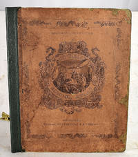
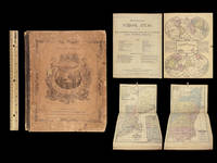
Thomas, Cowperthwait & Co, 1846. Hardcover. Acceptable. Bound in publisher's printed boards. Hardcover. Rebacked. 8 pages : complete with 28 color maps ; 31 cm. Maps dated 1839-1846. Staining. Contemporary signature of Elizabeth W. Mead, Ashton. Milo Francis Mead. Contents:1. The world, equatorial projection; 2. The world, polar projection; 3. Antarctic regions; 4. North… Read more about this item Item Price
£938.45

More Photos
Mitchell’s School Atlas: comprising the maps and tables designed to accompany
by MITCHELL, S Augustus
- Condition
- Used - Near Fine
- Published
- 1856
- Binding
- Leather; tight and secure
- Quantity Available
- 1
- Seller
-
COLUMBIA, Missouri, USA
- Item Price
-
£438.90
Show Details
Description:
1856 Mitchell School ATLAS 32 MAPS America Holy Land Texas Egypt United States
The name Mitchell has long been synonymous with 19th-century maps; in fact, Mitchell maps are often considered the best of atlas maps from the 1800s. S Augustus Mitchell published an important geography book designed for schools and with it an impressive atlas. This 1856 atlas contains, as expected,… Read more about this item Item Price
£438.90
More Photos
Mitchell’s School Atlas: comprising the maps, etc., designed to accompany
by MITCHELL, S Augustus
- Condition
- Used - Near Fine
- Published
- 1865
- Binding
- Leather; tight and secure
- Quantity Available
- 1
- Seller
-
COLUMBIA, Missouri, USA
- Item Price
-
£478.00
Show Details
Description:
1865 Mitchell School ATLAS 31 MAPS America TEXAS Wild West Confederate South
The name Mitchell has long been synonymous with 19th-century maps; in fact, Mitchell maps are often considered the best of atlas maps from the 1800s. S Augustus Mitchell published an important geography book designed for schools and with it an impressive atlas. This 1865 atlas contains 31 maps.
Item… Read more about this item Item Price
£478.00

Mitchell's School Atlas: Comprising the Maps and Tables Designed to Accompany Mitchell's School and Family Geography.
by MITCHELL, S. Augustus.
- Condition
- Used - Corners and spine a bit worn; light soiling to boards; maps fine.
- Published
- 1861.
- Binding
- Publisher's illustrated leather-backed boards.
- Quantity Available
- 1
- Seller
-
Rochester, New York, USA
- Item Price
-
£239.40
Show Details
Description:
Philadelphia:: Published by E. H. Butler & Co.,, 1861.. publisher's illustrated leather-backed boards.. Corners and spine a bit worn; light soiling to boards; maps fine.. Folio,. Complete with 31 tinted maps (32 are listed on the title page, but there is no No. 6. listed).. Old student's ownership annotation in ink and pencil notes on endsheets.… Read more about this item Item Price
£239.40
Mitchell's SCHOOL ATLAS: Comprising the Maps and Tables Designed to Accompany Mitchell's School and Family Geography.
by Mitchell, S. Augustus
- Condition
- Used - Good
- Jacket Condition
- No Jacket
- Edition
- 2nd.
- Published
- 1863
- Binding
- Hardcover
- Quantity Available
- 1
- Seller
-
NEWARK, Ohio, USA
- Item Price
-
£179.55
Show Details
Description:
Philadelphia, PA, U.S.A.: E. H. Butler & Co., 1863. Atlas. Good. Hardcover. 2nd.. 32 copperplate maps, engraving on Front Cover, leather spine hinge in process of disintegrating, worn corners and edges, binding is loose but all pages are present. Will not fit in Flat Rate Priority Mail envelope. USPS Variable Rate applies for Domestic or International. Size: Folio. Item Price
£179.55
