Click for full-size.


Indiana
by [Burlington Route] [Railroad Map] Rand McNally & Company
- Used
- Condition
- See description
- Seller
-
GIG HARBOR, Washington, United States
Payment Methods Accepted
About This Item
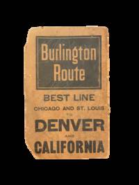
[Chicago]: Rand, Mcnally & Co, 1900. Two color map, 28x21," folding to 6x3.5." Few small marginal tears at folds, some toning else very good. Attached to original Burlington Route folder, lacking front cover.
Uncommon Indiana pocket map from the Burlington Route, showing roads, counties, cities, etc., with an emphasis on railways, which are listed in red at the bottom right corner. List of chief cities with populations along left margin.
.
Uncommon Indiana pocket map from the Burlington Route, showing roads, counties, cities, etc., with an emphasis on railways, which are listed in red at the bottom right corner. List of chief cities with populations along left margin.
.
Reviews
(Log in or Create an Account first!)
Details
- Bookseller
- Peruse the Stacks
 (US)
(US)
- Bookseller's Inventory #
- 5708
- Title
- Indiana
- Author
- [Burlington Route] [Railroad Map] Rand McNally & Company
- Format/Binding
- Two color map, 28x21," folding to 6x3.5." Few small marginal tears at folds, some toning else very good. Attached to original Bu
- Book Condition
- Used
- Quantity Available
- 1
- Publisher
- Rand, Mcnally & Co
- Place of Publication
- [Chicago]
- Date Published
- 1900
Terms of Sale
Peruse the Stacks
30 day return guarantee, with full refund including original shipping costs for up to 30 days after delivery if an item arrives misdescribed or damaged.
About the Seller
Peruse the Stacks
Biblio member since 2021
GIG HARBOR, Washington
About Peruse the Stacks
Independent bookseller out of Gig Harbor, WA offering all manner of signed, first edition, and collectible books.
This Book’s Categories

Michael Bond - the man behind Paddington Bear
“All the same ... it’s a very important name. And I don’t expect there are many bears in the world called Paddington!”
A lonely toy bear on an empty shop shelf on Christmas Eve in 1956 first captured the attention of Michael Bond, who kindly shared Paddington with the world.

Collecting and identifying signed letters and holographic documents
Many authors and other famous literary figures wrote and signed letters by hand, and you can find a great collection of them in the Biblio rare book room. See our great collection of handwritten letters and holographic documents