Description:
Department of the Army Tulsa District Corps of Engineers, 1970-01-01. Map. Very Good. 1970. Ships next day. Map is in very good shape; no tears, scribbles, highlighting or underlining; a little general wear; from a smoke-free environment.
Engineering manual, civil works construction, Part 114: Hydrologic and hydraulic analyses, Chapter 9: Computation of backwater curves in river channels by DEPARTMENT OF THE ARMY, CORPS OF ENGINEERS - 1952
by DEPARTMENT OF THE ARMY, CORPS OF ENGINEERS

Engineering manual, civil works construction, Part 114: Hydrologic and hydraulic analyses, Chapter 9: Computation of backwater curves in river channels
by DEPARTMENT OF THE ARMY, CORPS OF ENGINEERS
- Used
- Good
- Paperback
GPO, 1952. Paperback. Good. Staplebound softcover, light soiling to cover. Cover has owner's name and address. Contents clean. B&w illustrations, references.
-
Bookseller
Independent bookstores
 (US)
(US)
- Format/Binding Paperback
- Book Condition Used - Good
- Quantity Available 1
- Binding Paperback
- Publisher GPO
- Date Published 1952
- X weight 0 oz
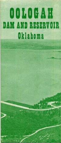
Oologah Dam and Reservoir Oklahoma Map
by Department of the Army Tulsa District Corps of Engineers
- Used
- Very Good
- Condition
- Used - Very Good
- Quantity Available
- 1
- Seller
-
Tulsa, Oklahoma, United States
- Item Price
-
£15.88
Show Details
Item Price
£15.88

Chouteau and Newt Graham Locks and Dams Single Sheet Map
by Department of the Army Tulsa, Oklahoma District Corps of Engineers
- Used
- Good
- Condition
- Used - Good
- Quantity Available
- 1
- Seller
-
Tulsa, Oklahoma, United States
- Item Price
-
£15.88
Show Details
Description:
Department of the Army Tulsa, Oklahoma District Corps of Engineers. Good. Ships next day. Map is in good shape, no scribbles, highlighting or underlining, has a little nick on the top, a little general wear, from a smoke-free environment.
Item Price
£15.88
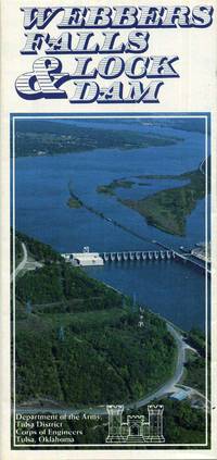
Webbers Falls Lock and Dam Oklahoma Lake Map
by Department of the Army Tulsa District Corps of Engineers
- Used
- Very Good
- Condition
- Used - Very Good
- Quantity Available
- 2
- Seller
-
Tulsa, Oklahoma, United States
- Item Price
-
£15.88
Show Details
Description:
Department of the Army Tulsa District Corps of Engineers, 1970-01-01. Map. Very Good. 1970. Ships next day. Map is in very good shape; no tears, scribbles, highlighting or underlining; a little general wear; from a smoke-free environment.
Item Price
£15.88
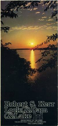
Robert S. Kerr Lock and Dam and Lake Oklahoma Map
by Department of the Army Tulsa District Corps of Engineers
- Used
- Very Good
- Condition
- Used - Very Good
- Quantity Available
- 1
- Seller
-
Tulsa, Oklahoma, United States
- Item Price
-
£15.88
Show Details
Description:
Department of the Army Tulsa District Corps of Engineers, 1978-01-01. Map. Very Good. 1978. Ships next day. Map is in very good shape; no tears, scribbles, highlighting or underlining; a little general wear; from a smoke-free environment.
Item Price
£15.88
THE INTRACOASTAL WATERWAY: PART I ATLANTIC SECTION
by Department of The Army Corps of Engineers
- Used
- Very Good
- Hardcover
- Condition
- Used - Very Good
- Binding
- Hardcover
- Quantity Available
- 1
- Seller
-
Columbus, Ohio, United States
- Item Price
-
£19.46
Show Details
Description:
No Place: No Publisher. Very Good. 1948. Hardcover. January, 1948. With many fold-out maps and charts. In the original, lightly soiled, paper wraps. Front hinge is cracked but firm. .
Item Price
£19.46
CAPE COD CANAL: Gateway to America's Intra-Coastal Waterway
by Department of the Army/ Corps of Engineers
- Used
- Condition
- Used - Good
- Quantity Available
- 1
- Seller
-
Frederick, Maryland, United States
- Item Price
-
£31.32
Show Details
Description:
Dept. Of The Army/ Corps of Engineers. Used - Good. Good condition. (Massachusetts, Cape Cod, canals)
Item Price
£31.32
CONSTRUCTION INSPECTOR'S GUIDE; 4 VOLUMES
by Corps of Engineers; Department of the Army
- Used
- Very Good
- Paperback
- Condition
- Used - Very Good
- Jacket Condition
- No Dust Jacket
- Binding
- Paperback
- Quantity Available
- 1
- Seller
-
Calumet, Michigan, United States
- Item Price
-
£35.02
Show Details
Description:
Washington DC: Department of the Army, 1960. Soft cover. Very Good/No Dust Jacket. About 200pp each volume. Sturdy brown flexible cloth. Size: 16mo - over 5¾" - 6¾" tall
Item Price
£35.02
Waterborne Commerce of the United States. Calendar Year 1956. Part 4, Waterways and Harbors: Pacific Coast, Alaska and Pacific Islands
by Department of the Army Corps of Engineers
- Used
- Paperback
- Condition
- Used
- Binding
- Paperback
- Quantity Available
- 1
- Seller
-
Cleveland, Ohio, United States
- Item Price
-
£52.19
Show Details
Description:
Department of the Army Corps of Engineers, 1956. 164 pp., Paperback, ex library, else text clean and binding tight. - If you are reading this, this item is actually (physically) in our stock and ready for shipment once ordered. We are not bookjackers. Buyer is responsible for any additional duties, taxes, or fees required by recipient's country.
Item Price
£52.19
Lake Series No. 6 (Revised 1949). The Port of Detroit and Ports on the Saginaw River, Michigan. Prepared by the Board of Engineers for Rivers and Harbors.
by United States. Department of the Army. Corps of Engineers
- Used
- Condition
- Used
- Quantity Available
- 1
- Seller
-
Cleveland, Ohio, United States
- Item Price
-
£78.22
Show Details
Description:
Washington: GPO,, 1950. large quarto, viii, 207 pp., illustrations include 6 folding maps, most of them color; library hand stamps and markings, paper wrappers faded but sound and interior very good. - If you are reading this, this item is actually (physically) in our stock and ready for shipment once ordered. We are not bookjackers. Buyer is responsible for any additional duties, taxes, or fees required by recipient's country.
Item Price
£78.22
More Photos
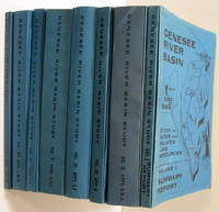
GENESEE RIVER BASIN STUDY OF WATER AND RELATED LAND RESOURCES (8 VOLUMES & PACKET OF 5 MAPS)
by Corps Of Engineers, Department Of The Army
- Used
- Very Good
- Paperback
- first
- Condition
- Used - Very Good
- Edition
- First Edition
- Binding
- Paperback
- Quantity Available
- 1
- Seller
-
Fairfield, New Jersey, United States
- Item Price
-
£158.82
Show Details
Description:
Buffalo N.Y.: Corps of Engineers , Dept of the Army. Very Good. 1969. First Edition. Soft Cover. 8 soft cover volumes plus envelope with 5 folded maps, published June 1969. Accompanied by a letter from the Corps of Engineers, Department of the Army. Volume 1. Summary Report. Volume 2. Appendix A, B, C; History, Plan Formation, Project Designs and Cost Estimate. Volume 3. Appendix D; Economic Base Study. Volume 4. E, F; Hydrology, Flood Control. Volume 5. Appendix G, H; State Water Laws, Water Quality & Water Supply. Volume 6. Appendix J, K; Agriculture Studies, Sedimentation. Volume 7. L, M, N; Hydroelectric Power, Outdoor Recreation, Fish and wild life. Volume 8. New York State Supplement. Item 9, an envelope containing 5 folded maps. Illustrated with tables, charts, photographs and maps. Binding clips are some what rusty. Science; Maps, Photographs, charts and tables; 4to 11" - 13" tall; Unpaginated pages .
Item Price
£158.82