Rare and Antiquarian Books
Maps and Atlases
Results 256 - 270 of 322
More Photos
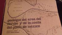
Geologia del area del Caribe y de la Costa del Golfo de Mexico
by Judoley, Constantino M. & Furrazola-Bermudez, Gustavo
- Used
- very good
- Signed
- first
- Condition
- Used - Very Good
- Seller
-
Lanvellec, France
- Item Price
-
£172.28£22.00 shipping to USA
Show Details
Item Price
£172.28
£22.00
shipping to USA

Sea Chart Portland to the Lizard. De Custe van Engelant tußchen Poortlant en Lezard [Sea Chart Portland to the Lizard]. Jacob Aertsz Colomb. Ca1640: Sea Chart Portland to the Lizard.
by Jacob Aertsz Colomb
- Used
- Condition
- Used
- Seller
-
Plymouth, Devon
- Item Price
-
£180.00£35.00 shipping to USA
Show Details
Item Price
£180.00
£35.00
shipping to USA

Netherlands. Greenville Collins. 1753: Original 18th Century, Hand Coloured Sea Chart. Coast line of Flanders at Calles [Calais] to Der Scheling [Terschelling]of the West Frisian Islands and then Eastern England Margate in Kent to Burnham Flats in Norfolk. Much detail is given of the Thames es
by Greenville Collins
- Used
- very good
- Condition
- Used - Very Good
- Seller
-
Plymouth, Devon
- Item Price
-
£180.00£35.00 shipping to USA
Show Details
Item Price
£180.00
£35.00
shipping to USA

More Photos
Seven Wonders of the Ancient World.
by [Citron Press] Stephanie Copoulos-Selle.
- Used
- Signed
- Condition
- Used
- Edition
- Edition of 40
- Seller
-
Hoover, Alabama
- Item Price
-
£183.69£14.35 shipping to USA
Show Details
Item Price
£183.69
£14.35
shipping to USA
![Les Isles Britanniques [map]](https://d3525k1ryd2155.cloudfront.net/h/149/109/856109149.0.m.jpg)
More Photos
Les Isles Britanniques [map]
by Brion de La Tour, Louis
- Used
- Fine
- Condition
- Used - Fine
- Seller
-
Lansdowne, Pennsylvania
- Item Price
-
£168.18£4.70 shipping to USA
Show Details
Item Price
£168.18
£4.70
shipping to USA

More Photos
Scholia stin Megali Charta tou Riga / Comments on the Great Chart of Riga
by Chatzifotis, Ioannis M.
- Used
- Paperback
- Condition
- Used - Very Good+
- Binding
- Paperback
- Seller
-
Thessaloniki, Greece
- Item Price
-
£174.28£14.50 shipping to USA
Show Details
Item Price
£174.28
£14.50
shipping to USA

More Photos
Geographia Map Company's The Premier Street Map of Buffalo (NY) House Numbers - Transit Lines - Postal Zones - Street Index, Etc.
by Gross, Alexander, F.R.G.S.,under the direction of
- Used
- very good
- Paperback
- Condition
- Used - Very Good
- Binding
- Paperback
- Seller
-
Bloomington, Indiana
- Item Price
-
£163.28FREE shipping to USA
Show Details
Item Price
£163.28
FREE shipping to USA

More Photos
Map of France - 1842
- Used
- Condition
- Used
- Seller
-
Cashiers, North Carolina
- Item Price
-
£183.69FREE shipping to USA
Show Details
Item Price
£183.69
FREE shipping to USA

More Photos
California of the South: Its Physical Geography, Climate, Resources, Routes of Travel, and Health Resorts. 1888 FIRST EDITION
by Windley, Walter and Widney, J P
- Used
- Hardcover
- first
- Condition
- Used - Very Good+
- Edition
- First
- Binding
- Hardcover
- Seller
-
Lincoln, Nebraska
- Item Price
-
£185.94£5.00 shipping to USA
Show Details
Item Price
£185.94
£5.00
shipping to USA

Lost Places
by Unsworth, Simon Kurt
- Used
- Hardcover
- Condition
- Used
- Edition
- First Edition
- Binding
- Hardcover
- Seller
-
St. Paul, Minnesota
- Item Price
-
£163.28£5.00 shipping to USA
Show Details
Item Price
£163.28
£5.00
shipping to USA

More Photos
An Ancient History from the Creation to the Fall of the Western Empire in A.D. 476, by Vuibert, 1886
by Vuibert, A J B
- Used
- Hardcover
- first
- Condition
- Used - Very Good+
- Edition
- First
- Binding
- Hardcover
- Seller
-
Lincoln, Nebraska
- Item Price
-
£167.97£5.00 shipping to USA
Show Details
Item Price
£167.97
£5.00
shipping to USA
More Photos
Notes on Peking and Its Neighbourhood (Bound Offprint from The Journal of the Royal Geographical Society of London, Vol. 36 (1866))
by Lockhart, W.
- Used
- very good
- Hardcover
- first
- Condition
- Used - Very Good
- Edition
- First Printing
- Binding
- Hardcover
- Seller
-
Bloomington, Indiana
- Item Price
-
£163.28FREE shipping to USA
Show Details
Item Price
£163.28
FREE shipping to USA

More Photos
Yellowstone Through the Stereoscope: with folding map
- Used
- very good
- Hardcover
- Condition
- Used - Very Good
- Binding
- Hardcover
- Seller
-
Saint Albans, Vermont
- Item Price
-
£163.28£7.50 shipping to USA
Show Details
Item Price
£163.28
£7.50
shipping to USA

The Mineral Belt, Volumes I-III: An Illustrated History: Volume I - Old South Park - Denver to Leadville, Volume II - Old South Park - Across the Great Divide, Volume III - Georgetown - Mining - Colorado Central Railroad
by David S. Digerness
- Used
- very good
- Hardcover
- Condition
- Used - Very Good
- Edition
- First Printing - November, 1977
- Binding
- Hardcover
- Seller
-
Longmont, Colorado
- Item Price
-
£175.53£6.00 shipping to USA
Show Details
Item Price
£175.53
£6.00
shipping to USA
More Photos
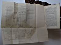
Report of a Military Reconnaissance in Alaska, made in 1883., maps, 1st edition
by Frederick Schwatka
- Used
- Hardcover
- first
- Condition
- Used - All twenty maps are in near fine to fine condition, a few minor tears. Some wear along the binding edges and spine ends. Else ve
- Edition
- First
- Binding
- Hardcover
- Seller
-
Hillsboro, Oregon
- Item Price
-
£163.27FREE shipping to USA
Show Details
Item Price
£163.27
FREE shipping to USA

