
Click for full-size.


PLAN DE PARIS,: commencé l’année 1734, dessiné et gravé sur les ordres de Messire Michel-Etienne Turgot, Marquis de Sousmons, Seigneur de St-Germain-sur-Eaulne… achevé de graver en 1739. Levé et dessiné par Louis Bretz, gravé par Claude et écrit par Aubin.
- Used
- Hardcover
- first
- Condition
- See description
- Seller
-
Paris, France
Payment Methods Accepted
About This Item
N.p., 1739.
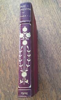
Folio [558 x 443 mm] bound in red morocco, covers decorated with fleur-de-lys borders, fleurs-de-lys in the corners, coat of arms in the center, spine ribbed and decorated with fleur-de-lys of various sizes, stars and gilt fillets, inner border decorated with fleurs-de-lys, gilt edges. Contemporary binding.
First issue of the most famous antique map of Paris, called " plan de Turgot ".
James de Rothschild. 2312; Cohen 807.
It is composed of one plan of combination and of 20 engraved plates on double-page (800 x 515 mm) representing the capital, house by house, in a panoramic view. " We propose by making this engraved map to show at a glance all the buildings and all the streets of Paris " informed the editor.
"This bird's eye map, the widest of this sort ever tackled, is known under the improper designation of 'Plan de Turgot'. It is composed (besides the map of combination) of twenty leaves that, altogether, form five ranks. Each leave as a surround of 79 centim. large on 50 high. The twenty assembled leaves thus form a square of about 316 centim. on 245, excluding the margin. This surface would bother more than one Parisian amateur, whose allocation is way too narrow to have it in its cabinet.
The engraved title is at the bottom of the leaves 18 and 19, in the middle of a cartouche with a very circumvented shape, surrounded with volutes and topped with the allegorical figure of the city of Paris resting on her shield.
This map takes usually the form of a large folio atlas; each leaf, printed on thick paper, is folded in two and glued on guard. It is said that most copies were bound at the time with more or less luxury, to be distributed for free, with no doubt, to distinguished figures; all sheepskin or Levant morocco bindings are decorated in their center with the arms of Paris. Some copies were printed with wide margins..
This map ends the series of bird's eye maps, and if, after this period, we still see some of those published, it would be older maps, copied or refreshed. Louis Bretez, who drew it around 1734, derogated the generally admitted custom of positioning maps according to the noon mark, because, willing to give of Paris an image in front view, he had to prefer, with the model of previous geographers, a system that would allow to see in front view the gates of our ancient churches, so numerous still, churches that, for the most part, had their facades directed westward. It is deplorable that the map, as it was conceived, wasn't created on an earlier date at least from a century. It would have been, because of its dimensions, of a much higher interest for the archaeologists of today.
The drawing ordered by Turgot was achieved in 1734; it represents thus the state of Paris at this time. Claude Lucas, who engraved it, is probably the one who worked on the maps of the districts of La Caille, 1714, or perhaps his son.
The choice that was made of a bird's eye map must have led to huge costs…
The image of Paris represented here still offers, I say it again, a big appeal and documentation for archaeology. The few number of ancient buildings that have survived is so quickly diminishing, day by day, or is suffering from strange metamorphoses with the hideous mask of replastering, so much that the Paris of Turgot, threatened by our thousands of projects of alignment and expansion, will soon have to be called, in turn, the 'old Paris' […]. (A. Bonnardot, Etudes archéologiques sur les anciens plans de Paris, pp. 199-203).
These plates, remarkably engraved, show in a vivid way the former layout, in perspective, of the Parisian sites, residences and monuments.
Copy printed on thick paper, illustrated with brilliant proofs, preserved in a binding by Padeloup with the arms of Paris.
The title is engraved in the center of a blending of two plates. (1600 x 540 mm).
FRENCH
S.l., 1739.
In-folio relié en maroquin rouge, plats ornés d'une roulette fleurdelisée, fleurs-de-lys aux angles, armoiries au centre, dos à nerfs orné de fleurs de lys de différentes tailles, d'étoiles et de filets dorés, coupes décorées, roulette intérieure fleurdelisée, tranches dorées. Reliure de l'époque.
558 x 443 mm.
Premier tirage du plus célèbre plan ancien de Paris, dit Plan de Turgot.
James de Rothschild. 2312 ; Cohen 807.
Il se compose d'un plan d'assemblage et de 20 planches gravées à double page (800 x 515 mm) représentant la Capitale, maison par maison, en vue panoramique. " On s'est proposé en faisant graver ce plan de faire voir d'un seul coup d'œil tous les édifices et toutes les rues qu'elle renferme " avertit l'éditeur.
" Ce plan à vol d'oiseau, le plus vaste en ce genre qu'on ait entrepris, est connu sous la désignation impropre de 'Plan de Turgot'. Il se compose (outre le plan d'assemblage) de vingt feuilles qui, réunies, forment cinq rangs. Chaque feuille a d'encadrement 79 centim. De largeur sur 50 de hauteur. Les vingt feuilles réunies forment donc un carré d'environ 316 centim. Sur 245, non compris la marge. Cette surface embarrasserait plus d'un amateur parisien, trop étroitement logé pour en garnir son cabinet.
Le titre gravé se trouve au bas des feuilles 18 et 19, au milieu d'un cartouche de forme très contournée, entouré de volutes et surmonté de la figure allégorique de la ville de Paris appuyée sur son blason.
Ce plan forme, le plus souvent, un atlas grand in-folio ; chaque feuille, tirée sur un papier fort, est pliée en deux et collée sur onglet. Il paraitrait que la plupart des exemplaires furent reliés dans le temps avec plus ou moins de luxe, pour être distribués gratuitement, sans doute, à tous les personnages éminents ; toutes les reliures, en mouton ou en maroquin du Levant, sont ornées au centre des armes de Paris. Il y a des exemplaires tirés sur grandes marges.
Ce plan termine la série des plans à vol d'oiseau, et si, passé cette époque, on en voit paraitre encore quelques-uns de ce genre, ce sont des plans plus anciens, copiés ou rajeunis. Louis Bretez, qui le dessina vers 1734, dérogea à l'usage généralement admis d'orienter les cartes selon la méridienne, parce que, voulant donner de Paris une image en élévation, il dut, à l'exemple des anciens géographes, préférer un système qui permît de voir de face les portails de nos anciennes églises, si nombreuses ncore, églises qui, pour la plupart, avaient leur façade tournée vers l'occident. Il est à regretter que le plan, tel qu'il a été conçu, n'ait pas une date antérieure d'au moins un siècle. Il eût été, à raison de sa dimension, d'un bien haut intérêt pour les archéologues d'aujourd'hui.
Le dessin ordonné par Turgot était achevé en 1734 ; il représente donc l'état de Paris à cette époque. Claude Lucas, qui le grava, est le même sans doute qui travailla aux plans des quartiers de La Caille, 1714, ou peut-être son fils.
Le choix qu'on fit du genre à vol d'oiseau dut entrainer des frais immenses…
L'image de Paris qu'il représente offre encore, je le répète, beaucoup d'attraits et de documents à l'archéologie. Le petit nombre de vieux édifices qui ont survécu disaparaît, de nos jours, si rapidement, ou subit de si étranges métamorphoses sous le hideux masque du replâtrage, que la Paris de Turgot, en proie à nos mille projets d'alignements et d'agrandissements, devra bientôt s'appeler à son tour le 'vieux Paris' […]. (A. Bonnardot, Etudes archéologiques sur les anciens plans de Paris, pp. 199-203).
Ces planches, d'une gravure remarquable, montrent d'une façon très vivante la disposition ancienne, en perspective, des sites, des demeures et des monuments parisiens.
Exemplaire imprimé sur papier fort, orné de brillantes épreuves, revêtu d'une reliure de Padeloup aux armes de la ville de Paris.
Le titre est gravé au centre d'un assemblage de deux planches (1600 x 540 mm).
Reviews
(Log in or Create an Account first!)
Details
- Bookseller
- LIBRAIRIE CAMILLE SOURGET
 (FR)
(FR)
- Bookseller's Inventory #
- JUINBB19
- Title
- PLAN DE PARIS,
- Book Condition
- Used
- Quantity Available
- 1
- Binding
- Hardcover
- Weight
- 0.00 lbs
Terms of Sale
LIBRAIRIE CAMILLE SOURGET
30 day return guarantee, with full refund including original shipping costs for up to 30 days after delivery if an item arrives misdescribed or damaged.
About the Seller
LIBRAIRIE CAMILLE SOURGET
Biblio member since 2020
Paris
About LIBRAIRIE CAMILLE SOURGET
The Bookshop Camille Sourget is specialised in literary first editions, travel books and atlases, scientific books as well as any beautiful illustrated books that marked their century. Its area of expertise extends from the 15th to the beginning of the 20th century.
Glossary
Some terminology that may be used in this description includes:
- Gilt
- The decorative application of gold or gold coloring to a portion of a book on the spine, edges of the text block, or an inlay in...
- Folio
- A folio usually indicates a large book size of 15" in height or larger when used in the context of a book description. Further,...
- Morocco
- Morocco is a style of leather book binding that is usually made with goatskin, as it is durable and easy to dye. (see also...
- Edges
- The collective of the top, fore and bottom edges of the text block of the book, being that part of the edges of the pages of a...
- Leaves
- Very generally, "leaves" refers to the pages of a book, as in the common phrase, "loose-leaf pages." A leaf is a single sheet...
- Spine
- The outer portion of a book which covers the actual binding. The spine usually faces outward when a book is placed on a shelf....
- Gravure
- ...
Frequently asked questions

Collecting P. T. Barnum
P. T. Barnum was not only one of the founders of modern day circus performance, he was also the author of the second most printed book of the 19th century. Learn about collecting P. T. Barnum books and ephemera here.

Is your family bible valuable?
While they may have sentimental value, bibles passed down through the family are not often worth a lot of money. Learn more...
Also Recommended
-

-
-

-

-

Save 10% on every purchase!
Join the Bibliophiles’ Club and start saving 10% on every book.
$29.95 / Year
