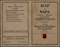
Skip to content

Search Results: Titles starting with N from Original Antique Maps

You searched for:
  • Bookseller inventory: Original Antique Maps (titles starting with N)
  • Bookseller: Original Antique Maps
Results 1 - 7 of 7
Napa County California. 1914
More Photos

Napa County California. 1914

by Copyright 1914 by Punnett Brothers

  • Used
Condition
Used
Quantity Available
1
Seller
FRAMINGHAM, Massachusetts, United States
Seller rating:
This seller has earned a 5 of 5 Stars rating from Biblio customers.
Item Price
£775.58
£8.98 shipping to USA

Show Details

Description:
Map Details and Condition:
color lithograph
dimensions: 26 3/4" x 19"
Brown Paper pocket covers with red bookstore label of Neal Stratford & Kerr, San Francisco
condition: professionally flattened and otherwise in as found, very good conditionDescription:
This 1914 map of now popular wine country Napa County, California shows the county in 1914, with early roads, largely undeveloped, vast open land areas, and natural features. The numbered grid system on this map reflects the Public Land Survey System. Large open tracts of land are identified as ranches, such as Rancho Catacoula, or Rancho Las Putas, Rancho LaJota all of which are large swaths of undivided land. Urban grids are shown in the southernmost part of Napa County, and sections of the southernmost sections of Sonoma County and Solano County. The cities of Petaluma, Sonoma, Vallejo and Napa and Benicia show populated urban areas. A corner of Marin County is shown.
C.F. Weber & Co. and the Punnett Brothers published… Read More
Item Price
£775.58
£8.98 shipping to USA
A New Map of the Crimea and Sea of Azof ,1856

A New Map of the Crimea and Sea of Azof ,1856

  • Used
Condition
Used
Quantity Available
1
Seller
FRAMINGHAM, Massachusetts, United States
Seller rating:
This seller has earned a 5 of 5 Stars rating from Biblio customers.
Item Price
£489.84
£8.98 shipping to USA

Show Details

Description:
Details:color lithograph, originally folded into coversdimensions: 33" x 24"condition: professionally conserved and flattened, good condition, original colors, toning to thin paper, staining at point of attachment at top left corner to former cover Description:The format of A New Map of the Crimea and Sea of Azof resembles a war newsmap which is appropriate for a map published contemporaneously with the Crimean War. It is also pertinent one hundred and sixty-seven years later today with Russia's invasion of the Ukraine and renewed attention on the region. The latest battle information labeled on the map appears to be September 8, 1855. The format of this map includes geography, topography, other graphic art in an oval inset map with 55 numbered reference notes and battle locations with dates and outcomes. The map records the Sept. 14, 1854 landing of the Allies and therefore the date range of this war news map is approximately one year.
The scale of this large map is in miles. The map describes… Read More
Item Price
£489.84
£8.98 shipping to USA
New York World's Fair Transit Map BMT c.1939
More Photos

New York World's Fair Transit Map BMT c.1939

by BMT Rapid Transit Lines Corp.

  • Used
Condition
Used
Quantity Available
1
Seller
FRAMINGHAM, Massachusetts, United States
Seller rating:
This seller has earned a 5 of 5 Stars rating from Biblio customers.
Item Price
£285.74
£8.98 shipping to USA

Show Details

Description:
details:color print, double sideddimensions open: 16 1/4" x 20"condition: as found, good original condition, good color in map, paper toned evenly, small areas of loss at horizontal fold line, small areas of loss along top and bottom at each of three vertical fold lines
Item Price
£285.74
£8.98 shipping to USA
New and Correct Map of the Lines of the Northern Pacific Railroad and Oregon Railway &...
More Photos

New and Correct Map of the Lines of the Northern Pacific Railroad and Oregon Railway & Naviagation Co. Fall, 1883, November

by Northern Pacific Railroad and Oregon Railway & Naviagation Co.

  • Used
Condition
Used
Edition
Fall, 1883, November
Quantity Available
1
Seller
FRAMINGHAM, Massachusetts, United States
Seller rating:
This seller has earned a 5 of 5 Stars rating from Biblio customers.
Item Price
£2,939.04
£8.98 shipping to USA

Show Details

Description:
Details:color lithograph, double sided and originally folded into its own paper coversdimensions open: 15 5/8 " x 43 5/8"condition: professionally flattened and conserved, complete, good color and condition, paper shows toning and several age spots, fine repairs at fold lines of paper covers and small tearsDescription:This New and Correct Map of the Northern Pacific Railroad
is the Fall, 1883, November edition of the map that announces the completion by the Northern Pacific Railroad of the first northern transcontinental route from St. Paul, Minnesota through the northwestern territories to Portland, Oregon. The final spike ceremony for the line had been held on September 8, 1883 in Gold Creek, Montana with more work yet to be done. 1/ The ultimate goal as outlined in the Northern Pacific Railroad's 1864 Congressional charter was a rail connection between the Great Lakes and Puget Sound. This goal took until 1888 to complete. 2/ This November, 1883 edition of the New and Correct Map of the Lines of… Read More
Item Price
£2,939.04
£8.98 shipping to USA
New and Correct Map of the Lines of the Northern Pacific Railroad and Oregon Railway & Navigation...
More Photos

New and Correct Map of the Lines of the Northern Pacific Railroad and Oregon Railway & Navigation Co. Fall, 1883, November: - 1883 is First Map of Completed Northwest Transcontinental Route

  • Used
Condition
Used
Quantity Available
1
Seller
FRAMINGHAM, Massachusetts, United States
Seller rating:
This seller has earned a 5 of 5 Stars rating from Biblio customers.
Item Price
£2,939.04
£8.98 shipping to USA

Show Details

Description:
Map Details:Northern Pacific Railroad, publisherRand McNally & Co., Printer and Engraver, Chicagocolor lithograph, double sided and originally folded into its own paper coversdimensions open: 15 5/8 " x 43 5/8"condition: professionally flattened and conserved, complete, good color and condition, paper shows toning and several age spots, fine repairs at fold lines of paper covers and elsewhere Description:This New and Correct Map of the Northern Pacific Railroad is the Fall, 1883, November edition of the map that announces the completion by the Northern Pacific Railroad of the first northern transcontinental route from St. Paul, Minnesota through the northwestern territories to Portland, Oregon. The final spike ceremony for the line had been held on September 8, 1883 in Gold Creek, Montana with more work yet to be done. 1/ The ultimate goal as outlined in the Northern Pacific Railroad's 1864 Congressional charter was a rail connection between the Great Lakes and Puget Sound. This goal took until 1888… Read More
Item Price
£2,939.04
£8.98 shipping to USA
Nikon NASA advertising poster nd

Nikon NASA advertising poster nd

  • Used
Condition
Used
Quantity Available
1
Seller
FRAMINGHAM, Massachusetts, United States
Seller rating:
This seller has earned a 5 of 5 Stars rating from Biblio customers.
Item Price
£183.69
£8.98 shipping to USA

Show Details

Description:
Details:color photograph on polished poster papercondition: as founddimensions: 16 1/2" x 23 1/2"Description:The NIKON/NASA art speaks to photography and space exploration as the imagery of modernity in the second half of the 20th century. NIKON, seeking to hook its star to the future of photography, successfully earned NASA's endorsement of its photo technology for documenting NASA's space program.The poster shows Earth in the background, an unusual placement graphically and as a photograph perhaps initially disorienting as centuries of pictorial art oriented the subject and the viewer to Earth's horizon. As in turn of the 19th c. northern German painer Caspar David Friedrich's paintings, at the horizon the sun or moon just above the horizon appears, raising the question is it daybreak or day's end. The traditional map orientation is with north "up" that in the NIKON Poster for NASA here gives way to "up" meaning outer space. Rather than seeing human's place in the world as geographic, this… Read More
Item Price
£183.69
£8.98 shipping to USA
Northern and Southern CircumPolar Map for each month of the Year  Plate. VI and VII (1835)
More Photos

Northern and Southern CircumPolar Map for each month of the Year Plate. VI and VII (1835)

by Elijah H. Burritt

  • Used
Condition
Used
Quantity Available
1
Seller
FRAMINGHAM, Massachusetts, United States
Seller rating:
This seller has earned a 5 of 5 Stars rating from Biblio customers.
Item Price
£367.38
£8.98 shipping to USA

Show Details

Description:
Map Details:hand colored engravingdimensions: 14 1/8" x 16"condition: professionally conserved, cleaned, good condition, some toning to paper, good color throughout Map Descriptions: Lot of Two [May be purchased individually priced at $225.00 each]
This 1835 hand colored engraving, is Plate. VI. from Elija H. Burritt's Atlas, Designed To Illustrate the Geography of the Heavens. Elijah H. Burritt, A.M. was a Connecticut school teacher who decided that the then available school astronomy books were not adequate. He trained himself further in astronomy by traveling to Cambridge, Massachusetts to use the Harvard Telescope. His illustrated celestial Atlas, Designed to Illustrate the Geography of the Heavens of 1835 and accompanied in the classroom by a published text book, the Class Book of Astronomy is in fact the second edition of his seminal 1833 work of the same title, and became the standard astronomy atlas and text book for students in the United States. The recommendations published on the back… Read More
Item Price
£367.38
£8.98 shipping to USA
Add to Want List

Didn’t find what you’re looking for?

Try adding this search to your want list. Millions of books are added to our site everyday and when we find one that matches your search, we’ll send you an email. Best of all, it’s free.

Add to Want List
Book lovers can save on books by joining our Bibliophiles club

Are you a frequent reader or book collector?

Join the Bibliophile's Club and save 10% on every purchase, every day — up to $20 savings per order!

Biblio is a socially responsible company

Social Responsibility

Did you know that since 2004, Biblio has used its profits to build 16 public libraries in rural villages of South America?