Description:
London, 1850. Near fine, hand colored on heavy paper. This is one of the most decorative 19th century maps of South America, with 7 different vignettes, including Condor and Llamas of Peru, Valparaiso, Natives of Chili, rio Janeiro, Brazilian Bridge of Ropes, Gold Washing in Brazil, and one unlabeled with natives hauling some sort of cargo in a large barrel (slung with ropes). This measures 13.75x9.5 inches (35x24cm)..
Search Results: Authors starting with T from The Prime Meridian: Antique Maps & Books
You searched for:
- Bookseller inventory: The Prime Meridian: Antique Maps & Books (authors starting with T)
- Bookseller: The Prime Meridian: Antique Maps & Books
Results 1 - 20 of 32

(Map of South America): South America
by Tallis, J (drawn and engraved by J. Rapkin)
- Used
- Condition
- Used
- Quantity Available
- 1
- Seller
-
Crozet, Virginia, United States
- Item Price
-
£182.09£6.88 shipping to USA
Show Details
Item Price
£182.09
£6.88
shipping to USA
(Map of S. Carolina): Charleston and Adjacent Country
by Tanner, B
- Used
- Condition
- Used
- Quantity Available
- 1
- Seller
-
Crozet, Virginia, United States
- Item Price
-
£121.40£6.88 shipping to USA
Show Details
Description:
Philadelphia: John Melish, 1822. Map is generally very good, with some browning. Includes one page related text, which has more prominent browning. For John Melish's 1822 edition of "A Geographical Description of the United States...". Many churches listed. B&W, as issued. 16.5x10cm..
Item Price
£121.40
£6.88
shipping to USA
(Map of New York): A New Map of New York with Its Canals, Roads & Distances from Place to Place Along the Stage & Steam-Boat Routes
by Tanner, Henry S
- Used
- Condition
- Used
- Quantity Available
- 1
- Seller
-
Crozet, Virginia, United States
- Item Price
-
£149.72£6.88 shipping to USA
Show Details
Description:
Philadelphia: Carey & Hart, 1840. VG-, original hand color. Paper a bit browned, as is often the case, with a fewl stains, and lower marginal soiling (mostly outside neatline; would frame well). One of the later Tanner issues, from "Tanner's Universal Atlas". Elaborate road, railroad detail, with individual counties hand colored. A nice, and increasingly scarce, map measuring 10.5x13 inches..
Item Price
£149.72
£6.88
shipping to USA
(Map of New York): A New Map of New York with Its Canals, Rail-Roads & Distances from Place to Place Along the Stage Roads
by Tanner, Henry S
- Used
- Condition
- Used
- Quantity Available
- 1
- Seller
-
Crozet, Virginia, United States
- Item Price
-
£198.28£6.88 shipping to USA
Show Details
Description:
Philadelphia: H.S. Tanner, No. 189 Chestnut St., 1840. VG, engraved on thin paper, hand colored outlines, with folds as issued and mild browning. This was bound in Tanner's 1840 edition "A Description of the Canals and Rail Roads of the United States...". Actual and proposed canals and railways are color coded. A profile of the Erie Canal is at the bottom. This is relatively uncommon in this form. The image measures 10.5x13 inches..
Item Price
£198.28
£6.88
shipping to USA
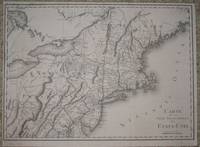
(Map / Chart of New England- USA): Carte De La Partie Septentrionale Des Etats_Unis
by Tardieu, P. F
- Used
- Condition
- Used
- Quantity Available
- 1
- Seller
-
Crozet, Virginia, United States
- Item Price
-
£428.93£6.88 shipping to USA
Show Details
Description:
Paris: Tardieu, 1802. VG+, b&w as issued. Scarce, detailed, with entire New England coastline from Delaware northward to Pasamaquody Bay, and streching westward to the eastern halves of Lake Huron and Lake Erie. Includes listings for Great and Little Egg Harbor, Martha's Vineyard, Cape Cod. A very handsome map with numerous waterway and topographical details, with place names of all major cities of the times, on excellent paper . The Tardieu's were a family of mapmakers from the mid-18th to early 19th century. Left margin a bit close. Measuring 14x19.75 inches (36x50cm). .
Item Price
£428.93
£6.88
shipping to USA
(Lithographic Views): The City of Richmond Virginia Supplement (Friday, July 7, 1882)
by The Daily Graphic
- Used
- Condition
- Used
- Quantity Available
- 1
- Seller
-
Crozet, Virginia, United States
- Item Price
-
£157.81£6.88 shipping to USA
Show Details
Description:
New York: The Daily Graphic, 1882. VG, b&w, with a few small repairs with archival tape images unaffected). There are 3 pages of views here (4 on page 1, 16 combined on pages 2 & 3). This is an orginal, although the full 12 pages are not present here.The lithographic vignettes are st riking, including "The Old Stone House", Washington statue in Capitol Building,Jefferson's Tomb at Monticello, Mayo & Brothers' Tobacco Co., General View of Richmond from Gamble's Hill, Confederate Monument (Hollywood Cemetery), and others. Each pag e is approx. 46x32cm. (The title page is one of those included.).
Item Price
£157.81
£6.88
shipping to USA
(Civil War): Arrival of the Body of President Lincoln at the City Hall, New York
by The Illustrated London News
- Used
- Condition
- Used
- Quantity Available
- 1
- Seller
-
Crozet, Virginia, United States
- Item Price
-
£28.33£6.88 shipping to USA
Show Details
Description:
The Illustrated London News, May 20, 1865. Full page b&w engraving of this solemn event. Some foxing of right upper image corner, does not interfere with main image. Some minor soiling. 24x34cm..
Item Price
£28.33
£6.88
shipping to USA
(Civil war): Ball in Honour of President Lincoln in the Great Hall of the Patent Office at Washington
by The Illustrated London News
- Used
- Condition
- Used
- Quantity Available
- 1
- Seller
-
Crozet, Virginia, United States
- Item Price
-
£28.33£6.88 shipping to USA
Show Details
Description:
The Illustrated London News, April 8, 1865. Full page b&w engraving of festivities. 23.5x34cm..
Item Price
£28.33
£6.88
shipping to USA
(Civil War): General Winfield Scott, Commander-in-Chief of the United States' Forces
by The Illustrated London News
- Used
- Condition
- Used
- Quantity Available
- 1
- Seller
-
Crozet, Virginia, United States
- Item Price
-
£36.42£6.88 shipping to USA
Show Details
Description:
The Illustrated London News, Supplement, March 16, 1861. Full page, frontal, b&w original engraved view of General Winfield Scott. Verso text discusses portrait. An impressive view. 23x35cm..
Item Price
£36.42
£6.88
shipping to USA
(Civil War): The City of Richmond, Virginia After its Surrender
by The Illustrated London News
- Used
- Condition
- Used
- Quantity Available
- 1
- Seller
-
Crozet, Virginia, United States
- Item Price
-
£52.60£6.88 shipping to USA
Show Details
Description:
London: The Illustrated London News, 1865. 2 views of a damaged city, b&w engraving: 1. Ruins of the Armoury 2. Ruins of the Arsenal The entire image (single sheet) is 34x24cm. From issue dated June 3, 1865..
Item Price
£52.60
£6.88
shipping to USA
(Civil War): The Main Battery at Fort Sumter: Guns bearing on Fort Moultrie and the Channel During the Action of Friday, April 12
by The Illustrated London News
- Used
- Condition
- Used
- Quantity Available
- 1
- Seller
-
Crozet, Virginia, United States
- Item Price
-
£28.33£6.88 shipping to USA
Show Details
Description:
The Illustrated London News, May 11, 1861. Large, full-page, original b&w engraving with soldiers firing cannon, lifting cannonballs, in a smke-filled area. 24x35cm..
Item Price
£28.33
£6.88
shipping to USA
(Civil War): The War in America
by The Illustrated London News
- Used
- Condition
- Used
- Quantity Available
- 1
- Seller
-
Crozet, Virginia, United States
- Item Price
-
£28.33£6.88 shipping to USA
Show Details
Description:
The Illustrated London News, March 18, 1865. 2 b&w engravings, single page: 1. Interior of Fort Lafayette, New York Harbour. 2. Camp of Confederate Prisoners at Elmira, New York Image of full page is 33.5x24cm..
Item Price
£28.33
£6.88
shipping to USA
(Civil war): Major Anderson, Late Commandant of Fort Sumter Charleston Harbour
by The Illustrated London News
- Used
- Condition
- Used
- Quantity Available
- 1
- Seller
-
Crozet, Virginia, United States
- Item Price
-
£32.37£6.88 shipping to USA
Show Details
Description:
The Illustrated London News, May 11, 1861. Full page b&w frontal view of Major Anderson. Verso text applicable to portrait. A nice image. 34x24cm..
Item Price
£32.37
£6.88
shipping to USA
(Civil War): The War in America: Interior of Fort Fisher, Near Wilmington, During the Second Bombardment-- From a Sketch by Our Special Artist
by The Illustrated London News
- Used
- Condition
- Used
- Quantity Available
- 1
- Seller
-
Crozet, Virginia, United States
- Item Price
-
£28.33£6.88 shipping to USA
Show Details
Description:
The Illustrated London News, March 18, 1865. Dramatic b&w engraving of fighting, w/canon explosions, injured and dying soldiers. 23.5x34.5cm..
Item Price
£28.33
£6.88
shipping to USA
(Civil War Lithographs): Set of 3 Civil War Lithographs
by The Illustrated London News
- Used
- Condition
- Used
- Quantity Available
- 1
- Seller
-
Crozet, Virginia, United States
- Item Price
-
£101.16£6.88 shipping to USA
Show Details
Description:
The Illustrated London News, 1864. Set of 3 VG b&w lithographs from the war: 1. Sept. 3rd-- a large double-page "View of Petersburg and Its Suburbs from General Lee's Headquarters" 2. Oct. 22nd-- "Howlett's Battery, on the James River, Engaging the Federal Monitors." 3. Oct. 22 nd-- 2 views on a single page-- "Passage of the Shenandoah RDiver at Front Royal by the Divisions Sent to Reinforce General Early" and "March of Kershaw's and Fitz Lee's Divisions of the Confederate Army up the Valley of Virginia" Each single im age page is approx. 36x24cm..
Item Price
£101.16
£6.88
shipping to USA
The Wilderness Campaign May-June 1864 (vol. IV of Papers of the Military Historical Society of Massachusetts)
by The Military Historical Society of Massachusetts
- Used
- Condition
- Used
- Quantity Available
- 1
- Seller
-
Crozet, Virginia, United States
- Item Price
-
£182.09£6.88 shipping to USA
Show Details
Description:
The Military Historical Society of Massachusetts, Boston, 1905. VG, HB, no DJ (as issued), 471pp including index, with 6 b&w folding maps in rear (From the Rapidan to the James, The Wilderness, Spottsylvania Court House, The North Anna, The Totopotomoy, Cold Harbor). All the maps are in excellent conditon (there are a few minor marginal tears, none crossing neatlines of map). This book contains 16 separate essays read before the society between 1887 and 1899. The cover is a bit bumped and rubbed, with minor fraying at ends of spine, but the binding is tigh t..
Item Price
£182.09
£6.88
shipping to USA
Atlas of Israel, Cartography Physical and Human Geography
by The Survey of Israel (multiauthored atlas)
- Used
- as new
- Hardcover
- Condition
- As New
- Edition
- 3rd
- Binding
- Hardcover
- Quantity Available
- 1
- Seller
-
Crozet, Virginia, United States
- Item Price
-
£121.40£6.88 shipping to USA
Show Details
Description:
New York: MacMillan Publishing Company, 1985. As new. This is the third edition (the most recent), with 40 printed color plates (numbered), in collaboration with The Survey of Israel (Tel Aviv). The first edition, published c. 1964, dealt with Israel within the 1949 armistice lines. The second edition (1970) covered the post-cease fire lines from 1967. This edition, beautifully produced, includes the territory as of 1985, but also include the Sinai (returned to Egypt 1982). . 3rd. Cloth. As New/No Jacket. Elephant Folio - over 15" - 23" tall.
Item Price
£121.40
£6.88
shipping to USA
(Military History, French Revolution, 32 Battle / Campaign / Town maps and plans): Atlas Per Servir A L'Intelligence Des Campagnes De La Revolution Francaise
by Thiers, M
- Used
- Hardcover
- first
- Condition
- Used
- Edition
- First Edition
- Binding
- Hardcover
- Quantity Available
- 1
- Seller
-
Crozet, Virginia, United States
- Item Price
-
£238.74£6.88 shipping to USA
Show Details
Description:
Paris: Furne et Cie , 1846. Small oblong 16 inch elephant folio, with original cloth boards (edges chipped, rear peeled and a bit warped, hinges separating but binding reasonably sound). Original gilt-lettered cover label present and legible. Thirty-two engraved maps and plans, b&w as issued, generally very good or better with occasional foxing and browining. Images very detailed, with topography, some streets, battle lines (image size variable, averaging 8x10 inches). A wealth of information, intended to accompany Thier's history of the French revolution, with images drawn by Duvotenay and engraved by Dyonnet. This is the first, and larger format, edition of this atlas. Some of the battle plans include Valmy, Jemmapes, Hondschoote, Wattignies, Nerwinde, Fleurus, Montenotte and Millesimo, Coastglone, Arcole, Rivoli, Pyrmides (near Cairo), Aboukir, Monthabor. City plans include Zurich, Venise, Strasbourg, Toulon, Lyon and more. Although the covers aren't the best, the maps are complete and…
Read More Item Price
£238.74
£6.88
shipping to USA
(New York: 3 Volume Set): History of Long Island from Its Discovery and Settlement to the Present Time..The Third Edition..Greatly Enlarged
by Thompson, Benjamin F. (with author biography by Charles J. werner)
- Used
- very good
- Hardcover
- Condition
- Used - Very Good
- Edition
- 3rd
- Binding
- Hardcover
- Quantity Available
- 1
- Seller
-
Crozet, Virginia, United States
- Item Price
-
£392.51£6.88 shipping to USA
Show Details
Description:
New York: Robert H. Dodd, 1918. Very good condition, complete 3 vol. set on Berkshire linen (limited to 600 copies), deckle edges. Early owner's bookplates on front pastedown, and some indication that this set had come from the library of the late Alistaire Cook. Original endpapers present. Numerous illustrations, including the folding maps in vols. 1 and 3 (this one is a copy of Colton's 1848 map of Long Island), with sound bindings and original spine labels, minimally scratched, with some scuffing of boards. All vols. 9 inch quartos, top edges gilt, with frontispiece buts of Thompson in vol. 1 (original tissue guard present). Vol I: xlix, 538; Vol. 2: 649: Vol. 3 677 (includes complete index to all 3 vols.). This was considered the 'best' edition. Howes T187. This third edition was the one recently reproduced in CD format. The set was limited to 750 copies, 600 in our format, and another 150 on French handmade paper and issued in 4 vols.. 3rd. Cloth. Very Good.
Item Price
£392.51
£6.88
shipping to USA
(New York: 3 Volume Set): History of Long Island from Its Discovery and Settlement to the Present Time..The Third Edition..Greatly Enlarged
by Thompson, Benjamin F. (with author biography by Charles J. werner)
- Used
- very good
- Hardcover
- Condition
- Used - Very Good
- Edition
- 3rd
- Binding
- Hardcover
- Quantity Available
- 1
- Seller
-
Crozet, Virginia, United States
- Item Price
-
£424.88£6.88 shipping to USA
Show Details
Description:
New York: Robert H. Dodd, 1918. Very good condition, complete 3 vol. set on Berkshire linen (limited to 600 copies), very little internal use with several pages uncut. Original endpapers present. Numerous illustrations, including the folding maps in vols. 1 and 3 (this one is a copy of Colton's 1848 map of Long Island), with sound bindings and original spine labels. All vols. 9 inch quartos, top edges gilt, with frontispiece buts of Thompson in vol. 1 (original tissue guard present). Vol I: xlix, 538; Vol. 2: 649: Vol. 3 677 (includes complete index to all 3 vols.). This was considered the 'best' edition. Howes T187. This third edition was the one recently reproduced in CD format. The set was limited to 750 copies, 600 in our format, and another 150 on French handmade paper and issued in 4 vols.. 3rd. Cloth. Very Good.
Item Price
£424.88
£6.88
shipping to USA

Didn’t find what you’re looking for?
Try adding this search to your want list. Millions of books are added to our site everyday and when we find one that matches your search, we’ll send you an email. Best of all, it’s free.
Add to Want List

Are you a frequent reader or book collector?
Join the Bibliophile's Club and save 10% on every purchase, every day — up to $20 savings per order!

Social Responsibility
Did you know that since 2004, Biblio has used its profits to build 16 public libraries in rural villages of South America?
