Skip to content

Search Results: Authors starting with B from Original Antique Maps

You searched for:
  • Bookseller inventory: Original Antique Maps (authors starting with B)
  • Bookseller: Original Antique Maps
Results 1 - 9 of 9
Published by the Milwaukee Sentinel Commemorating Its One Hundredth Anniversary June 27, 1937

Published by the Milwaukee Sentinel Commemorating Its One Hundredth Anniversary June 27, 1937: Approved by the Wisconsin Conservation Commission, Checked and Approved by Dr. Joseph Schafer, Superintendent of the Historical Society of Wisconsin and Dr. Louise Phelps Kellogg, Senior Research Associate Endorsed by the Wisconsin State Chamber of Commer

by Copyright 1932 by Erwin F. Bahlmann and Artist Nina S. Bahlman

  • Used
Condition
Used
Quantity Available
1
Seller
FRAMINGHAM, Massachusetts, United States
Seller rating:
This seller has earned a 5 of 5 Stars rating from Biblio customers.
Item Price
£528.38
£8.94 shipping to USA

Show Details

Description:
Map Details and Condition:
color lithograph by Litho in U.S.A.
dimensions: 24" x 28.5 " print, 26 1/4" x 30" sheet size
condition: professionally removed from wood backing and restored, deeply toned paper, some surface damage to paper, repaired vertical tear through sheet, backed with Japanese Mulberry tissue, some chipping at edges Map Description:
This scarce Wisconsin pictorial map was created by the artist Nina S. Bahlman (b1886-___) whose art work other than this map may exist in collections but is not readily identified. The copyright is held by Erwin F. Bahlmann (b.1886-__) a family member or spouse. The Library of Congress cites its copy of this map as Historical Map of Wisconsin and cites a 1995 copyright registration. WorldCat confirms that there is a 1995 reprint of this map. A further note corrects the spelling of the artist's name to read "Bahlmann". The example of the map on offer gives every appearance of being the 1932 edition.
The map was published… Read More
Item Price
£528.38
£8.94 shipping to USA
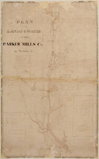
PLAN OF THE LANDS & WATER OF THE PARKER MILLS CO. in Wareham, Mass.  - Manuscript (nd) (c. 1834?)

PLAN OF THE LANDS & WATER OF THE PARKER MILLS CO. in Wareham, Mass. - Manuscript (nd) (c. 1834?)

by Sylvanus Bourne

  • Used
Condition
Used
Quantity Available
1
Seller
FRAMINGHAM, Massachusetts, United States
Seller rating:
This seller has earned a 5 of 5 Stars rating from Biblio customers.
Item Price
£1,056.77
£8.94 shipping to USA

Show Details

Description:
Details:S[ylvanus]. Bourne, Surveyormanuscript survey map, hand inked, with partial water color, a working map with some ink overwriting in a different handdimensions: 36 ¾" x 23 1/8"condition: original inks and water colors, cleaned, professionally conserved, original fabric backing removed, area of loss due to a hungry mouse filled, other paper loss filled, unbacked. Description:
This undated manuscript
Plan of the Lands & Water of the Parker Mills Co. in Wareham, Mass. c. 1834? is a rare, new discovery that offers a detailed view of Wareham in its early industrial period. The scope of the Plan of the Lands and Water of the Parker Mills Co. (the "Plan")
is defined by the geographic scope of the property of one of Wareham's major iron and nail manufacturers, the Parker Mills Co., whose business history begins in the 1830's, and predate its 1845 legal incorporation by Act of the Massachusetts Legislature. The predecessor to the Parker Mills Co. was the Wareham Iron Co. (Tihonet Pond Upper Works… Read More
Item Price
£1,056.77
£8.94 shipping to USA
The Singing Bird or Progressive Music Reader 1853
More Photos

The Singing Bird or Progressive Music Reader 1853

by William B. Bradbury

  • Used
Condition
Used
Quantity Available
1
Seller
FRAMINGHAM, Massachusetts, United States
Seller rating:
This seller has earned a 5 of 5 Stars rating from Biblio customers.
Item Price
£121.93
£8.94 shipping to USA

Show Details

Description:
details:mid-19th century singing and song book with seller's and owner's book platesdimensions: 7 3/4" x 5 1/4" x 5/8"
condition: good original condition, front cover professionally reinforced at hinge Description:This volume of The Singing Bird or Progressive Music Reader, 1853 is inscribed in faint pencil that appears to be "Mary Whitneys" "Boston, Mass. 1855" on the top right corner of the inside free end paper. The book's yellow decorated paper board cover is printed with the music for the song "The Wild Bird's Song" in keeping with the educator's philosophy that vocal music is the student's goal. The rear cover of the book is printed with a publisher's advertisement of titles.
There is the music bookseller's yellow paper bookplate inside the front cover. Please see photograph. The music book was sold from Andrew Whitney's Piano Forte Carhart's Patent Seraphine, Aeolian and Melodian Ware-Room on Main Street in Fitchburg, Worcester County, Massachusetts. The book owner and the book seller may… Read More
Item Price
£121.93
£8.94 shipping to USA
Napa County California. 1914
More Photos

Napa County California. 1914

by Copyright 1914 by Punnett Brothers

  • Used
Condition
Used
Quantity Available
1
Seller
FRAMINGHAM, Massachusetts, United States
Seller rating:
This seller has earned a 5 of 5 Stars rating from Biblio customers.
Item Price
£772.26
£8.94 shipping to USA

Show Details

Description:
Map Details and Condition:
color lithograph
dimensions: 26 3/4" x 19"
Brown Paper pocket covers with red bookstore label of Neal Stratford & Kerr, San Francisco
condition: professionally flattened and otherwise in as found, very good conditionDescription:
This 1914 map of now popular wine country Napa County, California shows the county in 1914, with early roads, largely undeveloped, vast open land areas, and natural features. The numbered grid system on this map reflects the Public Land Survey System. Large open tracts of land are identified as ranches, such as Rancho Catacoula, or Rancho Las Putas, Rancho LaJota all of which are large swaths of undivided land. Urban grids are shown in the southernmost part of Napa County, and sections of the southernmost sections of Sonoma County and Solano County. The cities of Petaluma, Sonoma, Vallejo and Napa and Benicia show populated urban areas. A corner of Marin County is shown.
C.F. Weber & Co. and the Punnett Brothers published… Read More
Item Price
£772.26
£8.94 shipping to USA
Planisphere Plate VIII.

Planisphere Plate VIII.

by Elijah H. Burritt

  • Used
Condition
Used
Quantity Available
1
Seller
FRAMINGHAM, Massachusetts, United States
Seller rating:
This seller has earned a 5 of 5 Stars rating from Biblio customers.
Item Price
£182.90
£8.94 shipping to USA

Show Details

Description:
Details:hand colored engravingcondition: professionally cleaned, very good condition, some toning to paper, good color throughoutDescription:This 1835 hand colored engraving, is Pl. VIII. from Elija H. Burritt's Atlas, Designed To Illustrate the Geography of the Heavens. Elijah H. Burritt, A.M. was a Connecticut school teacher who decided that the then available school astronomy books were not adequate. He trained himself further in astronomy by traveling to Cambridge, Massachusetts to use the Harvard Telescope. His illustrated celestial Atlas, Designed to Illustrate the Geography of the Heavens of 1835 and accompanied in the classroom by a published text book, the Class Book of Astronomy
is in fact the second edition of his seminal 1833 work of the same title, and became the standard astronomy atlas and text book for students in the United States. The recommendations published on the back cover of the 1835 edition of Burritt's Atlas explain "This book is now used in the principal Seminaries of the… Read More
Item Price
£182.90
£8.94 shipping to USA
Northern and Southern CircumPolar Map for each month of the Year  Plate. VI and VII (1835)
More Photos

Northern and Southern CircumPolar Map for each month of the Year Plate. VI and VII (1835)

by Elijah H. Burritt

  • Used
Condition
Used
Quantity Available
1
Seller
FRAMINGHAM, Massachusetts, United States
Seller rating:
This seller has earned a 5 of 5 Stars rating from Biblio customers.
Item Price
£365.80
£8.94 shipping to USA

Show Details

Description:
Map Details:hand colored engravingdimensions: 14 1/8" x 16"condition: professionally conserved, cleaned, good condition, some toning to paper, good color throughout Map Descriptions: Lot of Two [May be purchased individually priced at $225.00 each]
This 1835 hand colored engraving, is Plate. VI. from Elija H. Burritt's Atlas, Designed To Illustrate the Geography of the Heavens. Elijah H. Burritt, A.M. was a Connecticut school teacher who decided that the then available school astronomy books were not adequate. He trained himself further in astronomy by traveling to Cambridge, Massachusetts to use the Harvard Telescope. His illustrated celestial Atlas, Designed to Illustrate the Geography of the Heavens of 1835 and accompanied in the classroom by a published text book, the Class Book of Astronomy is in fact the second edition of his seminal 1833 work of the same title, and became the standard astronomy atlas and text book for students in the United States. The recommendations published on the back… Read More
Item Price
£365.80
£8.94 shipping to USA
The Visible Heavens in September, August, July. Pl.V. (1835)

The Visible Heavens in September, August, July. Pl.V. (1835)

by Elijah H. Burritt

  • Used
Condition
Used
Quantity Available
1
Seller
FRAMINGHAM, Massachusetts, United States
Seller rating:
This seller has earned a 5 of 5 Stars rating from Biblio customers.
Item Price
£182.90
£8.94 shipping to USA

Show Details

Description:
Details:hand colored engravingcondition: professionally cleaned, toning to paper, good original colorDescription:This 1835 hand colored engraving, is Pl.V. from Elija H. Burritt's Atlas, Designed To Illustrate the Geography of the Heavens. Elijah H. Burritt, A.M. was a Connecticut school teacher who decided that the then available school astronomy books were not adequate. He trained himself further in astronomy by traveling to Cambridge, Massachusetts to use the Harvard Telescope. His illustrated celestial Atlas, Designed to Illustrate the Geography of the Heavens of 1835 and accompanied in the classroom by a published text book, the Class Book of Astronomy
is in fact the second edition of his seminal 1833 work of the same title, and became the standard astronomy atlas and text book for students in the United States. The recommendations published on the back cover of the 1835 edition of Burritt's Atlas explain "This book is now used in the principal Seminaries of the United States" and is recommended… Read More
Item Price
£182.90
£8.94 shipping to USA
A Celestial Planisphere, Or Map of the Heavens.  (1835)

A Celestial Planisphere, Or Map of the Heavens. (1835)

by Elijah H. Burritt

  • Used
Condition
Used
Quantity Available
1
Seller
FRAMINGHAM, Massachusetts, United States
Seller rating:
This seller has earned a 5 of 5 Stars rating from Biblio customers.
Item Price
£182.90
£8.94 shipping to USA

Show Details

Description:
Map Details:hand colored engraving on folded sheetdimensions: 14 1/8" x 28"condition: professionally conserved, very good condition, some toning to paper, good color throughout
Description:This 1835 hand colored engraving, is Pl. VIII. from Elija H. Burritt's Atlas, Designed To Illustrate the Geography of the Heavens. Elijah H. Burritt, A.M. was a Connecticut school teacher who decided that the then available school astronomy books were not adequate. He trained himself further in astronomy by traveling to Cambridge, Massachusetts to use the Harvard Telescope. This research was preparation for writing his book and celestial atlas. His illustrated celestial Atlas, Designed to Illustrate the Geography of the Heavens of 1835 that was accompanied in the classroom by a published text book, the Class Book of Astronomy is in fact the second edition of his seminal 1833 work of the same title, and became the standard astronomy atlas and text book for students in the United States. The contemporary praise and… Read More
Item Price
£182.90
£8.94 shipping to USA
Plate I. Relative Magnitude of the Planets (1835)

Plate I. Relative Magnitude of the Planets (1835)

by Elijah H. Burritt

  • Used
Condition
Used
Quantity Available
1
Seller
FRAMINGHAM, Massachusetts, United States
Seller rating:
This seller has earned a 5 of 5 Stars rating from Biblio customers.
Item Price
£182.90
£8.94 shipping to USA

Show Details

Description:
Details:black and white engraving
condition: professionally cleaned, good condition, some toning to paperDescription:This 1835 black and white engraving, is Plate I. from Elija H. Burritt's Atlas, Designed To Illustrate the Geography of the Heavens. Elijah H. Burritt, A.M. was a Connecticut school teacher who decided that the then available school astronomy books were not adequate. He trained himself further in astronomy by traveling to Cambridge, Massachusetts to use the Harvard Telescope. His illustrated celestial Atlas, Designed to Illustrate the Geography of the Heavens of 1835 and accompanied in the classroom by a published text book, the Class Book of Astronomy
is in fact the second edition of his seminal 1833 work of the same title, and became the standard astronomy atlas and text book for students in the United States. The recommendations published on the back cover of the 1835 edition of Burritt's Atlas explain "This book is now used in the principal Seminaries of the United States" and is… Read More
Item Price
£182.90
£8.94 shipping to USA
Add to Want List

Didn’t find what you’re looking for?

Try adding this search to your want list. Millions of books are added to our site everyday and when we find one that matches your search, we’ll send you an email. Best of all, it’s free.

Add to Want List
Book lovers can save on books by joining our Bibliophiles club

Are you a frequent reader or book collector?

Join the Bibliophile's Club and save 10% on every purchase, every day — up to $20 savings per order!

Biblio is a socially responsible company

Social Responsibility

Did you know that since 2004, Biblio has used its profits to build 16 public libraries in rural villages of South America?