Navigation
From A Regiment For the Sea and Other Writings On Navigation to Knight's Modern Seamanship, 15th Ed, from Amaretto to Regiment For the Sea, A, we can help you find the navigation books you are looking for. As the world's largest independent marketplace for new, used and rare books, you always get the best in service and value when you buy from Biblio.co.uk, and all of your purchases are backed by our return guarantee.
Top Sellers in Navigation


Navigation Books & Ephemera


A Run Round the Empire Being a Log of Two Young People who Circumnavigated the Globe
by Alex Hill
London : Swan Sonnenschein & Co, 1897. First edition. Cloth. Very Good. 7.5" by 5". Not Stated. A smart first edition copy of A Run Round the Empire, signed by the editor and illustrated throughout. Presentation copy from the editor, signed to the front free endpaper. First edition copy.A Run Round the Empire, is a log of the adventures of two young people who circumnavigated the globe, as written by their father Alex Hill. Richly illustrated with photographs throughout. In the publisher's...
Read more about this item
Item Price
£95.00

Encyclopedia of Nautical Knowledge
by McEwen, W.A. and A.H. Lewis
Cambridge, MA: Cornell Maritime Press. Very Good- in Good dust jacket. 1953. First Edition. Hardcover. Navy blue cloth binding rubbed at extremities; boards soiled; paste-downs & endpapers lightly foxed, else bright & tight. Dj rubbed, soiled, foxed, and creased; impression of writing on front panel, now protected by mylar cover. ; 4to 11" - 13" tall; 618 pages .
Item Price
£16.23

The Arcturus Adventure
by William Beebe
New York and London: G. P. Putnam's Sons, 1926. Cloth. Very Good Indeed. 10" by 7". Not Stated. An early edition of this prominent American marine biologist's exploratory mission to the Galapagos, with illustrated colour plates, maps and photographs. The fourth printing of the first edition of this work. With brightly coloured pictorial endpapers, illustrations from maps and photographs, and with eight full colour illustrated plates. Each colour plate retains original captioned tissue guard. Collated,...
Read more about this item
Item Price
£90.00

Catalogue des Cartes & Ouvrages Geographiques qui composent le Cabinet de..
by SCHROPP, Simon, & Comp., publisher & bookseller
Engraved calligraphic title, xii, 199 pp. 8vo, orig. cloth-backed printed slick orange boards (a little worn). Berlin: September 1805. This is apparently the first catalogue of globes, maps, and printed geographical works issued by Schropp (1751-1817), the leading publisher and bookseller in cartographical materials in Berlin of his time. Approximately 2500 items are listed, all priced. Due to Schropp's successes, the manufacture of globes shifted from Nuremberg to Berlin. Very good copy. WorldCat...
Read more about this item
Item Price
£1,014.50

Two Voyages to the South Seas -- D'Urville
by Helen Rosenman
Helen Rosenman's translation and retelling of Captain Jules S.C. Dumont D'urville's two 19th Century voyages to the Pacific and Anatarctica, accompanied by b+w illustrations.
Item Price
£14.46

The Orpheus Disaster
by Thayer Fairburn
A book on the 1863 'Orpheus' Shipwreck, a NZ Maritime Disaster, containing b+w photos and illustrations.
Item Price
£28.92

Paterson's Roads, Being an Entirely Original and Accurate Description of All the Direct and Principal Cross Roads in England and Wales
by Edward Mogg
London: Longman, Hurst, Rees, Orme and Brown, 1822. Leather. Very Good. 9" by 6". Not Stated. A fascinating account of the roads of Britain in the 1820's, in a smart full calf binding and illustrated with a number of folding maps. The 1822 sixteenth edition of 'Paterson's Roads', the work of Edward Mogg, a publisher and cartographer known for his maps and travel guides to London and other localities in England, Scotland and Wales. In a full calf binding, with the contemporary owner's name 'Rev. S....
Read more about this item
Item Price
£295.00£265.50

Lost on Everest
by Peter Firstbrook
Account of Making BBC Film 'Lost on Everest' with b+w photos.
Item Price
£12.05

Yankee Stargazer. The Life of Nathaniel Bowditch
by Berry, Robert Elton
New York: Whittlesey House. 1941. Large octavo size [16x24cm approx]. Very Good condition in Very Good Dustjacket. DJ protected in our purpose-made plastic sleeve. DJ rubbed at edges with some chipping to corners and spine ends; DJ spine lightly faded. Previous owner's details to preliminary pages. Illustrated with Black and White plates. Maps to endpapers. Robust, professional packaging and tracking provided for all parcels. 234 pages. Nathaniel Bowditch was an early American mathematician...
Read more about this item
Item Price
£78.90

Clyde to Colonsay (Yachtsman's Pilot to the West Coast of Scotland)
by Lawrence, Martin
Paperback. Good.
Item Price
£10.31

Micronesia: A Cruising Yachtsman's Notes
by Phil Cregeen
Micronesia: A Cruising Yachtsman's NotesPhil Cregeen A cruising yachtsman's notes on Tuvalu, Kiribati, Marshall Islands, Federated States of Micronesia, Palau and Guam.First edition, harback, binding intact and pages tight.EX LIB in good condition.For further detail, please paste the following into your browser bar: https://biblio.com.au/book/micronesia-cruising-yachtsmans-notes-phil-cregeen/d/1435976141
Item Price
£9.64

Atlantic Ocean Pilot: The Seaman's Guide to the Navigation of the Atlantic Ocean, with Numerous illustrations, charts and plans. To which is added Notes on the Physical Geography of the Atlantic Ocean by W. H. Rosser
by Imray, J. F., Jenkins, H. D., and Rosser, W. H
London: James Imray & Son, 1884 [Supplement to September, 1903.]. viii, 1008 (74). Octavo. Rebound in full dark red cloth. New endpapers. Gilt titling on cover and spine. Edges are trimmed and somewhat dust soiled. Minimal foxing and staining throughout the volume. Illustrated with 44 maps, including sixteen fold outs, and including charts of New York, Stanley Harbour in the Falklands and Rio. This would certainly have been the book you would have consulted if you were considering sailing the...
Read more about this item
Item Price
£738.12
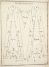
COSTRUZIONE ED USO DEL COMPASSO DI PROPORZIONE
by NAVIGATION. Pagnini, Giovanni
NAPLES: IGNAZIO RUSSO, 1753. FIRST EDITION. Hardcover. Fine. Bound in contemporary vellum over boards. Foxing. Complete with the 15 engraved plates. Little is known of the author other than that he wrote another book on navigation in 1750. This work on the sector was translated into Spanish in 1758.By the time this book was published, the design of the European sector had become standardized. Compare this design, for example, with that in the fourth edition of the works of Ozanam seventeen years earlier...
Read more about this item
Item Price
£1,217.40

Of Signals, Ships and Sundry Snippets
by Margaret de Jardine
3rd and final volume in Margaret Jardine's series on the maritime history of Taranaki, NZ, signed by author and illustrated with b+w photos.
Item Price
£19.28

Navigation and Commerce Their Original and Progress
by J Evelyn
London: T R for Benj Tooke, 1674. First edition. Leather. Very Good Indeed. 7" by 4.5". None. An excellent copy of the first edition of this history of the Dutch and the English conflict over the sovereignty of the seas. Evelyn discusses labour and industry in this work, and how humans cannot live alone on natural endowments. It gives an account of the discovery of America by Columbus, and the Venetian Zeno. Following from this there are explorations of subsequent voyages by Amerigo, Vespucci and John...
Read more about this item
Item Price
£9,900.00£8,910.00

Pacific Explorer
by John Dunmore
Biography of the eighteenth-century Pacific Explorer La Perouse, accompanied by b+w illustrations.
Item Price
£21.69

Carte Campbell en 4 Couleurs: Les Operations Militaires No. 2 Nord et Belgique
by None
Paris: Blondel La Rougery, c1920. Brochure/Pamphlet. Very Good. 7" by 5". None. A scarce coloured map of military operations in Northern France and Belgium. Scarce work. A large folding map of Northern France and Belgium, in four colours. Intending to display the areas of military operations in fifteen different regions of land, allowing you to follow the operations of the war of nations on all fronts. In the original paper slip jacket. Externally, smart with light shelf wear, some rubbing...
Read more about this item
Item Price
£45.00

Ortsbestimmung in Küstengewässern
by Eichel, Hasso:
1965.. Stuttgart, Franckh`sche Verlagshandlung, 149 Seiten,; Mit 52 Abbildungen im Text und 17 Fotos auf 8 Tafeln Softcover/Paperback ohne Schutzumschlag, Ecken/Kanten bestossen, Einband berieben, vergilbt, mit leichtenKNcikspuren, und fleckig, Buchschnitt mit Lagerspuren, Seiten gebräunt, Cover biegt sich auf, eher mittel bis gut für das Alter Bücher
Item Price
£8.95

Navigazioni di Cook Pel Grande Oceano e Intorno al Globo
by Captain James Cook
Milano: Sonzogno e Comp, 1816. First edition. Fine Binding. Very Good. 7" by 4". None. A beautifully illustrated Italian language edition of James Cook's global voyages. The first edition with these illustrations. Very rare and collated complete with all illustrations. In Italian. Captain James Cook was responsible for mapping New Zealand, to Hawaii in a detail not previously charted by Western explorers. He sailed for twelve years around the Pacific Ocean, which contributed to European's knowledge...
Read more about this item
Item Price
£11,000.00£9,900.00

A History of Civil Aviation in New Zealand
by Maurice E. McGreal
A History of Civil Aviation in NZ from 1912-1992, illustrated with b+w photos.
Item Price
£14.46

A Tour Thro' the Whole Island of Great Britain
by Daniel Defoe
London: Frank Cass & Co. Ltd, 1968. Cloth. Very Good Indeed. 9" by 6". None. Two illustrated volumes of this guide to travelling around the UK, divided into circuits and journeys, by Daniel Defoe. Two volumes. A tour of Great Britain divided into circuits or journeys giving a particular and diverting account of whatever is curious and worth observation. Volume one contains an introduction and information on travelling through Essex, Sussex, Hampshire, Cornwall, Westminster, and Somerset....
Read more about this item
Item Price
£95.00

Resolution -- The Story of Captain Cook's Second Voyage of Discovery
by Peter Aughton
2005 2nd (Phoenix) Ed soft-covers col-illus 214 pages VG Clean & tight, almost 'as new' condition. Cook's 'Resolution Voyage' (Aughton 2005)
Item Price
£9.64

Compendium of Ancient Geography
by J B B D'Anville; John Horsley
London: J Fauldie, 1810. Leather. Very Good Indeed. 8.5" by 5.5". None. A scarce copy of J B B D'Anville's Compendium of Ancient Geography. With 10 fold out maps, collated complete. A scholar of geography, J B B D'Anville was renowned for his gifted cartography skills. His work was meticulous and considered accurate, and he was cautious enough to highlight unknown areas. Here D'Anville produces beautiful and accurate work based on his own original research. He describes the landscape of ancient...
Read more about this item
Item Price
£495.00£445.50

The Description and Use of the Globes and the Orrery
by Joseph Harris
London: B Cole; Thomas Wright; E Cushee, 1757. Leather. Very Good Indeed. 8" by 5". Not Stated. A scarce edition of Joseph Harris' work which explains how to use terrestrial and celestial globes as well as an orrery. Illustrated, with five folding plates. Collated, complete. With the final advertisement leaf for Cole, Senr and Junr. In a very smart, recent, full calf binding. The eighth edition of this work. Former owner's inscription to the head of the title page 'John Ussher.' ESTC...
Read more about this item
Item Price
£495.00£445.50

Tables of Houses. Equator to 66 degrees North Latitude. Including How to use These Same Tables for Southern Latitudes
Chicago: Aries Press, 1969. Softcover. Fine. Later printing. Bookstore stamp (Astrological Books) on title page else fine in wrappers.
Item Price
£16.23

