Description:
London, 1775. Copper engraving, 19 x 29 cms, recent hand colour, blank verso; from Harrison’s History of London. Adams, London Illustrated: 57/64 Print
Search Results: London from Bryars and Bryars
You searched for:
- Subject: London from Bryars and Bryars
Results 1 - 20 of 101
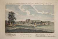
An Ancient View of St James’s, Westminster Abby & Hall &c. from the Village of Charing now Charing Cross
by Cooke, John:
- Used
- Condition
- Used
- Quantity Available
- 1
- Seller
-
London, United Kingdom
- Item Price
-
£65.00£5.95 shipping to USA
Show Details
Item Price
£65.00
£5.95
shipping to USA

Antient North East View of Bishopsgate Street
by Wilkinson, Robert:
- Used
- Condition
- Used
- Quantity Available
- 1
- Seller
-
London, United Kingdom
- Item Price
-
£65.00£5.95 shipping to USA
Show Details
Description:
London, 1814. Copper engraving, 26 x 33 cms, recent hand-colour, blank verso; from Londina Illustrata. Print
Item Price
£65.00
£5.95
shipping to USA

Antient North East View of Cornhill
by Wilkinson, Robert:
- Used
- Condition
- Used
- Quantity Available
- 1
- Seller
-
London, United Kingdom
- Item Price
-
£65.00£5.95 shipping to USA
Show Details
Description:
London, 1819. Copper engraving, 24 x 31 cms, recent hand-colour, blank verso; from Londina Illustrata. Print
Item Price
£65.00
£5.95
shipping to USA

Arc de Triomphe du Duc de Wellington/Triumphal Arch & Duke of Wellington
by Riviere, Duc de:
- Used
- Condition
- Used
- Quantity Available
- 1
- Seller
-
London, United Kingdom
- Item Price
-
£150.00£5.95 shipping to USA
Show Details
Description:
Paris, , 1862. Tinted lithograph, 18 x 27 cms, blank verso. Print
Item Price
£150.00
£5.95
shipping to USA
![An Architectural Group in Westminster [including the West Front of the Abbey]](https://d3525k1ryd2155.cloudfront.net/h/333/091/229091333.0.m.jpg)
An Architectural Group in Westminster [including the West Front of the Abbey]
by Illustrated London News:
- Used
- Condition
- Used
- Quantity Available
- 1
- Seller
-
London, United Kingdom
- Item Price
-
£150.00£5.95 shipping to USA
Show Details
Description:
London, 1862. Wood engraving, 33.5 x 50 cms, modern hand-colour, English text on verso. Print
Item Price
£150.00
£5.95
shipping to USA
Bacon’s Large Scale Plan of the City of London - Bacon’s Coloured Plan of the City of London... “Blitzed” areas shown
by Bacon, G.W., & Co, Ltd:
- Used
- Paperback
- Condition
- Used
- Binding
- Paperback
- Quantity Available
- 1
- Seller
-
London, United Kingdom
- Item Price
-
£300.00£5.95 shipping to USA
Show Details
Description:
London, c. 1947. Folding map of the City, 42.5 x 71.5 cms, printed in colours, blank verso, folding into original stiff card wraps with 16 pp. index and b/w Underground map on the lower cover; ownership signature of L.W. Turner, dated 11.1.48. A highly detailed map on a scale of 12 inches to one mile, this is also one of relatively few commercial maps to depict the extent of wartime bomb damage. ‘Blitzed City Areas’ account for roughly one third of the City. Book
Item Price
£300.00
£5.95
shipping to USA

Bow Church
by Maitland, William:
- Used
- Condition
- Used
- Quantity Available
- 1
- Seller
-
London, United Kingdom
- Item Price
-
£100.00£5.95 shipping to USA
Show Details
Description:
London, 1756. Copper engraving, 34.5 x 21.5 cms, engraved by W.H. Toms, recent hand-colour, blank verso. From the greatly expanded second edition of Maitland’s History of London. ` Print
Item Price
£100.00
£5.95
shipping to USA
![The Chapel of the Hospital for Lepers in Kent Street, Southwark, called Le Lock [...]](https://d3525k1ryd2155.cloudfront.net/h/697/804/359804697.0.m.jpg)
The Chapel of the Hospital for Lepers in Kent Street, Southwark, called Le Lock [...]
by Wilkinson, Robert:
- Used
- Condition
- Used
- Quantity Available
- 1
- Seller
-
London, United Kingdom
- Item Price
-
£65.00£5.95 shipping to USA
Show Details
Description:
London, 1813. Copper engraving, 32 x 26 cms, recent hand-colour, blank verso; from Londina Illustrata. Print
Item Price
£65.00
£5.95
shipping to USA
Cheap Ward with its Divisions into Parishes according to a New Survey
by Maitland, William:
- Used
- Condition
- Used
- Quantity Available
- 1
- Seller
-
London, United Kingdom
- Item Price
-
£180.00£5.95 shipping to USA
Show Details
Description:
London, 1756. Copper engraving, 36.5 x 47 cms, engraved by Benjamin Cole, centrefold and addtional vertical crease, modern hand-colour, blank verso; published in the greatly expanded second edition of Maitland’s History of London. Significant buildings, such as Grocer’s Hall, represented pictorially on the map; views include Guildhall Chapel; with the arms of Aldermen Samuel Fludyer. Hyde, Ward Maps, 53. Map
Item Price
£180.00
£5.95
shipping to USA
Cheap Ward with its divisions into Parishes according to a new survey
by Maitland, William:
- Used
- Condition
- Used
- Quantity Available
- 1
- Seller
-
London, United Kingdom
- Item Price
-
£175.00£5.95 shipping to USA
Show Details
Description:
London, 1756. Copper engraving, 36.5 x 47 cms, engraved by Benjamin Cole, black and white, blank verso; published in the greatly expanded second edition of Maitland’s History of London. Significant buildings, such as Guildhall, represented pictorially on the map; views of Guildhall Chapel, Grocers’ Hall etc, and with the arms of contemporary Alderman Sir Samuel Fludyer, with dedication in lower margin. Hyde, Ward Maps, 53. Map
Item Price
£175.00
£5.95
shipping to USA
Chronicles of London Bridge: by an antiquary.
by [Thomson, Richard]:
- Used
- Hardcover
- Condition
- Used
- Binding
- Hardcover
- Quantity Available
- 1
- Seller
-
London, United Kingdom
- Item Price
-
£180.00£5.95 shipping to USA
Show Details
Description:
London: Smith, Elder, and Co., 1827. 8vo. pp. xv, [i], 687, [i]. With 56 wood-engraved illustrations (many on India paper, pasted in) engraved by George Wilmot Bonner, William Hughes and Abraham John Mason after William Harvey. Contemporary red half morocco over marbled boards, rubbed, top edge gilt; late 19th century armorial bookplate of Ernest Hamilton Sharp to front pastedown (probably the Hong Kong-based barrister, 1861-1922), with book label of G.H. Wyatt below, and Wyatt’s ink ownership stamp to free endpaper. Thomson (1794-1865) wrote extensively on London history (including ‘Tales of an Antiquary’ and ‘Secrets of Old St Paul’s’). His father was a wealthy seed merchant and he was probabaly educated privately. ODNB notes that he never attended university, and there is no evidence that he entered any profession before the age of forty, when he was elected librarian to the London Institution through the influnce of his lifelong friend, the architect William Tite.…
Read More Item Price
£180.00
£5.95
shipping to USA

The Custom House
by Maitland, William:
- Used
- Condition
- Used
- Quantity Available
- 1
- Seller
-
London, United Kingdom
- Item Price
-
£150.00£5.95 shipping to USA
Show Details
Description:
London, 1756. Copper engraving, 22.5 x 33.5 cms, recent hand-colour, blank verso. From the greatly expanded second edition of Maitland’s History of London. Print
Item Price
£150.00
£5.95
shipping to USA
Daily Telegraph Picture Map of London
by Vale Studios Ltd:
- Used
- Paperback
- first
- Condition
- Used
- Binding
- Paperback
- Quantity Available
- 1
- Seller
-
London, United Kingdom
- Item Price
-
£300.00£5.95 shipping to USA
Show Details
Description:
London, Geographia Ltd, c. 1960. Pictorial map of London, sheet size 49 x 74 cm, printed in colours, folding into printed paper wrappers which carry a conventional street plan of central London on the verso; trivial wear to wraps. The pictorial map depicts various London ‘types’ in the borders, and shows the Royal Festival Hall (built for the 1951 Festival of Britain) and the Mermaid Theatre at Puddle Dock, which opened in 1959. It seems likely that the map was first printed to concide with the Festival, and this is a later issue, with the theatre added (it does not appear on all copies). An updated picture map by Simon Stern was issued by the Telegraph c. 1970. A price of 2/6 on the cover has been overprinted or coloured over. Map
Item Price
£300.00
£5.95
shipping to USA
Descriptive Map of East End Poverty, Compiled from School Board Reports' in 1887
by Booth, Charles:
- Used
- first
- Condition
- Used
- Quantity Available
- 1
- Seller
-
London, United Kingdom
- Item Price
-
£3,750.00£5.95 shipping to USA
Show Details
Description:
London, Macmillan &: Co., 1889. First edition, folding lithographed map, 36 x 48.5 cm, printed in colours, dissected into 8 panels and laid on linen, tabbed for inclusion in the first volume of Booth’s ‘Labour and Life of the People in London’. Charles Booth’s ‘poverty’ maps were the most distinctive and original aspect of his socio-economic survey of the metropolis. Shaded to show degrees of wealth and class street by street, they have become defining images of late Victorian London. A set of four larger maps covering the whole of the built-up area accompanied the second volume of the series in 1891, but this map of the East End marked the first occasion on which Booth’s revolutionary new methodology was presented to the public in published form. Booth chose to begin his work in the East End as he expected to prove that other social reformers were guilty of exaggeration in claiming that a quarter of Eastenders were living in poverty. The results of his survey…
Read More Item Price
£3,750.00
£5.95
shipping to USA

E.S.E. View of John Bunyan’s Meeting House, in Zoar Street, Gravel Lane, Southwark
by Wilkinson, Robert:
- Used
- Condition
- Used
- Quantity Available
- 1
- Seller
-
London, United Kingdom
- Item Price
-
£65.00£5.95 shipping to USA
Show Details
Description:
London, 1813. Copper engraving, 31 x 25 cms, recent hand-colour, blank verso; from Londina Illustrata. Print
Item Price
£65.00
£5.95
shipping to USA

The East Front of the Horse and Foot Guards at Whitehall
by Maitland, William:
- Used
- Condition
- Used
- Quantity Available
- 1
- Seller
-
London, United Kingdom
- Item Price
-
£100.00£5.95 shipping to USA
Show Details
Description:
London, 1756. Copper engraving, 21.5 x 35 cms, engraved by Benjamin Cole, recent hand-colour, offsetting from facing text, blank verso. From the greatly expanded second edition of Maitland’s History of London. Print
Item Price
£100.00
£5.95
shipping to USA

East View of the Gateway of Bermondsey Abbey
by Wilkinson, Robert:
- Used
- Condition
- Used
- Quantity Available
- 1
- Seller
-
London, United Kingdom
- Item Price
-
£65.00£5.95 shipping to USA
Show Details
Description:
London, 1820. Copper engraving, 25 x 31 cms, recent hand-colour, blank verso; from Londina Illustrata. Print
Item Price
£65.00
£5.95
shipping to USA
Environs of Wembley from Rocque's ‘An Exact Survey of the City's of London, Westminster, ye Borough of Southwark and the Country Near Ten Miles Round …’
by Rocque, John:
- Used
- Condition
- Used
- Quantity Available
- 1
- Seller
-
London, United Kingdom
- Item Price
-
£500.00£5.95 shipping to USA
Show Details
Description:
London, 1746. Copper engraving, 49 x 67.5 cm, engraved by Richard Parr, black and white as issued, one or two closed marginal nicks and tears, blank verso. The top-left map-sheet from one of the earliest large-scale surveys of the environs of London. John Rocque (c. 1704-62) was a Huguenot, probably born in Geneva and brought to London as a child. His brother Bartholomew worked as a 'dessinateur des jardins' and Rocque's earliest plans are of parks, gardens and estates. He is credited with completely revitalizing English cartography, particularly large-scale map-making, at a time when many English map-sellers were content to re-issue old and outdated material. He planned his survey of London in the 1730s, and it took him nine years to complete. By 1746 he was able to issue large scale maps of London (24 sheets), and London and environs (16 sheets), the former engraved by John Pine, who was among the leading English engravers of his day. In 1750 Rocque was appointed cartographer to the…
Read More Item Price
£500.00
£5.95
shipping to USA
Extracts from the Minutes of the Epping and Ongar Highway Trust. From its Commencement in 1769 to its Termination in 1870.
by Winstone, Benjamin:
- Used
- Hardcover
- Signed
- Condition
- Used
- Binding
- Hardcover
- Quantity Available
- 1
- Seller
-
London, United Kingdom
- Item Price
-
£250.00£5.95 shipping to USA
Show Details
Description:
London: Harrison and Sons,, 1891. Royal 8vo (27.5 cm tall). pp. viii, 303, [i] + 25 b/w maps and illustrations (including frontispiece), some folding, and 2 further illustrations in the text. Green publisher’s cloth, ruled and lettered in gilt, with gilt inner dentelles; top edge gilt. The verso of the free endpaper is inscribed ‘with the author’s compliments’, and loosely inserted is a signed autograph letter presenting the book to the library at Gaynes Park, Theydon Garnon, Essex. The letter is addressed to Chisenhall-Marsh Esq, presumably William Swaine Chisenhall-Marsh who lived at Gaynes Park 1882-1917. Deeds mentioning Gaynes Park are transcribed in the appendix. Printed for private circulation, Wintone clearly did not anticipate mass readership, but his book does provide a useful glimpse of the turnpike system in its heydey, and the early days of mdern road building. In 1830 John Loudon Macadam ‘the celebrated maker of roads’ (p. 199) was among three applicants…
Read More Item Price
£250.00
£5.95
shipping to USA

A Front View of East India House, in Leadenhall Street
by Laurie & Whittle:
- Used
- Condition
- Used
- Quantity Available
- 1
- Seller
-
London, United Kingdom
- Item Price
-
£250.00£5.95 shipping to USA
Show Details
Description:
London , 1800. Copper engraving, 28 x 41 cms, black and white, mounted in the nineteenth century, blank verso. Printed to mark the rebuilding of East India House by the architect Richard Jupp, completed in 1800. The East India Company continued to govern much of India until relieved of its responsibilities by the Crown in the aftermath of the Great Mutiny. Jupp’s building survived until 1929. Print
Item Price
£250.00
£5.95
shipping to USA

Didn’t find what you’re looking for?
Try adding this search to your want list. Millions of books are added to our site everyday and when we find one that matches your search, we’ll send you an email. Best of all, it’s free.
Add to Want List

Are you a frequent reader or book collector?
Join the Bibliophile's Club and save 10% on every purchase, every day — up to $20 savings per order!

Social Responsibility
Did you know that since 2004, Biblio has used its profits to build 16 public libraries in rural villages of South America?
