Description:
Washington D.C.: Army Map Service, U.S. Army, 1943 IN GOOD CONDITION. Measures 29-1/2 inches high by 42" wide, unfolded. Color map, scale 1:5,000,000. Showing Army, Navy or Marine Corps Fields; Commercial and Municipal Airports; Civil Aeronautics Intermediate Fields, Civil Airways & Lines of Equal Magnetic Variations. Occasional crease tear.
Search Results: MAPS from Monroe Bridge Books
You searched for:
- Subject: MAPS from Monroe Bridge Books
Results 1 - 20 of 33

Aeronautical Planning Chart - United States - 3060 b - Restricted
- Used
- good
- Condition
- Used - Good
- Quantity Available
- 1
- Seller
-
Houlton, Maine, United States
- Item Price
-
£134.71£4.89 shipping to USA
Show Details
Item Price
£134.71
£4.89
shipping to USA

Asher Rare Books Catalogue 27. Rare and Important Books and Atlases Including Some Manuscripts
- Used
- Paperback
- first
- Condition
- Used - VERY GOOD ++
- Edition
- First Edition
- Binding
- Paperback
- Quantity Available
- 1
- Seller
-
Houlton, Maine, United States
- Item Price
-
£21.23£4.89 shipping to USA
Show Details
Description:
The Netherlands: A. Asher & Co. B. V., 1997 101pp, printed on fine glossy paper, bound in stiff paper covers, with binding and hinges tight, illustrated throughout. NO LABELS, INSCRIPTIONS, NOR MARKINGS.
Item Price
£21.23
£4.89
shipping to USA

More Photos
BROCHURE - Visitor's Guide to New Orleans, with Two Maps
- Used
- very good
- Paperback
- Condition
- Used - Very Good
- Binding
- Paperback
- Quantity Available
- 1
- Seller
-
Houlton, Maine, United States
- Item Price
-
£12.25£4.89 shipping to USA
Show Details
Description:
1950 Circa 1950. A two-panel Brochure, depicting a street map for Downtown New Orleans, along with a Map for the Port of New Orleans. Printed in blue ink.
Item Price
£12.25
£4.89
shipping to USA
![The Cape Ann Trail. Compliments of Board of Trade, Rockport, Massachusetts [GUIDE & MAP]](https://d3525k1ryd2155.cloudfront.net/h/490/489/921489490.0.m.jpg)
The Cape Ann Trail. Compliments of Board of Trade, Rockport, Massachusetts [GUIDE & MAP]
- Used
- very good
- Condition
- Used - Very Good
- Quantity Available
- 1
- Seller
-
Houlton, Maine, United States
- Item Price
-
£36.74£4.89 shipping to USA
Show Details
Description:
Gloucester, Massachusetts: Chamber of Commerce, 1930 Folded, measures 10-1/4" tall x 4-3/8" wide. Opened, measures 26" high by 20-1/2" wide. Black and white drawn map, with a red numbered trail, which corresponds to the numbered places on the vignette border. A few small crease tears. Includes descriptive paragraphs on the various locations of interest, on the back of the map.
Item Price
£36.74
£4.89
shipping to USA
![Carte Nautique - L' Allier [The River Allier]](https://d3525k1ryd2155.cloudfront.net/h/775/137/330137775.0.b.jpg)
Carte Nautique - L' Allier [The River Allier]
- Used
- very good
- Paperback
- Condition
- Used - Very Good
- Binding
- Paperback
- Quantity Available
- 1
- Seller
-
Houlton, Maine, United States
- Item Price
-
£26.12£4.89 shipping to USA
Show Details
Description:
Touring Club De France IN VERY GOOD CONDITION. With text in French, English, Deutsch & Italiano. Alliance Internationale De Tourisme, Federation Internationale De Canoe. 10 stapled leaves, showing a map of the river Allier, in original stiff covers.
Item Price
£26.12
£4.89
shipping to USA

Contour-Coloured World Map Series - South Africa and Madagascar, with Boundaries, Roads and Railways
- Used
- fair
- Condition
- Used - Fair
- Quantity Available
- 1
- Seller
-
Houlton, Maine, United States
- Item Price
-
£12.25£4.89 shipping to USA
Show Details
Description:
Edinburgh, Scotland: John Bartholomew & Son Ltd., 1957 Scale 1:4,000,000. IN FAIR CONDITION, showing crease tears and pin holes. FOLDING MAP.
Item Price
£12.25
£4.89
shipping to USA
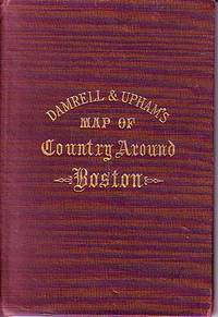
Damrell & Upham's Map of Country Around Boston
- Used
- good
- Hardcover
- Condition
- Used - Good
- Binding
- Hardcover
- Quantity Available
- 1
- Seller
-
Houlton, Maine, United States
- Item Price
-
£102.05£4.89 shipping to USA
Show Details
Description:
The Boston Map Store, 1889 IN GOOD CONDITION. Folds out to 32 inches by 22 inches. Hand coloured map of Boston and the Country Adjacent, from actual Surveys. Shows crease tears and stains.
Item Price
£102.05
£4.89
shipping to USA

Dead Ends: An Irreverent Field Guide to the Graves of the Famous
by Cross, David / Bent, Robert
- Used
- Paperback
- Condition
- Used - Very Good to Fine
- Binding
- Paperback
- ISBN 10 / ISBN 13
- 9780452266797 / 0452266793
- Quantity Available
- 1
- Seller
-
Houlton, Maine, United States
- Item Price
-
£20.41£4.89 shipping to USA
Show Details
Description:
Plume / Advertising Unlimited, Inc., 1991 With an Edward Gorey Cover. Folding Map in Fine Condition, with Covers in Very Good ++ Condition. Color folding map encased in illustrated glossy stiff paper covers, includes the resting places of Andy Warhol, Lucille Ball, Rin Tin Tin, Rocky Marciano, Edgar Cayce. Patsy Cline and more.
Item Price
£20.41
£4.89
shipping to USA

Edinburgh Transport Map - Bus Routes and City Centre Plan 1969-70
- Used
- very good
- Condition
- Used - Very Good
- Quantity Available
- 1
- Seller
-
Houlton, Maine, United States
- Item Price
-
£20.41£4.89 shipping to USA
Show Details
Description:
Edinburgh: Edinburgh Corporation Transport IN VERY GOOD ++ CONDITION. Folds out to 33-1/4 by 25 inches. STREET MAP bordered in red, with transport in red. NO TEARS, NOR CHIPS.
Item Price
£20.41
£4.89
shipping to USA
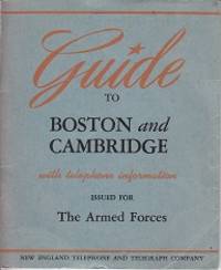
Guide to Boston and Cambridge with Telephone Information - Issued for The Armed Forces
- Used
- very good
- Paperback
- Condition
- Used - Very Good
- Binding
- Paperback
- Quantity Available
- 1
- Seller
-
Houlton, Maine, United States
- Item Price
-
£22.86£4.89 shipping to USA
Show Details
Description:
Boston: New England Telephone and Telegraph Company, 1942 (Circa 1942) Unpaginated, 6 leaves on glossy paper, with photographs, stapled booklet bound in original stiff paper covers, with binding tight. DOUBLE-SIDED FOLDING MAP IN BACK, Courtesy of Harvard University. One side showing the streets of Old Cambridge, and the other Down-Town Boston [no tears]. Some creases to covers. NO LABELS, INSCRIPTIONS, NOR MARKINGS.
Item Price
£22.86
£4.89
shipping to USA
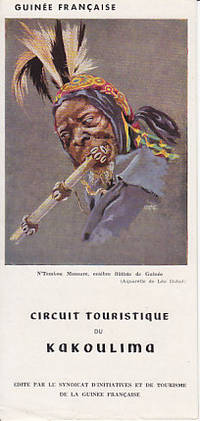
Guinee Francaise - Circuit Touristique Du Kakoulima. Edite Par LL Syndicat D'Initiatives Et De Tourisme De La Guinee Francaise
by Unknown
- Used
- very good
- Paperback
- Condition
- Used - Very Good
- Binding
- Paperback
- Quantity Available
- 1
- Seller
-
Houlton, Maine, United States
- Item Price
-
£20.41£4.89 shipping to USA
Show Details
Description:
Casablanca: Editions Interpresse, 1950 Circa 1950. 8-1/2 inch by 12 inch sheet, folded in thirds, which opens to a map, with descriptive text in French. In a protective mylar sleeve. EPHEMERA.
Item Price
£20.41
£4.89
shipping to USA

Indexed Map of Lowell Including Parts of Dracut and Chelmsford Massachusetts - Lucas Maps
- Used
- good
- Condition
- Used - Good
- Quantity Available
- 1
- Seller
-
Houlton, Maine, United States
- Item Price
-
£22.86£4.89 shipping to USA
Show Details
Description:
Reading, Mass.: Lucas Company, 1965 IN GOOD ++ CONDITION. Folding Street map, in original stiff covers. 22 inches by 34 inches, with one crease tear. Stiff covers soiled.
Item Price
£22.86
£4.89
shipping to USA
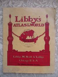
Libby's Atlas of the World
- Used
- Paperback
- Condition
- Used - Good+
- Binding
- Paperback
- Quantity Available
- 1
- Seller
-
Houlton, Maine, United States
- Item Price
-
£183.69£4.89 shipping to USA
Show Details
Description:
Chicago, IL: Libby, McNeill & Libby [Packers & Preservers of Meats], 1902 Circa 1902. 40pp, printed on fine glossy paper, staple bound, with stiff paper covers. All maps present, and in color lithography. Includes photographs of Libby's meat packing plant in back. Covers lightly soiled, with edge wear. Back cover and last four leaves have a small 3/4" edge tear, not affecting the maps.
Item Price
£183.69
£4.89
shipping to USA

The Literary Digest Liberty Map Of New Europe Revealing the Great Changes Resulting from The World War 1914-1920. Together With a Complete New Map of Africa - With Exhaustive Index of Over 13,000 Names - With Original Slipcase
- Used
- very good
- Condition
- Used - Very Good
- Quantity Available
- 1
- Seller
-
Houlton, Maine, United States
- Item Price
-
£61.23£4.89 shipping to USA
Show Details
Description:
New York: Funk & Wagnalls Company COLOR MAP IN GOOD+ CONDITION, 44 page Index in Very Good ++ Condition, Slipcase in Good + Condition. 1920-1921, Bond Paper Edition. Engraved and printed by The Matthews-Northrup Works in Buffalo, New York. Measures 41-1/2 inches tall by 52 inches wide. Map paper is slightly yellowed, with some crease tears and a few crease chips. Index book has color covers, stapled binding (staples rusty), with advertising in the back.
Item Price
£61.23
£4.89
shipping to USA
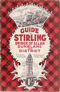
Mackay's Guide to Stirling, Bridge of Allen and Neighbourhood, with Maps and Illustrations
by Mackay, Eneas
- Used
- very good
- Paperback
- Condition
- Used - Very Good
- Binding
- Paperback
- Quantity Available
- 1
- Seller
-
Houlton, Maine, United States
- Item Price
-
£28.57£4.89 shipping to USA
Show Details
Description:
Stirling, Scotland: Eneas Mackay, 1920 Circa 1920, with folding map in Fine Condition. 104pp, with [8] of advertising in the back, printed on fine glossy paper, bound in stiff illustrated and plaid paper. Covers show edge wear/tear. Black and white photographs throughout. In a protective mylar sleeve.
Item Price
£28.57
£4.89
shipping to USA

Map of Siberia from Travels in Siberia: Including Excursions Northwards, Down the Obi, to the Polar Circle, and Southwards, to the Chinese Frontier
by Erman, Adolph
- Used
- very good
- Condition
- Used - Very Good
- Quantity Available
- 1
- Seller
-
Houlton, Maine, United States
- Item Price
-
£61.23£4.89 shipping to USA
Show Details
Description:
London: Longman, Brown, Green & Longmans, 1848 A Map if Siberia illustrating Erman's Route in red, which goes into Volume I as the frontis-piece. Slightly age darkened, light edge wear, no tears. When open it measures approximately 11" tall by 16-1/2" wide.
Item Price
£61.23
£4.89
shipping to USA
More Photos
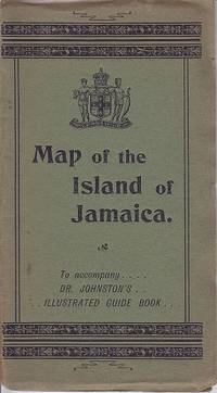
The Map of the Island of Jamaica To Accompany Dr. Johnston's Illustrated Guide Book
by Prepared Under the Direction of Thomas Harrison Gov't Surveyor By Colin Liddell
- Used
- Paperback
- Condition
- Used - Map in Very Good ++ Condition
- Binding
- Paperback
- Quantity Available
- 1
- Seller
-
Houlton, Maine, United States
- Item Price
-
£204.10£4.89 shipping to USA
Show Details
Description:
London: Stanford's Geographical Establishment, 1895 16 section, folding, color lithograph map, housed in it's original, stiff green paper covers. Opens to measure an oblong 13-1/4" X 27", with the upper left section mounted onto the paper covers. No tears to the map, occasional light foxing. Covers sunned, with edge wear.
Item Price
£204.10
£4.89
shipping to USA

Massachusetts Aeronautical Chart
- Used
- Condition
- Used - VERY GOOD ++
- Quantity Available
- 1
- Seller
-
Houlton, Maine, United States
- Item Price
-
£9.80£4.89 shipping to USA
Show Details
Description:
Boston, Massachusetts: Massachusetts Aeronautics Commission, 1988 Folding color MAP, no tears, measuring approx. 19 inches tall by 26 3/4" wide. Includes a Legend, with an Airport Directory on the back side.
Item Price
£9.80
£4.89
shipping to USA
The New England Commercial And Route Survey MAP
- Used
- good
- Condition
- Used - Good
- Quantity Available
- 1
- Seller
-
Houlton, Maine, United States
- Item Price
-
£13.06£4.89 shipping to USA
Show Details
Description:
Boston: The Bullard Company, 1914 IN GOOD CONDITION. Opens up to 43-3/4 inches wide by 48-3/4 inches tall. With an inset map of a portion of Maine. Covers chipped and lacking portions of paper. Map has a few crease tears, with slight age darkening.
Item Price
£13.06
£4.89
shipping to USA
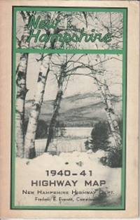
New Hampshire 1940-41 Highway Map
- Used
- very good
- Paperback
- Condition
- Used - Very Good
- Binding
- Paperback
- Quantity Available
- 1
- Seller
-
Houlton, Maine, United States
- Item Price
-
£22.86£4.89 shipping to USA
Show Details
Description:
New Hampshire Highway Department, 1942 Includes photographs of *The Old Man of the Mountains *Robert's Cove at Lake Winnipesaukee *Aerial Tramway at Cannon Mountain *Pinkham Notch *Dartmouth College *Dixville Notch along with others. Color folding map opens up to 28-1/2 by 18-1/4 inches.
Item Price
£22.86
£4.89
shipping to USA

Didn’t find what you’re looking for?
Try adding this search to your want list. Millions of books are added to our site everyday and when we find one that matches your search, we’ll send you an email. Best of all, it’s free.
Add to Want List

Are you a frequent reader or book collector?
Join the Bibliophile's Club and save 10% on every purchase, every day — up to $20 savings per order!

Social Responsibility
Did you know that since 2004, Biblio has used its profits to build 16 public libraries in rural villages of South America?
