Description:
Monmouth Beach, New Jersey: Philip Freneau Press, 1966. Near Fine condition. Sharp corners. 10" wide by 12.25" tall. Clean, square, tight. Endpaper has one small erasure. Pages are fresh and crisp. No underlining. No highlighting. No margin notes. Gilt minuteman on the cover and gilt lettering are bright and shiny. Illustrated with numerous map reproductions. Contains an informative Introduction, and an alphabetical listing of 50 cartographers, with a short biography of each map maker, and listing of his known maps. Also has a section describing anonymous maps. In the Foreword, Gerard L. Alexander (Chief, Map Division, The New York Public Library) states that many of these biographical sketches appear in print here for the first time, and "a great number of the maps are likewise newly discovered." Index. Bound in the original greenish-blue cloth.. First Edition. Hardcover. Near Fine condition/No jacket, as issued. 48pp. Great Packaging, Fast Shipping.
Search Results: Maps / Cartography from About Books
You searched for:
- Subject: Maps / Cartography from About Books
Results 1 - 20 of 152

American Maps and Map Makers of the Revolution
by Guthorn, Peter J.; Foreword by Gerard L. Alexander
- Used
- Hardcover
- first
- Condition
- Used - Near Fine condition
- Edition
- First Edition
- Binding
- Hardcover
- Quantity Available
- 1
- Seller
-
Henderson, Nevada, United States
- Item Price
-
£36.58£5.29 shipping to USA
Show Details
Item Price
£36.58
£5.29
shipping to USA
Animals and Maps
by George, Wilma; Helen Wallis
- Used
- Hardcover
- first
- Condition
- Used - Fine condition
- Edition
- First Edition
- Binding
- Hardcover
- Quantity Available
- 1
- Seller
-
Henderson, Nevada, United States
- Item Price
-
£13.80£5.29 shipping to USA
Show Details
Description:
Berkeley & Los Angeles: University of California Press, 1969. Fine condition. Bright, shiny, clean, square and tight. Sharp corners. NOT a library discard. NO owner's name or bookplate. NO remainder mark. Pages are fresh and crisp. NO underlining. NO highlighting. NO margin notes. Preface by Helen Wallis. Illustrated throughout with old maps embellished with images of various animals. Bibliography. Index. Bound in the original gilt-stamped maroon cloth.. First Edition. Hardcover. Fine condition/No Jacket. 8vo. 235pp. Great Packaging, Fast Shipping.
Item Price
£13.80
£5.29
shipping to USA
Atlas of Morris Co. New Jersey : From Actual Surveys and Records by and under the Direction of F.W. Beers, Assisted by A. B. Prindle & Others
by Beers F. W.
- Used
- Paperback
- Condition
- Used - Near Fine condition
- Edition
- Facsimile Edition
- Binding
- Paperback
- Quantity Available
- 1
- Seller
-
Henderson, Nevada, United States
- Item Price
-
£122.08£5.29 shipping to USA
Show Details
Description:
New York: F. W. Beers; A.D. Ellis; G.G. Soule , 1868. Near Fine condition. NO chips. NO tears. A bright, clean, tight copy. The spine is square and flat with NO creases. NO owner's name or bookplate. Pages are bright white, clean and crisp. This is an undated modern facsimile of the 1868 original. Oversize Softcover, with black cloth spine. 10.75" wide by 14" tall. This atlas consists of a printed title-page; an outline map of Morris County; 31 single and double-page maps; a Table of Distances for Morris County; and 2 pages of lithographic views of 6 buildings (George Washington's Headquarters in 1779/80; Boonton Academy; Schooley's Mountain Seminary; etc). Included are maps of: Washington; Chester; Mendham; Brookside; Stephensburg; Whippany; Morris; Morristown; Passaic; Green Village; New Vernon; Chatham; Madison; Troy; Hanover; Chatham, Long Hill; Parsippany; Roxbury; Drakesville; Randolph; Dover; Oram; Jefferson; Flanders; Milton; German Valley; Schooley's…
Read More Item Price
£122.08
£5.29
shipping to USA
Stock Photo: Cover May Be Different
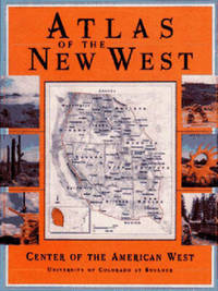
Atlas of the New West: Portrait of a Changing Region (signed by 4 authors)
by Riebsame, William (signed); Patricia Nelson Limerick (signed); James J. Robb (signed) Charles Wilkinson (signed)
- Used
- Hardcover
- Signed
- first
- Condition
- Used - Very Good condition
- Edition
- First Printing of the First Edition
- Binding
- Hardcover
- ISBN 13
- 9780393045505
- ISBN 10
- 0393045501
- Quantity Available
- 1
- Seller
-
Henderson, Nevada, United States
- Item Price
-
£32.52£5.29 shipping to USA
Show Details
Description:
University of Colorado, Boulder Center Of The American West / W. W. Norton, 1997. Inscribed to Dean [Nicole?] Speer of the College of Arts and Sciences, University of Colorado, Boulder and SIGNED by 4 of the book's contributors. The inscription reads: "For Dean Speer - with our thanks for your support" (signed by) William E. Riebsame (General Editor); James J. Robb (Director of Cartography) and historians Patricia Nelson Limerick and Charles Wilkinson. Very Good condition in a bright and shiny Very Good dust jacket. NOT price clipped ($35.00). The jacket is protected by a removable Brodart clear-plastic sleeve. Light wear/bumps to edges of the cover (NO pages are affected). A few sentences highlighted on 2 pages only. All other pages are clean and unmarked. Bound in the original blue boards. Oversize Hardcover. 9.25" wide by 12.25" tall. This large heavy book will require extra postage for Priority and International shipments, but only the standard charge for media…
Read More Item Price
£32.52
£5.29
shipping to USA
More Photos
Atlas of New Jersey : Geological Survey of New Jersey
by New Jersey Geological Survey; George H. Cook (State Geologist)
- Used
- Hardcover
- Condition
- Used - Fair - Fine condition
- Edition
- Second Edition?
- Binding
- Hardcover
- Quantity Available
- 1
- Seller
-
Henderson, Nevada, United States
- Item Price
-
£1,871.93£5.29 shipping to USA
Show Details
Description:
New York: Julius Bien & Co, 1889. Condition of the binding is only Fair with pest damage. Leather over the spine has perished. Front and rear outer hinges cracks have been neatly reinforced with high quality clear flexible glue. Inner hinges are OK, having been reinforced by the publisher/bookbinder with sturdy maroon cloth. SEE PHOTOS. Condition of all maps is NEAR FINE - FINE. NO foxing or toning. Pages are clean and unmarked. SEE PHOTOS. Includes a title page map of New Jersey [Key to the System of Mapping] and 19 linen-backed double page maps. Collated and complete (per table of contents -- SEE PHOTOS). The maps are lithographically printed in blue, red, yellow, and black. The double page maps open to an impressive 26.50" across by 36.50" tall. No year of publication is stated, but Phillips 2149 in A LIST OF GEOGRAPHIC ATLASES, Vol. 1, says [1889]. The maps themselves are variously dated up to 1888. Titles of Sheets: No. 0. New Jersey State Map Geographic; No. 1.…
Read More Item Price
£1,871.93
£5.29
shipping to USA

Stock Photo: Cover May Be Different
The Atlas of North American Exploration : From the Norse Voyages to the Race to the Pole
by Goetzmann, William H.; & Glyndwr Williams
- New
- Hardcover
- first
- Condition
- New
- Edition
- First Printing of the First Edition
- Binding
- Hardcover
- ISBN 13
- 9780132971287
- ISBN 10
- 0132971283
- Quantity Available
- 1
- Seller
-
Henderson, Nevada, United States
- Item Price
-
£16.24£5.29 shipping to USA
Show Details
Description:
New York: Prentice Hall, 1992. Brand New in a Brand New dust jacket. A gorgeous, pristine copy. NOT price clipped ($40.00). NO chips. NO tears. NO creases. NO rubbing. NO fading. Bright, shiny, clean, square, and tight. Sharp corners. NO owner's name or bookplate. NOT a remainder. Fresh and crisp -- obviously never read. Bibliographical references. Index. Bound in the original gilt-stamped blue boards. First printing, with "First Edition" so stated and complete number row (10 987654321) on the copyright page. From the dust jacket: "For over 500 years, explorers roamed the wilderness of North America... [T]his great adventure is captured as never before in the lavishly illustrated ATLAS OF NORTH AMERICAN EXPLORATION... [with] more than 100 full-color maps... The routes of explorers Ponce de León, Henry Hudson, Hernando de Soto, Daniel Boone, Vitus Bering, Lewis and Clark, Admiral Peary and dozens more are re-created, showing the sites of encounters with native…
Read More Item Price
£16.24
£5.29
shipping to USA
More Photos
Atlas of Part of Morris Co. N. J., Embracing Town of Morristown, The Boroughs of Madison, Florham Park, Chatham and Mendham: Morris Township and Parts of Chatham, Hanover, Mendham, and Passaic Townships
by Muller, A. H.; & J. M. Lathrop; Thomas Flynn
- Used
- Hardcover
- first
- Condition
- Used - Good - Fine condition
- Edition
- First Edition
- Binding
- Hardcover
- Quantity Available
- 1
- Seller
-
Henderson, Nevada, United States
- Item Price
-
£3,011.39£5.29 shipping to USA
Show Details
Description:
Philadelphia, Pennsylvania: A. H. Muller, Publisher, 1910. Condition of the binding is Good but for rubbing at the corners and outer hinges cracked. SEE PHOTOS. Inner hinges are PERFECT, having been reinforced by the publisher/bookbinder with sturdy maroon cloth. Housed in a Fine custom-made, maroon cloth-covered clamshell case. SEE 2 PHOTOS, its outside and both inner halves when opened. Condition of all maps is NEAR FINE - FINE. Pages are clean and unmarked. NO tears or foxing. SEE PHOTOS. This atlas consists of 25 (i. e. 26, counting the Index map) hand-colored, lithographic, linen-backed double page maps. The maps are color-keyed to the locations of each of the following: stone buildings, brick buildings, frame or half frame buildings, stables or barns, green houses, steam railroads, electric railroads, water pipes, sewers, improved roads and fire hydrants. SEE PHOTOS. The double page maps open to an impressive 31.50" across by 22.25" tall. Each map did have a maroon leather…
Read More Item Price
£3,011.39
£5.29
shipping to USA
Atlases Published in the Netherlands in the Rare Atlas Collection / Atlas publiés aux Pays-Bas se trouvant dans la collection d'atlas rares
by Seboek, Lou
- Used
- Paperback
- first
- Condition
- Used - Very Good condition
- Edition
- First Edition
- Binding
- Paperback
- Quantity Available
- 1
- Seller
-
Henderson, Nevada, United States
- Item Price
-
£93.56£5.29 shipping to USA
Show Details
Description:
Ottawa: National Map Collection, Public Archives of Canada, 1973. Very Good condition. Covers lightly rubbed. NOT a library discard. NO owner's name or bookplate. Pages are clean and unmarked. NO underlining. NO highlighting. NO margin notes. A descriptive carto-bibliography with full collations, contents, notes, lists of maps, map measurements, etc. Foreword by Theodore E. Layng, Keeper of Maps, in French and English. Subtitle: "No. 1 in a provisional series describing the atlases in the National Map Collection by country of origin." Bound in the original dark pink wraps, stamped in white. 8.5" wide by 11" tall. . First Edition. Softcover. Very Good condition. xvii, 132pp. Great Packaging, Fast Shipping.
Item Price
£93.56
£5.29
shipping to USA
Stock Photo: Cover May Be Different
A Battlefield Atlas of the Civil War
by Symonds, Craig L.
- Used
- Hardcover
- first
- Condition
- Used - Fine condition.
- Edition
- First Printing of the First Edition
- Binding
- Hardcover
- ISBN 13
- 9780933852402
- ISBN 10
- 0933852401
- Quantity Available
- 1
- Seller
-
Henderson, Nevada, United States
- Item Price
-
£12.17£5.29 shipping to USA
Show Details
Description:
Annapolis, Maryland: The Nautical and Aviation Publishing Company of America, 1983. 7" wide by 10" tall. Bright, clean, square, tight copy. No underlining. No highlighting. No margin notes. Pages are fresh and crisp. Bound in the original red boards, lettered in gold on the spine and front cover. Gilt lettering is still bright and shiny. Illustrated throughout with vintage portraits and photos, and 43 two-color, full-page maps. The text accompanying each map enables the reader to relive the action of battle and sense the drama it held for the troops that fought. Introduction. Suggestions for Further Reading.. First Printing of the First Edition. Hard Cover. Fine condition./VG DJ (short closed tears). Illus. by Clipson, William J. (cartography). xv, 106pp. .
Item Price
£12.17
£5.29
shipping to USA
More Photos
Black's General Atlas: Comprehending Sixty-One Maps... Engraved on Steel... with Geographic Descriptions, and Index of 56,000 Names
by Hall, Sidney; Hughes; etc
- Used
- Hardcover
- Condition
- Used - Good - Very Good condition
- Edition
- 1844 edition
- Binding
- Hardcover
- Quantity Available
- 1
- Seller
-
Henderson, Nevada, United States
- Item Price
-
£1,216.78£5.29 shipping to USA
Show Details
Description:
Edinburgh / London / Dublin: Adam and Charles Black / Longman / Simpkin / Whittaker / Hamilton / Cumming, 1844. Good - Very Good condition. Bound in green cloth with black leather spine and corners, elaborately gilt decorated. The leather is surprisingly well preserved. The cloth is faded and soiled, with frayed edges. SEE PHOTOS. NO owner's name or bookplate. NOT a library discard. Imprinted "MDCCCXLIV" at the foot of the title page with "1844" hand inked beneath. All other pages are crisp, clean and umarked with almost no foxing. Full title; "Black's General Atlas: Comprehending Sixty-One Maps from the Latest and Most Authentic Sources, Engraved on Steel in the First Style of the Art by Sidney Hall, Hughes, etc. with Geographic Descriptions, and an Index of 56,000 Names." The maps, several double page, are tissue guarded and most are handcolored in red, yellow and green. SEE PHOTOS. With the binder's ticket of Smith & Son, 306 Lawnmarket,…
Read More Item Price
£1,216.78
£5.29
shipping to USA
![Blatt 8 (VIII) : Aarau - Luzern Zug - Zürich [Zurich] : Topographische Karte der Schweiz :...](https://d3525k1ryd2155.cloudfront.net/h/777/796/330796777.0.m.jpg)
More Photos
Blatt 8 (VIII) : Aarau - Luzern Zug - Zürich [Zurich] : Topographische Karte der Schweiz : Massstab 1 : 100,000, Vermessen und herausgegeben unter Aufsicht von General G. H. Dufour
by Dufour, General G. H. [Guillaume-Henri]
- Used
- Hardcover
- Condition
- Used - Very Good (somewhat spotted)
- Edition
- 1861 edition
- Binding
- Hardcover
- Quantity Available
- 1
- Seller
-
Henderson, Nevada, United States
- Item Price
-
£142.43£5.29 shipping to USA
Show Details
Description:
Bern [Switzerland]: Hans Körber [Koerber] (Huber & Comp.), 1861. Very Good condition. SEE PHOTOS. Karten etwas fleckig (maps somewhat spotted). This is Blatt VIII, Aarau - Luzern Zug - Zürich [Zurich]. The map is dated 1861 and has 21 sections. It is printed on paper, then mounted on cloth (i.e. backed with linen). When folded the map measures 19 cm tall x 11 cm wide. When unfolded, 57 cm tall x 79 cm wide. SEE PHOTOS. Linen-backed, steel-engraved folding map in 21 segments. Scale 1:100,000.. 1861 edition. Hardcover. Very Good (somewhat spotted).
Item Price
£142.43
£5.29
shipping to USA
A Book of Old Maps Delineating American History from the Earliest Days Down to the Close of the Revolutionary War
by Fite, Emerson D.; & Archibald Freeman
- Used
- Hardcover
- Condition
- Used - Near Fine condition
- Edition
- Reprint of the 1926 original
- Binding
- Hardcover
- Quantity Available
- 1
- Seller
-
Henderson, Nevada, United States
- Item Price
-
£23.97£5.29 shipping to USA
Show Details
Description:
New York: Arno Press, 1969. Near Fine condition in a Near Fine dust jacket. NO chips. NO creases. NOT price clipped ($100.00). Protected by a removable Brodart clear-plastic sleeve. SHARP CORNERS. Hinges are perfect. NO owner's name or bookplate. NOT a remainder. NOT a library discard. Pages are clean, crisp and unmarked. Reproduced here are 75 folio sized maps. Scholarly commentary, historical significance, and references are provided for each. Index. Bound in the original gilt-stamped brown leatherette. Complete with dust jacket. Oversize Hardcover. 10" wide by 14.25" tall. This large, heavy book will require extra postage for Priority and International shipments, but only the standard charge for media mail. Howes F160.. Reprint of the 1926 original. Oversize Hardcover. Near Fine condition/Near Fine dust jacket. xviii, 299pp. Great Packaging, Fast Shipping.
Item Price
£23.97
£5.29
shipping to USA
Braun & Hogenberg's The City Maps of Europe, A Selection of 16th Century Town Plans & Views
by Goss, John (edited by)
- Used
- Hardcover
- first
- Condition
- Used - Fine condition
- Edition
- First Edition Thus
- Binding
- Hardcover
- ISBN 13
- 9781851707324
- ISBN 10
- 1851707328
- Quantity Available
- 1
- Seller
-
Henderson, Nevada, United States
- Item Price
-
£32.15£5.29 shipping to USA
Show Details
Description:
London: Studio Editions, 1991. Fine condition in a Very Good dust jacket (only lightly rubbed). NO chips. NO tears. Bright, clean, square and tight. Sharp corners. NO owner's name or bookplate. Not a remainder. Pages are crisp and unmarked. 1991 First Studio edition. For this production, the most decorative plates were selected from Braun & Hogenberg's CIVITATES ORBIS TERRARUM which was first published in 6 volumes between 1572 and 1617. Sixty gorgeous full-color maps are reproduced, each spread across two folio pages. Full annotations provide facts about the maps, their makers and history of the various cities. Bound in the original gilt-stamped green boards. Complete with dust jacket. Oversize Hardcover. 11.25" wide by 15.25" tall (285mm x 380mm). This large, heavy book will require extra postage for Priority and International shipments, but only the standard charge for media mail.. First Edition Thus. Oversize Hardcover. Fine condition/Very Good dust jacket.…
Read More Item Price
£32.15
£5.29
shipping to USA
Braun & Hogenberg's The City Maps of Europe, A Selection of 16th Century Town Plans & Views
by Goss, John (edited by)
- Used
- Hardcover
- first
- Condition
- Used - Fine condition
- Edition
- First Edition Thus
- Binding
- Hardcover
- ISBN 13
- 9781851707324
- ISBN 10
- 1851707328
- Quantity Available
- 1
- Seller
-
Henderson, Nevada, United States
- Item Price
-
£44.72£5.29 shipping to USA
Show Details
Description:
London: Studio Editions, 1991. Fine condition in a Near Fine dust jacket. NO chips. NO tears. Bright, clean, square and tight. Sharp corners. NO owner's name or bookplate. Not a remainder. Pages are crisp and unmarked. 1991 First Studio edition. For this production, the most decorative plates were selected from Braun & Hogenberg's CIVITATES ORBIS TERRARUM which was first published in 6 volumes between 1572 and 1617. Sixty gorgeous full-color maps are reproduced, each spread across two folio pages. Full annotations provide facts about the maps, their makers and history of the various cities. Bound in the original gilt-stamped green boards. Complete with dust jacket. Oversize Hardcover. 11.25" wide by 15.25" tall (285mm x 380mm). This large, heavy book will require extra postage for Priority and International shipments, but only the standard charge for media mail.. First Edition Thus. Oversize Hardcover. Fine condition/Near Fine dust jacket. 128pp. Great…
Read More Item Price
£44.72
£5.29
shipping to USA
Carta Marina, World Geography in Strassburg, 1525
by Johnson, Hildegard Binder
- Used
- Hardcover
- first
- Condition
- Used - Fine condition
- Edition
- First Edition, Limited to 750 copies
- Binding
- Hardcover
- Quantity Available
- 1
- Seller
-
Henderson, Nevada, United States
- Item Price
-
£13.80£5.29 shipping to USA
Show Details
Description:
Minneapolis: University of Minnesota Press, 1963. Fine condition in a Fine clear plastic dust jacket. NO chips. NO tears. NO creases. Bright, clean, square and tight. Sharp corners. Hinges are perfect. Previous owner's bookplate on pastedown endpaper. NOT a library discard. Pages are fresh and crisp. A publication from the James Ford Bell Collection in the University of Minnesota Library. Limited to 750 numbered copies; this being # 609. Complete with folding map in rear pocket. Title page portrait of Lorenz Fries. Bound in the original dark gray decorated boards, with a yellow paper label on the spine. Complete with clear plastic dust jacket.. First Edition, Limited to 750 copies. Hardcover. Fine condition/Fine dust jacket. 8vo. (ix), 161pp. Great Packaging, Fast Shipping.
Item Price
£13.80
£5.29
shipping to USA
![Cartographic Sources in the Rosenberg Library [still in SHRINKWRAP]](https://d3525k1ryd2155.cloudfront.net/f/612/961/9780890961612.IN.0.m.jpg)
Stock Photo: Cover May Be Different
Cartographic Sources in the Rosenberg Library [still in SHRINKWRAP]
by Taliaferro, Henry G.; & Jane A. Kenamore; Uli Haller
- New
- Hardcover
- first
- Condition
- New
- Edition
- First Edition
- Binding
- Hardcover
- ISBN 13
- 9780890961612
- ISBN 10
- 0890961611
- Quantity Available
- 1
- Seller
-
Henderson, Nevada, United States
- Item Price
-
£14.61£5.29 shipping to USA
Show Details
Description:
College Station: Texas A & M University Press, 1988. A gorgeous, pristine copy in PERFECT condition. Brand New in a Brand New dust jacket. STILL SEALED in the publisher's clear plastic SHRINKWRAP. NO chips. NO tears. NO creases. NO rubbing. NO fading. Bright, shiny, clean, square and tight. Sharp corners. NO owner's name or bookplate. NOT a remainder. Described and fully annotated here are more than 550 important maps that document the cartographic development of Texas, the Gulf of Mexico, the Caribbean Sea, and adjacent coasts. Also described are 16th and 17th century maps of North America that illustrate European exploration of the New World. Illustrated with 10 maps including 5 in full color. Based on the extensive map collection of the Rosenberg Library in Galveston. Bound in the original green cloth, stamped in shiny gold. Complete with pristine dust jacket.. First Edition. Hardcover. New/New. 8vo. xiii, 234pp. Great Packaging, Fast Shipping.
Item Price
£14.61
£5.29
shipping to USA

Stock Photo: Cover May Be Different
Cartographic Design and Production
by Keates, J. S.
- Used
- Hardcover
- first
- Condition
- Used - Very Good condition
- Edition
- First Edition
- Binding
- Hardcover
- ISBN 13
- 9780470462355
- ISBN 10
- 0470462353
- Quantity Available
- 1
- Seller
-
Henderson, Nevada, United States
- Item Price
-
£19.49£5.29 shipping to USA
Show Details
Description:
New York: John Wiley & Sons, 1973. NOT a library discard. Very Good condition in a Very Good dust jacket. NO chips. NO tears. Hinges are perfect. NO owner's name or bookplate. NO remainder mark. Pages are clean and crisp. NO underlining. NO highlighting. NO margin notes. Illustrated with 196 figures. Covers cartographic principles and theory, historical and modern techniques of map production, etc. Bound in the original red cloth, stamped in shiny silver. From the dust jacket: "This book provides a full analysis of the map as a graphic image, the principles which lie behind the design of map symbols, and the technical processes available for map construction.". First Edition. Hardcover. Very Good condition/Very Good dust jacket. xvi, 240pp.
Item Price
£19.49
£5.29
shipping to USA

Stock Photo: Cover May Be Different
The Cartography of the Northwest Coast of America to the Year 1800 [2 vols. in 1, complete; new, in publisher's shrinkwrap)
by Wagner, Henry R.
- New
- Hardcover
- first
- Condition
- New
- Edition
- First Martino printing
- Binding
- Hardcover
- ISBN 13
- 9781578981649
- ISBN 10
- 1578981646
- Quantity Available
- 1
- Seller
-
Henderson, Nevada, United States
- Item Price
-
£141.94£5.29 shipping to USA
Show Details
Description:
Mansfield Centre, Connecticut: Martino Publishing, 1999. 2 volumes bound as 1, complete. BRAND NEW HARDCOVER in perfect condition. STILL SEALED in the publisher's clear plastic SHRINKWRAP. NO rubbing. NO fading. Bright, clean, square and tight. Sharp corners. NOT a library discard. NO owner's name or bookplate. NOT a remainder. Fresh and crisp -- obviously never read. No date (but 1999, First Martino printing "Limited Edition Facsimile"). Reprint of the 1937 two volume set. 2 vols. in 1: xii, pp. 1-270; + (iv), pp. 271-543 + 13 maps not included in the pagination. Well illustrated with 41 map reproductions, including 13 that fold-out. Bound in the original pale yellow cloth, stamped in bright gold over a handsome dark green spine panel. "[A]lthough emphasis is on the Northwest Coast of America, this is a useful reference work for the student of the cartographic history of America. It contains an extensive index, bibliography, and list of place names, as well as a…
Read More Item Price
£141.94
£5.29
shipping to USA

Stock Photo: Cover May Be Different
Christie's Collectors Guides : Antique Maps, Second Edition
by Moreland, Carl; & David Bannister
- Used
- Hardcover
- Condition
- Used - Fine condition
- Edition
- Second Edition
- Binding
- Hardcover
- ISBN 13
- 9780714880341
- ISBN 10
- 0714880345
- Quantity Available
- 1
- Seller
-
Henderson, Nevada, United States
- Item Price
-
£20.31£5.29 shipping to USA
Show Details
Description:
Oxford (UK): Phaidon / Christie's, 1986. A beautful copy. Fine condition in a Fine dust jacket. NOT price clipped (£14.95). NO chips. NO tears. NO creases. NO fading. Bright, clean, square and tight. Sharp corners. NOT a library discard. NO owner's name or bookplate. NOT a remainder. Crisp and unmarked. 1986. 2nd edition, corrected. Describes the processes of map making from the year 1470 on. Lists, with brief biographies and descriptions of their major works, the principal map makers from 1450 to 1850. Gives advice on collecting and caring for maps, etc. With 168 illustrations, some in color. Bound in the original gilt-stamped blue boards. Complete with dust jacket. 7.75" wide by 10" tall.. Second Edition. Hardcover. Fine condition/Fine dust jacket. ix, 314pp. Great Packaging, Fast Shipping.
Item Price
£20.31
£5.29
shipping to USA
Stock Photo: Cover May Be Different
Civil War Newspaper Maps: A Cartobibliography of the Northern Daily Press
by Bosse, David
- New
- Hardcover
- first
- Condition
- New
- Edition
- First Printing of the First Edition
- Binding
- Hardcover
- ISBN 13
- 9780313287053
- ISBN 10
- 0313287058
- Quantity Available
- 1
- Seller
-
Henderson, Nevada, United States
- Item Price
-
£32.52£5.29 shipping to USA
Show Details
Description:
Westport, Connecticut & London: Greenwood Press, 1993. New and unread. Only very mild shelfwear to the cover (like you sometimes find in any new book store). Crisp, clean and unmarked - obviously never read or even opened. First Printing of the First Edition with "First published in 1993" and complete number row (10 987654321) on the copyright page. 2,041 entries. Illustrated. Bound in the original gray cloth, stamped in bright gold on the spine and over a black panel on the front cover. From the publisher: "During the course of the Civil War, Northern daily newspapers printed over 2,000 separate maps depicting campaigns and military operations. Although they are important primary documents, these maps have been largely overlooked by historians and enthusiasts because of the difficulty in locating them. This cartobibliography is the first finding aid to the war's journalistic cartography. The book lists all known Civil War maps published in eighteen daily newspapers in…
Read More Item Price
£32.52
£5.29
shipping to USA

Didn’t find what you’re looking for?
Try adding this search to your want list. Millions of books are added to our site everyday and when we find one that matches your search, we’ll send you an email. Best of all, it’s free.
Add to Want List

Are you a frequent reader or book collector?
Join the Bibliophile's Club and save 10% on every purchase, every day — up to $20 savings per order!

Social Responsibility
Did you know that since 2004, Biblio has used its profits to build 16 public libraries in rural villages of South America?
