Description:
3.
RAPID TRANSIT GUIDE. [New York City transit map and station guide]. by (New York City Transit Authority) - 1969.
by (New York City Transit Authority)
![RAPID TRANSIT GUIDE. [New York City transit map and station guide]. by (New York City Transit Authority) - 1969.](https://d3525k1ryd2155.cloudfront.net/h/255/523/962523255.0.m.jpg)
RAPID TRANSIT GUIDE. [New York City transit map and station guide].
by (New York City Transit Authority)
- Used
- very good
New York: New York City Transit Authority, 1969., 1969.. Very good. - An original 19 inch high by 15-1/2 inch wide map and station guide published in 1969 by the New York City Transit Authority. This map and guide published before New York's underground transportation system was known as the Subway measures 4-3/4 inches high by 3-1/4 inches wide when folded. The guide is titled in red, blue, and black on the front with the gray and black "M", possibly short for "MTA" or "Metro" as the system is known in other cities throughout the world. The front cover is slightly stained and there is a spot of browning to the verso. The color map shows the various lines and stations with connections. The verso lists each route, with stations, under color headings. A list of attractions which may be of interest to visitors and residents, with directions, is contained within an inset at bottom right of the verso. Very good. Created in 1953, New York City's Transit Authority ran New York's buses, streetcars and 3 of the city's subway lines. This map was published a year after the NYCTA and the Manhattan and Bronx Surface Transportation Operating Authority (MaBSTOA) merged under the management of the Metropolitan Transportation Authority (MTA).
-
Bookseller
Blue Mountain Books & Manuscripts, Ltd.
 (US)
(US)
- Book Condition Used - Very good
- Publisher New York: New York City Transit Authority, 1969.
- Date Published 1969.
- Keywords TRANSPORTATION; AMERICANA; NEW YORK CITY TRANSIT AUTHORITY; NYC; RAPID TRANSIT GUIDE; METRO; SUBWAY; FOLDING MAP; GUIDE; ROUTES; STATIONS; TRAINS; BUS CONNECTIONS; IRT; BMT; IND; USA; STATION GUIDE; TWENTIETH CENTURY; 20TH CENTURY.

Greenhaven Press
- Used
- Condition
- Used - 3
- Quantity Available
- 1
- Seller
-
Philadelphia, Pennsylvania, United States
- Item Price
-
£0.82
Show Details
Item Price
£0.82
HOTEL HOUSEKEEPING: OPERATIONS AND MANAGEMENT, 3RD EDN
- Used
- Paperback
- Condition
- Used - Paperback
- Binding
- Paperback
- Quantity Available
- 1
- Seller
-
New Delhi, India
- Item Price
-
£0.82
Show Details
Description:
G. Raghubalan ET AL", 9780199451746. 2015. Paperback. HOTEL HOUSEKEEPING: OPERATIONS AND MANAGEMENT, 3RD EDN ,
Item Price
£0.82
AD-HOC AND WIRELESS SENSOR NETWORK
- Used
- Paperback
- Condition
- Used - Paperback
- Binding
- Paperback
- Quantity Available
- 1
- Seller
-
New Delhi, India
- Item Price
-
£0.82
Show Details
Description:
SHASHIKANT V. ATHAWALE", 9789356066137. 2023. Paperback. AD-HOC AND WIRELESS SENSOR NETWORK ,
Item Price
£0.82
WHEN IDEAS MATTER: DEMOCRACY AND CORRUPTION IN INDIA
- Used
- Hardcover
- Condition
- Used - Hardcover
- Binding
- Hardcover
- Quantity Available
- 1
- Seller
-
New Delhi, India
- Item Price
-
£0.82
Show Details
Description:
Bilal A. Baloch (", 9781316519837. 2021. Hardcover. WHEN IDEAS MATTER: DEMOCRACY AND CORRUPTION IN INDIA ,
Item Price
£0.82
DATA MINING : PRACTICAL MACHINE LEARNING TOOLS AND TECHNIQUES, 4TH EDITION
by IAN H. WITTEN, EIBE FRANK & MARK A. HALL
- Used
- Paperback
- Condition
- Used - Paperback
- Binding
- Paperback
- Quantity Available
- 1
- Seller
-
New Delhi, India
- Item Price
-
£0.82
Show Details
Description:
,CHRISTOPHER J. PAL", 9789351073895. 2020. Paperback. DATA MINING : PRACTICAL MACHINE LEARNING TOOLS AND TECHNIQUES, 4TH EDITION , IAN H. WITTEN, EIBE FRANK & MARK A. HALL
Item Price
£0.82
ARTIFICIAL INTELLIGENCE: STRUCTURES AND STRATEGIES FOR COMPLEX PROBLEM SOLVING, 6/E
- Used
- Paperback
- Condition
- Used - Paperback
- Binding
- Paperback
- Quantity Available
- 1
- Seller
-
New Delhi, India
- Item Price
-
£0.82
Show Details
Description:
GEORGE F. LUGER, 9789354493782. 2021. Paperback. ARTIFICIAL INTELLIGENCE: STRUCTURES AND STRATEGIES FOR COMPLEX PROBLEM SOLVING, 6/E
Item Price
£0.82

Manning, Martha | Undercurrents | Unsigned First Edition Copy
by Manning, Martha
- Used
- Fine
- Hardcover
- first
- Condition
- Used - Fine
- Binding
- Hardcover
- Quantity Available
- 44
- Seller
-
Tualatin, Oregon, United States
- Item Price
-
£2.44£0.98Save £1.79!
Show Details
Description:
HarperCollins, 1995. hardcover. Fine. First Edition Hardcover Book. November 1995 NY: HarperCollins First edition, first printing, fine in a fine dust jacket, remainder marked.
Item Price
£2.44£0.98
Save £1.79
!
Stock Photo: Cover May Be Different
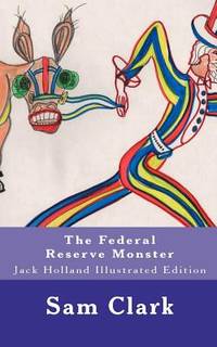
The Federal Reserve Monster: Jack Holland Illustrated Edition
by Sam H Clark
- Used
- good
- Paperback
- Condition
- Used - Good
- Edition
- Ill
- Binding
- Paperback
- ISBN 10 / ISBN 13
- 9781461127536 / 146112753X
- Quantity Available
- 1
- Seller
-
HOUSTON, Texas, United States
- Item Price
-
£1.27
Show Details
Description:
CreateSpace Independent Publishing Platform, 2011-04-29. Ill. Paperback. Good.
Item Price
£1.27
Original Sin (R Rated Version) [DVD]
by Cornell Woolrich
- Used
- Condition
- UsedGood
- Quantity Available
- 1
- Seller
-
Imperial, Missouri, United States
- Item Price
-
£1.37
Show Details
Description:
UsedGood. Case may show some shelf wear. Buy 3 get 1 free
Item Price
£1.37

Cold war era Czechoslovakia postage stamp
- Used
- Condition
- Used
- Quantity Available
- 1
- Seller
-
Colorado Springs , Colorado, United States
- Item Price
-
£1.43
Show Details
Description:
Czech stamp
Item Price
£1.43