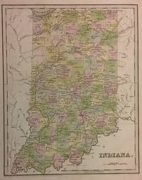
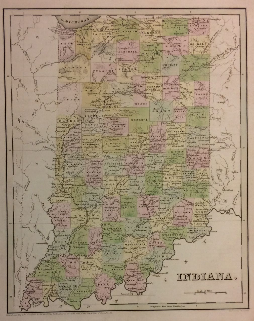
Click for full-size.
Indiana
by BRADFORD, Thomas Gamaliel
- Used
- very good
- Condition
- very good
- Seller
-
New York, New York, United States
Payment Methods Accepted
About This Item
Boston: T.G. Bradford, 1838. unbound. very good. G.W. Boynton. Map. Engraving with original hand coloring. Image measures 14 3/8" x 11 1/8".<br/> <br/> Nice early map of Indiana divided into counties and townships showing major routes, railroads and geographical details. Minor overall wear, pinholes to right edge, small tear to bottom edge.<Br> <br> T.G. Bradford (1802-1887) was a Boston based publisher. He worked as assistant editor of the American Encyclopedia before entering the field of map making. He was best known for his 1835 "A Comprehensive Atlas: Geographical, Historical & Commercial" and his 1838 "Illustrated Atlas Geographical, Statistical and Historical of the United States and Adjacent Countries", both of which proved to be important contributions to American cartography.<br/> <br/>
Reviews
(Log in or Create an Account first!)
Details
- Bookseller
- Argosy Book Store
 (US)
(US)
- Bookseller's Inventory #
- 222780
- Title
- Indiana
- Author
- BRADFORD, Thomas Gamaliel
- Illustrator
- G.W. Boynton
- Format/Binding
- Unbound
- Book Condition
- Used - very good
- Quantity Available
- 1
- Publisher
- T.G. Bradford
- Place of Publication
- Boston
- Date Published
- 1838
Terms of Sale
Argosy Book Store
All items are offered net, subject to prior sale. Returns accepted within 7 days of receipt--please contact us first. Payment by Visa , Mastercard & American Express. Appropriate sales tax will be added for all N.Y. State residents
About the Seller
Argosy Book Store
Biblio member since 2004
New York, New York
About Argosy Book Store
We are a large retail store, with 6 floors of out-of-print and rare books, (including, Americana, modern first editions, history of medicine and science), antique maps and prints, autograph manuscripts, letters & signatures.
Glossary
Some terminology that may be used in this description includes:
This Book’s Categories

Collecting BiblioMysteries
Want to get meta? Bibliomysteries are mystery stories which deal in some significant way with books and the world associated with books. Browse this fascinating subgenre of mystery novels.

Collecting the Civil Rights Movement
The Civil Rights Movement of the 1960s and ’70s was an explosive time in American history, and it inspired explosive literature. From Malcolm X to Martin Luther King, Jr., browse some of the most collectible books from and about that era.