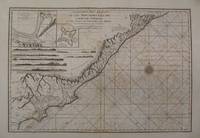
Click for full-size.
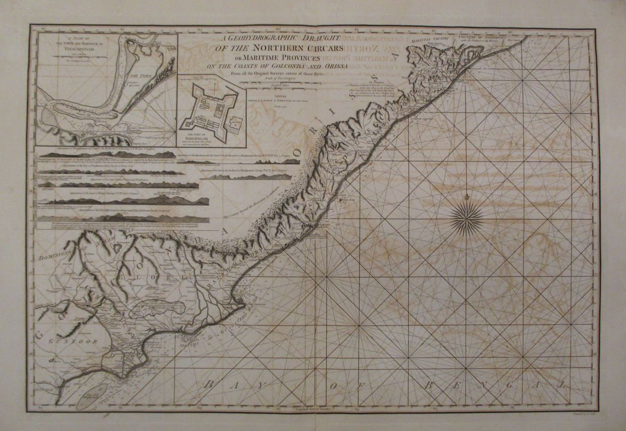
A Geohydrographic Draught of the Northern Circars or Maritime Provinces on the Coasts of Golconda and Orissa from all the Original Surveys extant of those Parts
by LAURIE & WHITTLE
- Used
- Condition
- See description
- Seller
-
New York, New York, United States
Payment Methods Accepted
About This Item
London: Laurie & Whittle, 1794. unbound. Sea chart. Uncolored copper plate engraving. Image measures 21" x 30.25". Sheet measures 23.5" x 33.75".<br/> <br/> Stunning sea chart of the coasts of Golconda Coast and Odisha in East India. Extends from Ongole north to Jagannath Puri (Puri) and Konark in Odisha. Also identifies the site of the famous Black Pagoda, the 13th century Sun Temple which still stands today and is a UNESCO World Heritage Site. Both Puri and Konark are important pilgrimage destinations. Spectacularly details inland features including roads, rivers, lakes, cities, etc. The chart includes rhumb lines, depth shoals, an enchanting compass rose and two inset maps. First inset features the plan of the town and harbor of Visakhapatnam, detailing batteries, forts and various inland features. Second inset details the Fort of Bimilipatnam (Bheemunipatnam) taken from the Dutch. The coast lines are further illustrated with with several topographical cross sections.<br> <br> Robert Laurie (c. 1755 - 1836) and James Whittle (1757-1818) were London-based map and atlas publishers active in the late 18th and early 19th century. Their firm combined Laurie's engraving skills with Whittle's social contacts and print sales experience. Together, they published numerous maps and atlases, often enlisting prominent cartographers such as Kitchin, Faden, Jefferys and others to update and modify their plates. Full original margins. Centerfold reinforced. Dampstains and offsetting with toning. With its beautiful and unusual visual approach, this scarce sea chart is rarely available for sale.<br/> <br/>
Reviews
(Log in or Create an Account first!)
Details
- Bookseller
- Argosy Book Store
 (US)
(US)
- Bookseller's Inventory #
- 262617
- Title
- A Geohydrographic Draught of the Northern Circars or Maritime Provinces on the Coasts of Golconda and Orissa from all the Original Surveys extant of those Parts
- Author
- LAURIE & WHITTLE
- Format/Binding
- Unbound
- Book Condition
- Used
- Quantity Available
- 1
- Publisher
- Laurie & Whittle
- Place of Publication
- London
- Date Published
- 1794
- Keywords
- sea chart, India, UNESCO
Terms of Sale
Argosy Book Store
All items are offered net, subject to prior sale. Returns accepted within 7 days of receipt--please contact us first. Payment by Visa , Mastercard & American Express. Appropriate sales tax will be added for all N.Y. State residents
About the Seller
Argosy Book Store
Biblio member since 2004
New York, New York
About Argosy Book Store
We are a large retail store, with 6 floors of out-of-print and rare books, (including, Americana, modern first editions, history of medicine and science), antique maps and prints, autograph manuscripts, letters & signatures.
Glossary
Some terminology that may be used in this description includes:
This Book’s Categories

Cleaning and repairing leather books
Wondering how to take care of the leather books in your collection? Renowned book care expert Bern Marcowitz explains how and when to clean and repair leather books.

Beat Poet Michael McClure
From the fateful reading at Six-Gallery in 1955 to his novels, poetry, and stage productions, Michael McClure was right in the thick of the Beat Generation as it was born. See his books and art and learn more about the works of Michael McClure.