Description:
UsedGood. The item shows wear from consistent use, but it remains in good condition and works perfectly. All pages and cover are intact (including the dust cover, if applicable). Spine may show signs of wear. Pages may include limited notes and highlighting. May NOT include discs, access code or other supplemental materials.
1:2,500 Ordnance Survey Map, Durham, Sheet XLIII.2. Edition of 1919, Surveyed 1856-57, Revised 1914-15, Re-Levelled 1896, Chilton Buildings (Chilton) and Area to East inc. Great Chilton by Ordnance Survey - 1919
by Ordnance Survey

1:2,500 Ordnance Survey Map, Durham, Sheet XLIII.2. Edition of 1919, Surveyed 1856-57, Revised 1914-15, Re-Levelled 1896, Chilton Buildings (Chilton) and Area to East inc. Great Chilton
by Ordnance Survey
- Used
- Paperback
Ordnance Survey, 1919. Revised Edition. Softcover. Good Condition/No Dust Jacket. Map Black and white map. Map is lightly marked and smudged and has no formal fold. Edges are slightly darkened with small tears and wear in the margins. One tear on the left side extends into the mapped area but has been taped on reverse. Faint brown staining is found down the right hand side of sheet and some faint pencil annotation. Bottom right corner margin has a sticker and hand written annotation. Reverse is marked and smudged with darkening to edges. 1:2,500 Ordnance Survey Map, Durham, Sheet XLIII.2. Edition of 1919, Surveyed 1856-57, Revised 1914-15, Re-Levelled 1896, Chilton Buildings (Chilton) and Area to East inc. Great Chilton Includes: Chilton Buildings (part), Great Chilton, Chilton Grange, Kay's Hill, Standalone, Chilton Hall, N.E.R Chilton Branch (railway), Windlestone Colliery Durham Road, Eden Terrace, South View, West Chilton Terrace Information included is buildings, property/field boundaries, acreage, parish and other boundaries, footpaths, tracks, roads, railways, watercourses, orchards and forestation, levels, earthworks, antiquities, etc Size: 73cm by 104cm. Item Type: Map. No dust jacket, as published. Single sheet map/chart which is suitable for framing and will be shipped rolled and in a cardboard tube.. Quantity Available: 1. Shipped Weight: under 1 kg. Pictures of this item not already displayed here available upon request. Inventory No: 45116121338..
-
Seller
Bailgate Books Ltd
 (GB)
(GB)
- Format/Binding Softcover
- Book Condition Used - Good Condition
- Jacket Condition No Dust Jacket
- Quantity Available 1
- Edition Revised Edition
- Binding Paperback
- Publisher Ordnance Survey
- Date Published 1919
- Keywords BZDB4 NOISBN map, British history Maps; British History; England; 1900-1920; Durham, Northumberland and North east England . 12500 Ordnance Survey Map Durham Sheet XLIII2 Edition of 1919 Surveyed 185657 Revised 191415 ReLevelled 1896 Chilton Buildings Chi
Stock Photo: Cover May Be Different
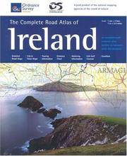
The Complete Road Atlas Of Ireland (Irish Maps, Atlases & Guides)
by Ordnance Survey of Northern Ireland
- Used
- Condition
- UsedGood
- ISBN 10 / ISBN 13
- 9781903974704 / 1903974704
- Quantity Available
- 1
- Seller
-
Interlochen, Michigan, United States
- Item Price
-
£5.02
Show Details
Item Price
£5.02

South Devon and Dartmoor - Walks
by Ordnance Survey Pathfinder Guild Staff
- Used
- very good
- Paperback
- Condition
- Used - Very Good
- Binding
- Paperback
- ISBN 10 / ISBN 13
- 9780711708518 / 0711708517
- Quantity Available
- 1
- Seller
-
Seattle, Washington, United States
- Item Price
-
£5.14
Show Details
Description:
Jarrold Publishing, 1996. Paperback. Very Good. Disclaimer:A copy that has been read, but remains in excellent condition. Pages are intact and are not marred by notes or highlighting, but may contain a neat previous owner name. The spine remains undamaged. At ThriftBooks, our motto is: Read More, Spend Less.Dust jacket quality is not guaranteed.
Item Price
£5.14

Stock Photo: Cover May Be Different
South Devon and Darthmoor Walks
by Ordnance Survey Pathfinder Guild
- Used
- Acceptable
- Paperback
- Condition
- Used - Acceptable
- Binding
- Paperback
- ISBN 10 / ISBN 13
- 9780711708518 / 0711708517
- Quantity Available
- 1
- Seller
-
Seattle, Washington, United States
- Item Price
-
£5.14
Show Details
Description:
Jarrold Publishing, 1996. Paperback. Acceptable. Readable copy. Pages may have considerable notes/highlighting. ~ ThriftBooks: Read More, Spend Less.Dust jacket quality is not guaranteed.
Item Price
£5.14

South Devon and Dartmoor Car Tours
by Ordnance Survey
- Used
- good
- Paperback
- Condition
- Used - Good
- Binding
- Paperback
- ISBN 10 / ISBN 13
- 9780711708242 / 071170824X
- Quantity Available
- 1
- Seller
-
Seattle, Washington, United States
- Item Price
-
£5.14
Show Details
Description:
Jarrold Publishing, 1995. Paperback. Good. Pages can have notes/highlighting. Spine may show signs of wear. ~ ThriftBooks: Read More, Spend Less.Dust jacket quality is not guaranteed.
Item Price
£5.14

Landranger Maps: Oxford and Surrounding Area Sheet 164 (OS Landranger Map)
by Ordnance Survey
- Used
- Condition
- Used - Good
- ISBN 10 / ISBN 13
- 9780319221648 / 0319221644
- Quantity Available
- 1
- Seller
-
Mishawaka, Indiana, United States
- Item Price
-
£5.50
Show Details
Description:
Used - Good. Used book that is in clean, average condition without any missing pages.
Item Price
£5.50
South Devon and Dartmoor
by Ordnance Survey Staff
- Used
- Condition
- Used - Very Good
- ISBN 10 / ISBN 13
- 9780711705425 / 0711705429
- Quantity Available
- 1
- Seller
-
Mishawaka, Indiana, United States
- Item Price
-
£5.65
Show Details
Description:
Seven Hills Book Distributors. Used - Very Good. Used book that is in excellent condition. May show signs of wear or have minor defects.
Item Price
£5.65

The Ordnance Survey Puzzle Tour of Britain: A Puzzle Journey Around Britain from Your Own Home!
by Ordnance Survey
- Used
- good
- Paperback
- Condition
- Used - Good
- Binding
- Paperback
- ISBN 10 / ISBN 13
- 9781409184713 / 1409184714
- Quantity Available
- 3
- Seller
-
Seattle, Washington, United States
- Item Price
-
£5.65
Show Details
Description:
Trapeze, 2020. Paperback. Good. Pages can have notes/highlighting. Spine may show signs of wear. ~ ThriftBooks: Read More, Spend Less.Dust jacket quality is not guaranteed.
Item Price
£5.65

The Ordnance Survey Puzzle Tour of Britain: A Puzzle Journey Around Britain from Your Own Home!
by Ordnance Survey
- Used
- very good
- Paperback
- Condition
- Used - Very Good
- Binding
- Paperback
- ISBN 10 / ISBN 13
- 9781409184713 / 1409184714
- Quantity Available
- 1
- Seller
-
Seattle, Washington, United States
- Item Price
-
£5.65
Show Details
Description:
Trapeze, 2020. Paperback. Very Good. May have limited writing in cover pages. Pages are unmarked. ~ ThriftBooks: Read More, Spend Less.Dust jacket quality is not guaranteed.
Item Price
£5.65

Stock Photo: Cover May Be Different
The Ordnance Survey Journey Through Time
by The Ordnance Survey
- Used
- Condition
- UsedVeryGood
- ISBN 10 / ISBN 13
- 9781398707061 / 1398707066
- Quantity Available
- 10
- Seller
-
Easley, South Carolina, United States
- Item Price
-
£3.27
Show Details
Description:
UsedVeryGood. Ships Within 24 Hours M-F- Satisfaction Guaranteed! Has a publisher overstock mark.
Item Price
£3.27

Stock Photo: Cover May Be Different
Lake District Car Tours (Travelmaster Guides)
by Ordnance Survey
- Used
- Acceptable
- Paperback
- Condition
- Used - Acceptable
- Binding
- Paperback
- ISBN 10 / ISBN 13
- 9780711708235 / 0711708231
- Quantity Available
- 1
- Seller
-
Seattle, Washington, United States
- Item Price
-
£5.71
Show Details
Description:
Jarrold Publishing, 1995. Paperback. Acceptable. Readable copy. Pages may have considerable notes/highlighting. ~ ThriftBooks: Read More, Spend Less.Dust jacket quality is not guaranteed.
Item Price
£5.71
